|
Ok, now it gets really, really good! No, seriously! Everything we saw up to this point
had been superb and well worth the trip. Even so, we were ill-prepared for what lay ahead. We can truthfully say that our stay
on the Northern Peninsula was the singularly most fascinating RV-ing experience we have
ever had. If we had to choose only one place to visit in the Canadian Maritimes, this would
be it!
Remember how I said earlier, in the Western NL blog, that the trip out to Bottle Cove
was the new winner as far as scenic drives go? Well, 86 that.
The Great Northern Peninsula of Newfoundland is unquestionably the most impressive part of the island,
both for touring as well as for history.
| |
| |
[click to enlarge]
|
|
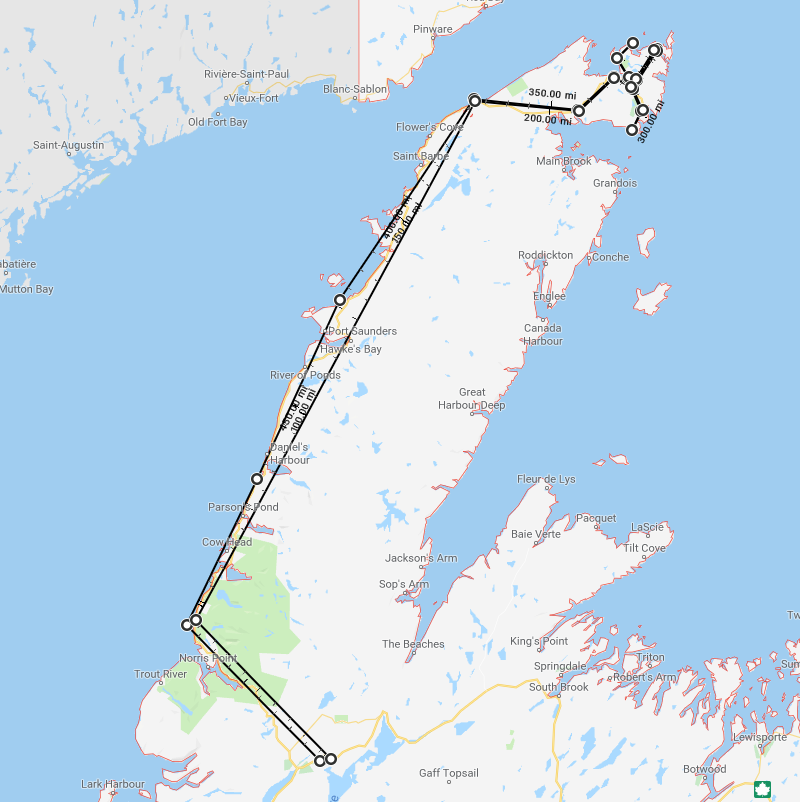
You'll see from the map at right that we didn't go anywhere on the middle eastern side
of the peninsula. There are several towns there but I couldn't find any roads
that looked reasonably accessible.
Deer Lake to Portland Creek
[87282 - ---]
If you want to get to the northern peninsula from either the eastern or western direction,
you have to go through Deer Lake and get onto route 430.
You travel up north on 430 and then come back south again the same way.
The good news is that there are several side roads
which should not be missed, as they take you to wonderfully picturesque places.
Route 430 running north from Deer Lake up to Port au Choix is quite nice as far as views are concerned.
There is water for much of the drive,
and the road isn't bad. There are ups and downs on the mountains but nothing to tax either your
transmission or brakes;
certainly nothing like the big challenges along the Cabot Trail.
We noticed that the trees started getting quite smaller north of Rocky Harbor.
Just past St. Pauls, on the right there are lots of little and not so little ponds.
It sorta looks like a golf course with hundreds of water traps!
The entryway to the campground is a rough road about 1.5 km long, but I think the sites are worth the
drive in.
They say there are moose in the area but we didn't see any, although I did spot moose tracks in the campground while
walking my dogs.
Mountain Waters Resort Park
Route 430, Portland Creek, NL A0K-4G0
Ph: 709.898.2490
paulette@mountainwatersresort.ca
http://www.mountainwatersresort.ca/
20 Aug @ 3 nights, 30 C$ / night
|
This campground was a pleasant surprise! Nestled way back in the woods of Portland Creek Pond island, the
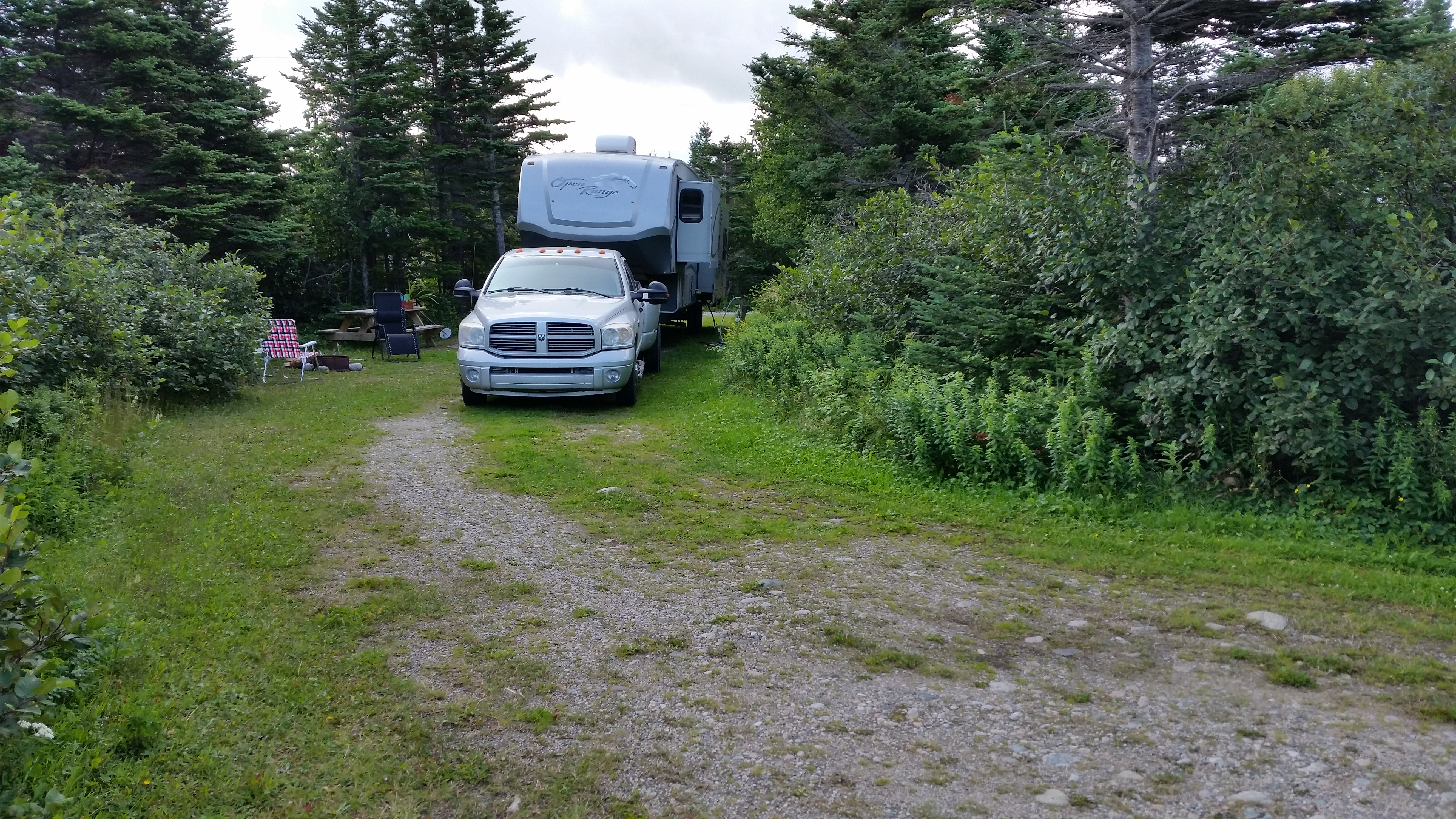
grounds are spacious, as are the sites. They are quite long; enough to unhitch a big trailer and be able to
park either in front or back with room to spare. They are grassy, and there are trees between sites so you can
barely see your neighbor, if at all. There is a kids play area, and several
nice looking cabins on the property. There is not really a camp store, although they do have a handful of things on the shelves. The folks
at the desk are quite friendly and helpful.
We camped in site # 10. There was 30 amp, water and sewer; no wi-fi or cable. There are 30 sites with full hookups, and 20
tent sites,
and the tent area has a great view of the water. There is a laundromat and washrooms. One of the tent
sites has
an old stone fireplace that's what's left of a cabin owned by bush pilot Lee Wulff, somewhat of a legend
in the area.
| |
| |
[click to enlarge]
| | |
|
|
|
The campground closes around Canadian Thanksgiving, which was on 8 Oct in 2018.
There are two convenience stores in the area. One is in Portland Creek, and the other is a few minutes north. Ask at the office.
We were told that there are interesting beach fossils in the area, although we weren't able to find where they are located.
The office can probably point you to this also.

|
|
|
Click here to see photos of the Mountain Waters campground.
|
|
The Arches Provincial Park
| |
[click to enlarge]
| | |
|
|
| |
This park is located on route 430 about 5 minutes south of the town of Portland Creek, which is itself about 5 minutes south of the
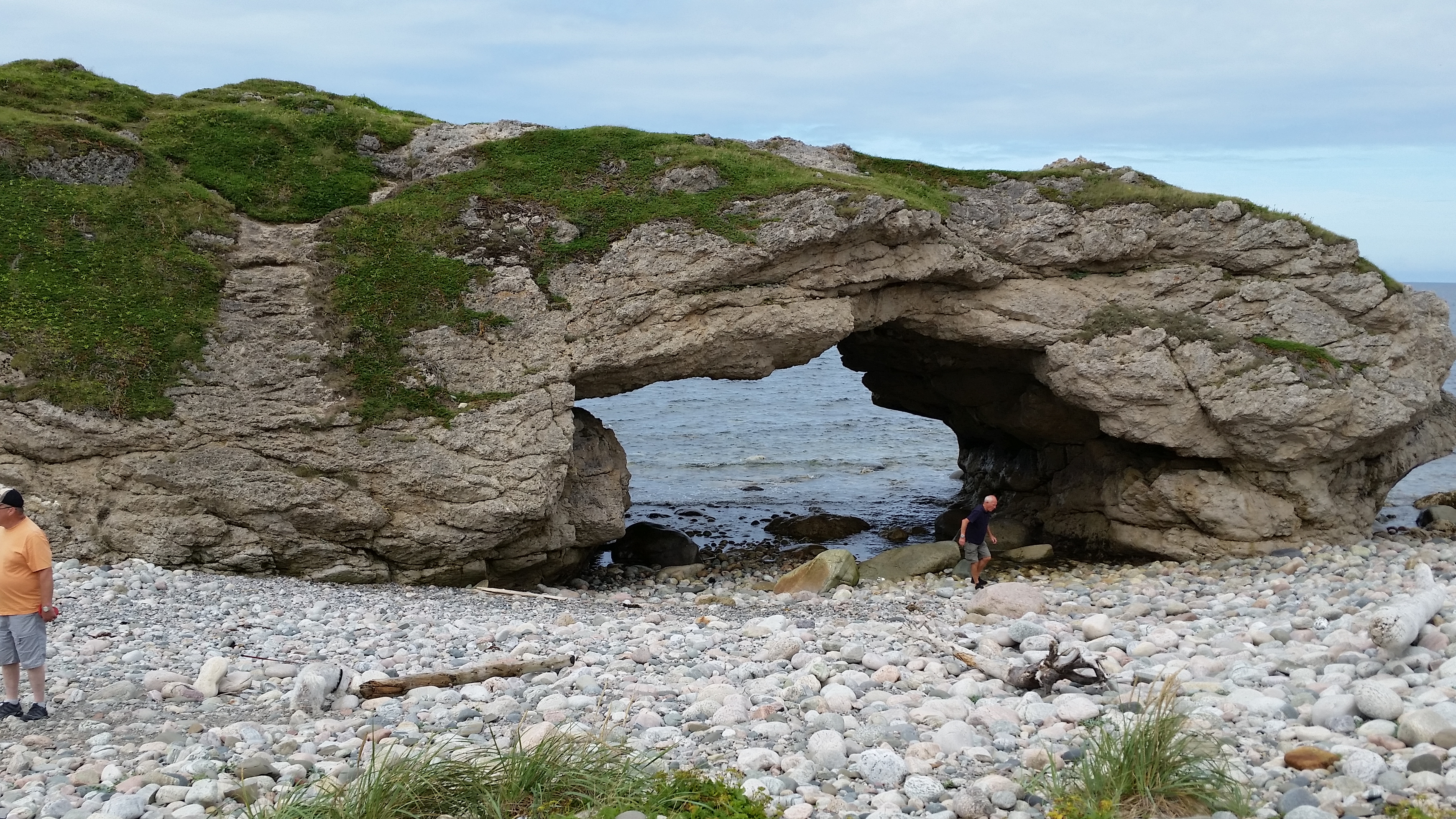
campground. The Arches, as the name implies, is a rock structure with two big holes through it, giving the impression of
stone arches. If you are a rockhound, the beach is littered with interesting stones. There is also a picnic table if
you want to have lunch there.
This is a popular attraction in the area, so it may get a bit crowded during the busy season.
It's also somewhat problematic trying to get pics without other folks in the shot.
To the rear of the area is an interesting, if somewhat surreal, stand of small, weathered trees that look
like something from a
Lord of the Rings episode. They make for a neat photographic opportunity.
|
They say the arches look best at low tide, so you may want to check the tidal schedule online before going to get the
best views. Apparently you have about an hour on either end. I don't know what the tidal situation was when we were
there, but I can't imagine there being a bad time to go!

|
|
|
Click here to see photos of the Arches Provincial Park.
|
|
Route 430 north to Port au Choix
|
We took a day trip up to Port au Choix to take in the seaside delights. We knew we would be
going up there to camp in a couple days but there were a lot of things between Portland Creen
and Port au Choix that needed investigating.
This stretch of 430 was also good road, with only a few minor exceptions.
Just up 430 from the campground, just before Daniels Harbor, is a little park called the
Bill Woods Trail. It has a
very long (1.5 km) boardwalk down to a really nice water view. I didn't walk particularly fast
but not slow either, and
it took around 20 minutes to reach the end.
There is a store in Daniels Harbor. Note there are two exits to the town from 430.
A little further up 430 there is a road on the left side that leads to a really nice overlook.
Drive until to you see the brown rails
at the top of the hill. There is a parking area with an old portable sawmill and blade up on
the hill. A long boardwalk leads out past the
gazebo but I didn't go all the way due to time constraints.
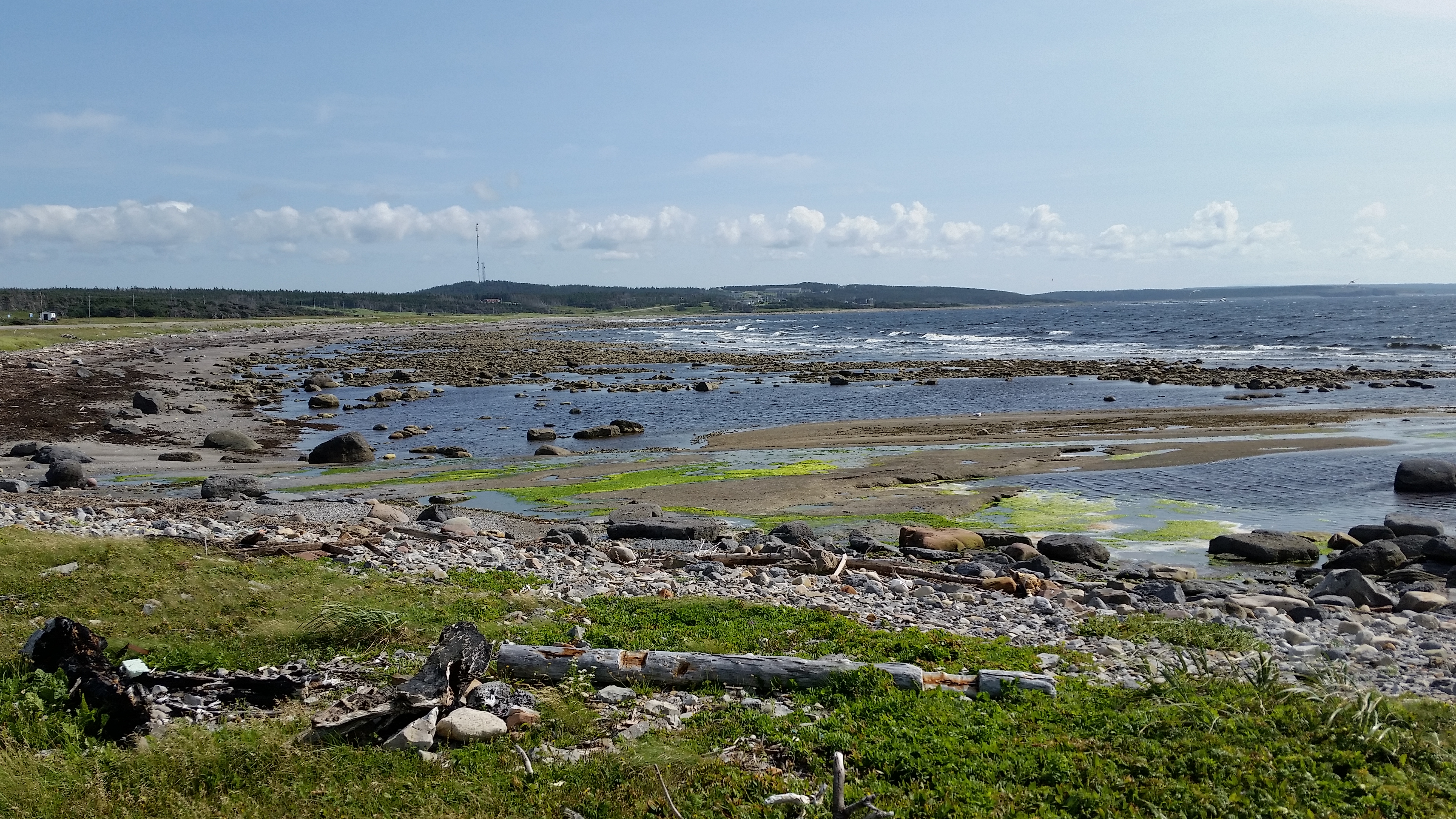
We were told that at Bellburns there are fossils on the beach.
According to my research they may be talking about the
Table Point Ecological Reserve. It is supposed to be just
north of town, where there is a plaque. Find a place to park.
| |
| |
[click to enlarge]
| | |
|
|
|
Further north we had lunch at the Torrent River Inn in Hawkes Bay.
They had a nice buffet with pizza, soup,
salad and several other hot dishes. We both got pizza for 33.30 C$.
At Port Sanders there is a gas station but it doesn't have diesel.
At River of Ponds there is a fish market and a campground on the right.
At Hawkes Bay there is a
Salmon Interpretation Center
where you can see salmon runs along the "salmon ladders" or "steps"
on the Torrent River. You can also learn about the history of the river. This all depends, of course,
on the salmon season,
so you might want to Google it before you commit. There is also Dollar Store on the left of 430
and an Irving station with diesel close by on the right.
Further up, there is a fish market on the right where we got some fresh cod and scallops.
They also had halibut, cod eyes and cheeks, and other stuff, both fresh and frozen.
In the little town of Daniel's Harbor is the Nurse Bennett Heritage House. One of my favorite stories
about the people of the area is when we tried to visit the Nurse Bennett house and found it closed,
I started chatting with a man walking around in front of the house. I noticed he had a really nice piece of driftwood on top
of his wood pile. I told him about my wife growing orchids and mounting some on pieces of wood and how we
were trying to find and he said "Ya want it?". I politely said that we couldn't but it was nice of him to
offer. He said "Well, as far as I'm concerned
it's just a piece of junk. My grand kids are always coming over and bringing back driftwood from the beach,
so there's nothing
unusual about it to me. I'll probably throw it away anyway, or use it for fire kindling."
So, I graciously accepted. This
is just another instance of how nice the people there are.
A little north of Bellburn there is a road to the left where fossils can be found at the shore.
They took the sign down due
to folks stealing the fossils, so you'll have to ask a local how to find it.
Along 430 you will find a lot of firewood stacked up. While it is tempting to think that it might
be free for the taking,
it is not. It is there because locals have cut it and brought it down from the hills and left it
there to dry out before taking
it home. Although there is occasional stealing, it seems to be rare.
According to the campground host, local's income seems to be a mixture of the service trades,
fishing, and what they call
"turnarounds" which means that people go away to work for several weeks and then return.

|
|
Click here to see photos of the drive to Port Au Choix.
Click here to see photos of the Bill Woods Trail.
Click here to see photos of Portland Creek.
Click here to see photos of the lookoff north of Daniels Harbor.
|
|
Portland Creek to Port au Choix
[--- - 88291]
| |
[click to enlarge]
| | |
|
|
| |
Since we had driven up 430 [Viking Trail] earlier I don't have any other comments, other
than to say that it is about an 88 km drive, or about an hour or so.
From the 430 there are two exits to Port Saunders and Port au Choix, both on the left.
The southernmost exit doesn't seem to have a name as far as I could tell. A bit farther north is
route 430-28. Both roads soon meet and go westward for about 5 km to Port Sanders and then for
another 9 km to
Port au Choix. There will be a big Foodland on the right and the
Oceanside campground is on the left, just before you get into town.
Port Saunders is basically a small fishing village with a harbor. There is an Esso station, a grocery
store and
a pharmacy. There is also a hardware store that's closed on weekends and perhaps Monday also.
Although Port au Choix is not very far north of the last campground, we were excited by the chance to
camp right
on the water. The sites are literally on the beach and have wonderful views. If you are interested in
collecting
driftwood, it's all around.
|
The word Choix is pronounced like "Schwah" and is French for "choice." But don't sweat the pronunciation,
because the locals are used to hearing it said all sorts of ways.
There is a Western Petroleum with diesel, a couple of pharmacies, several restaurants, a hardware store,
a bank and a couple bakeries in town.
Although there is a building in town with a sign that says Hardware Store, it's not. It used to be but
they
haven't taken the sign down yet. Right now it's just a warehouse. There is an actual hardware store
in Port Sanders.
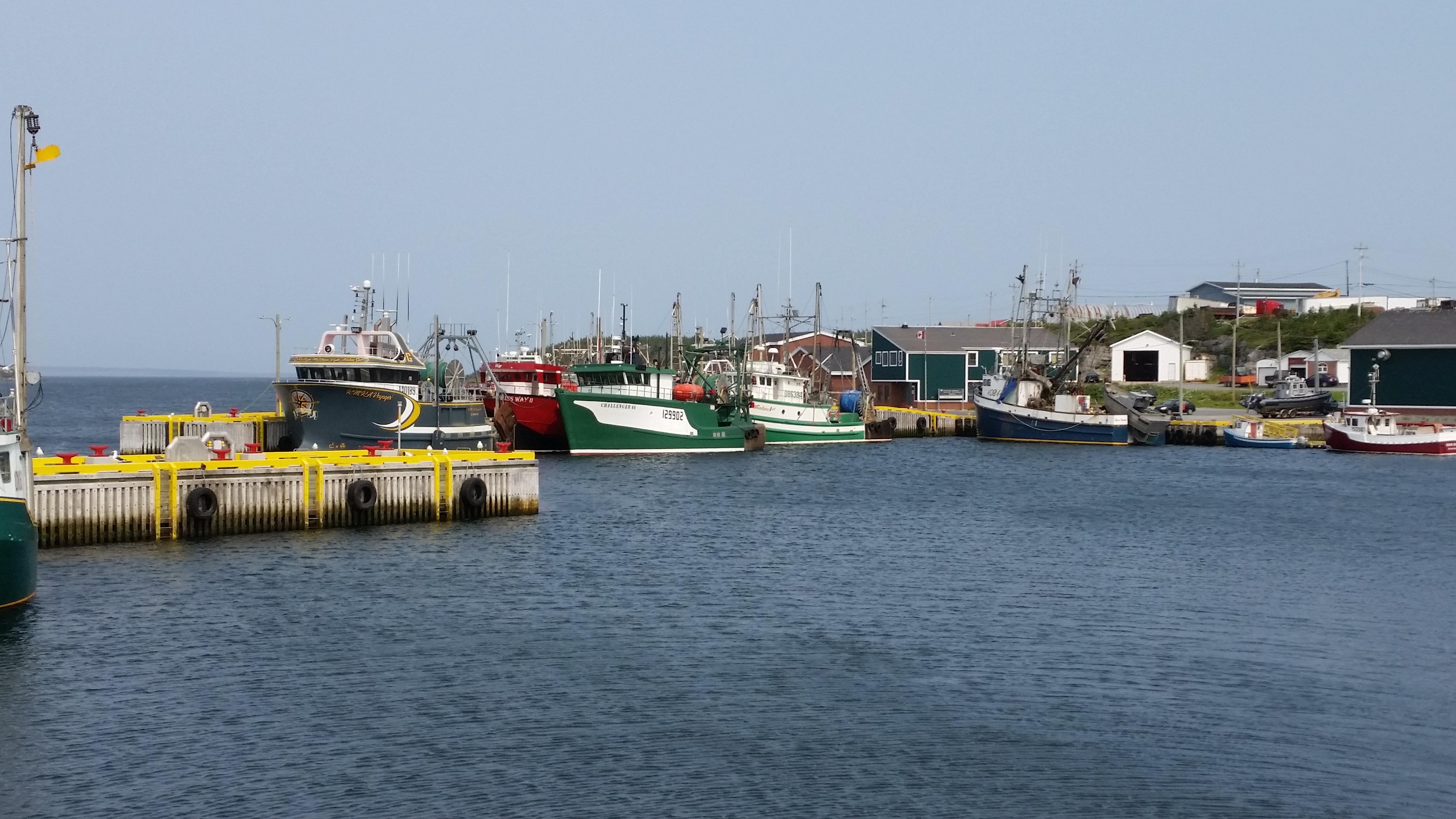
The three harbors in Port au Choix are nice places to visit and are quite photogenic.
We ate the first night at the Anchor Cafe. I had the pan fried cod which was very good.
Phyllis had shrimp and rice.
The shrimp is very small compared to what we think of in the U.S. but it was good. I had a huge glass of
ice cream topped with bakeapple berries for dessert.
As mentioned earlier, someone gave us a couple pounds of moose meat, so the second night we made
moose stew. It was based
on an old recipe
from when we used to do a lot of backpacking. The meat tasted very much like beef stew meat and
it wasn't
gamey as we had anticipated. Now we can't wait to cook the moose steaks we had acquired earlier.
We also went to Ben's Folk Art, a woodcraft speciality shop. Ben is a relative of Todd, the campground
manager. He had some interesting and colorful wood art; it's a bit on the expensive side but would make
great gifts to take back home. Ben was drying some cod outside while we were there.
He loves to talk and show you around, and he can be convinced to give you a little town history
if gently prodded.
Oceanside RV Park
18 Fisher St, Port Au Choix NL A0K-4C0
Ph: 709.861.7213 [Todd], 709.861.8261 [off-season]
kelly3279@hotmail.com
Website
23 August @ 2 nights, 30 C$ / night
|
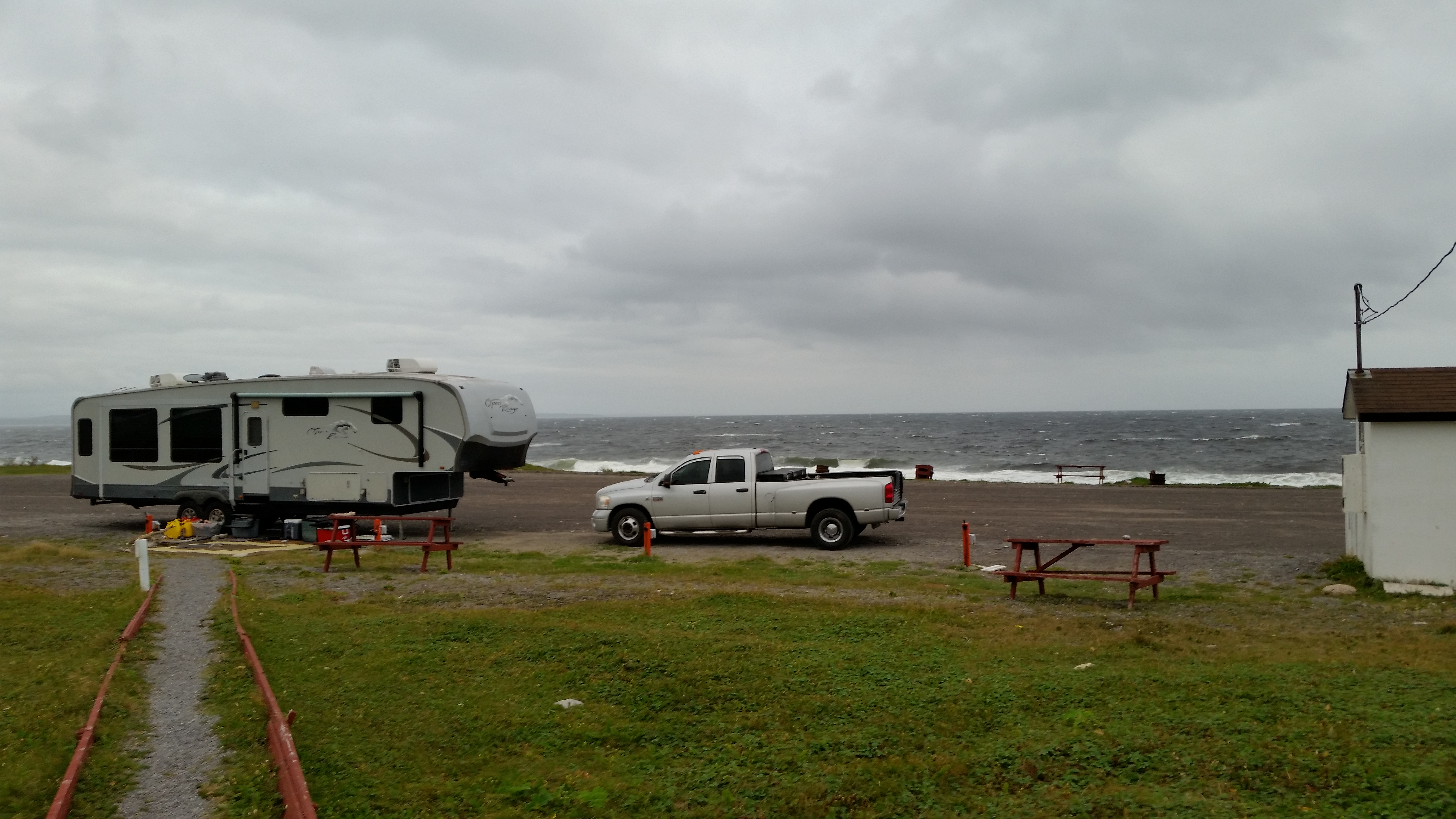
This campground was another nice surprise, as all the sites are right on the ocean beach.
When we arrived, there were no
other rigs so we asked if it would be ok to park sideways so we could get a nice view of the water,
and they said it was.
After we got there a pusher showed up and also parked sideways like us. So here we were, the only two rigs on the beach,
enjoying the water and sunset through our picture windows. We also had a brief rainbow.
They have 26 sites with 30 amp, water and wi-fi internet. There are picnic tables and fire rings.
There is no
sewer on the beach, of course, but there is a convenient dump station on the way out.
There is no camp store, but across the road there is a grocery
store called Foodland which is rather large and has a good selection, by Newfoundland standards.
The park has indoor grills you can use if it is too windy outside.
| |
| |
[click to enlarge]
| | |
|
|
|
The campground is owned by the local Lions Club.
Todd House, who runs the campground, told us
about Gus Humber, the guy that founded the campground many years ago.
He had a farm just outside of Port Saunders.
Gus was a very outgoing man who saw rigs blowing through town and thought it
what a shame it was that there was no place for them to stay. He reasoned that if they did,
they would naturally remain in town longer. So the Lions Club bought
the property and set up the sites. Old Gus turned out to be both a prophet and an entrepreneur, as
the tourist trade has picked up considerably since.
Old Gus passed away in 2015 at the age of 80. I never did find out if he had any relationship
to the Humber River down in Deer Lake.
The campground gets several caravans during the year; when they
are there most or all of the sites will be occupied.
However, while we were there
we had the beach pretty much to ourselves, likely because it wss getting late
in the season.
We envisioned coming back here on our return from St. Johns, but a doggie emergency
voided those plans.
It was quite windy while we were there, but the views and the area more than made up for it.

|
|
Click here to see photos of the Oceanside campground.
|
|
French Rooms Cultural Center and French Bread Oven
Website
| |
[click to enlarge]
| | |
|
|
| |
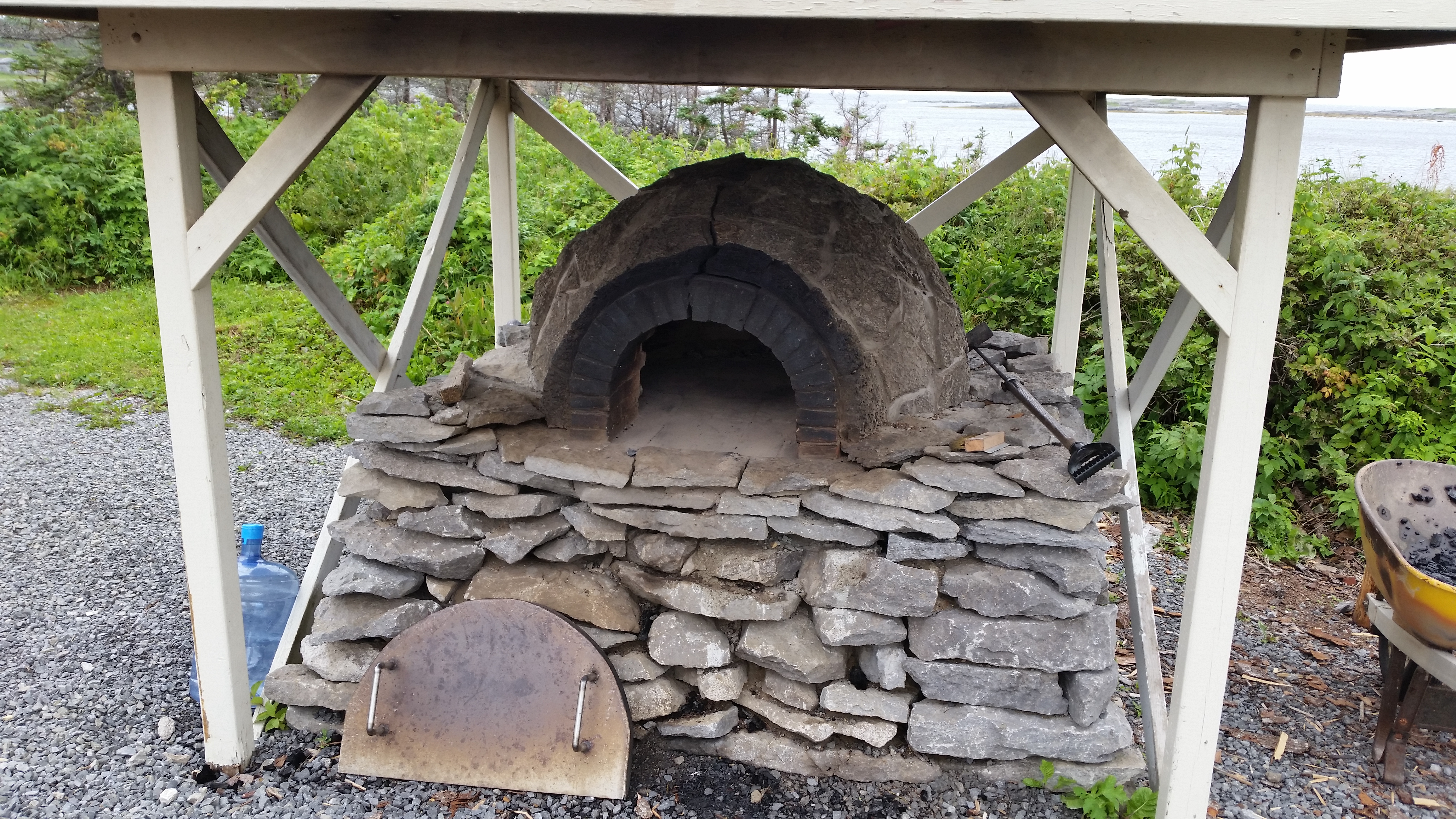
This is one of the local attractions where, among other things, you can get [for a small fee] fresh
bread cooked in an
old-fashioned outdoor stone French oven, topped with local jams and served with tea. Get tickets in town
at the French Rooms
museum on the left of the main drag. The actual coffee & tea room is a bit further down the road -
the sign is hard to see,
but look for the road on the right. There is a nice view of one of the harbours.
You can buy bread and jams at the Oven. Try the
Partridge Berry and
Bakeapple jams for some interesting tastes you aren't
likely to find elsewhere. At the main office they also sell the jams and frozen shrimp.
While at the Oven be sure to look at the painting on the wall, and the clouds in particular.
If you look close you will
see that they are in the shapes of Newfoundland and France. Ask the folks there about the story
behind the painting, as well
as the large tapestry at Plumb Point.
|
If you like the painting as much as I did, be sure to get contact info from the Oven's office.
They said they plan to offer prints of the painting in a couple years or so.

|
|
Click here to see photos of the French Rooms and Oven.
|
|
Visitor Center, aka Heritage Center
Website
|
This heritage museum has a nice exhibit of the history of indigenous peoples of Port au Choix.
You can get to it from the main
road by taking Lavers Drive, then right on Point Richey Road.
One of the attractions we liked was going on past the Center up to the lighthouse.
We had heard that there were moose and caribou to be seen, but we weren't lucky enough
to see any on this particular drive. However, Our campground host Todd House was kind enough
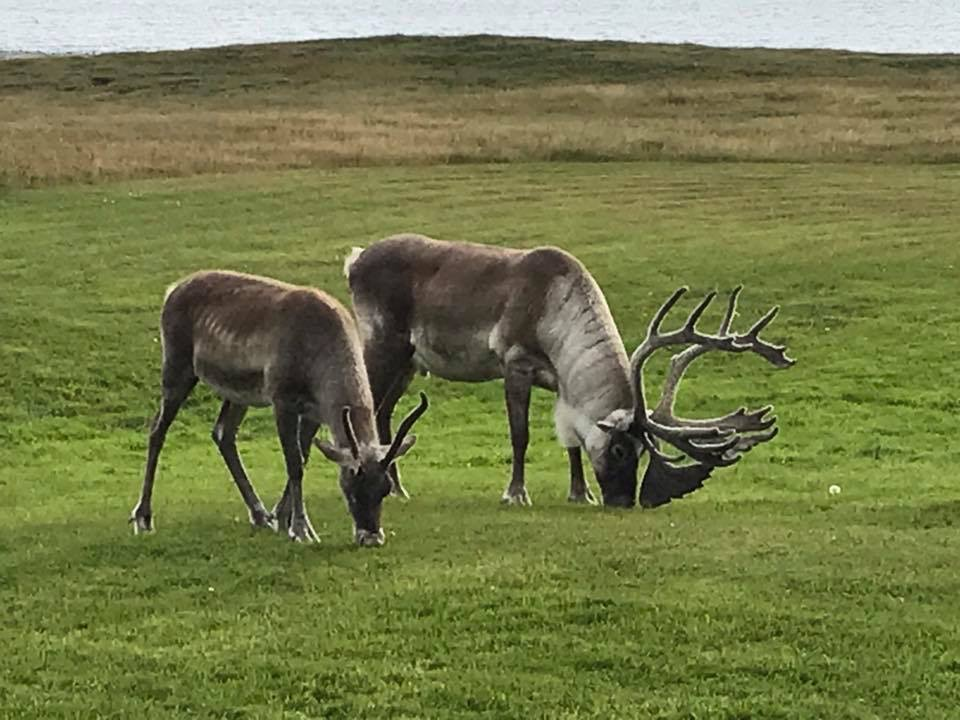
to drive me back up to the lighthouse area next morning. We did find a small heard of caribou
with a big bull and six does and I got some good photos. They seem to be friendly and you can
get somewhat close, but I decided not to test the bull!
I would like to thank Todd
for going out of his way to ensure we had a viewing experience, and for sharing with us some
of his won photos of caribou and moose around his house.
Todd went out of his way to make us happy - a trait we had found over and over again in Newfoundland.
| |
| |
[click to enlarge]
|
|

|
|
|
Port au Choix to L'Anse aux Meadows
[88330 - 88470]
Route 430 north to L'Anse aux Meadows [Anse is French for cove] was pretty good in some parts, and downright awful in others.
When we got to the campground we found that almost every door was flung open, as were some drawers, and stuff was strewn all
over the floor. I thought I had packed pretty securely but I guess I was no match for the potholes, ruts and generally poor
stretches of road. About the only things that didn't fling open were the doors that I
had put child locks on.
There are lots of this cove and that cove on the way up, all on the left of course since that's
where the water is. Heading north, there is a ferry at St. Barbe [pronounced 'barb'] going over to
Blanc-Sablon in Labrador. We were told by a fellow camper that there is a boat tour up north
from Mary's Harbor to historic Battle Harbor, and that the tour at Happy Valley - Goose Bay is
quite nice. You might also want to check out White Water Falls in Mary's Harbor.
The Roads in Labrador are said to be ok but very rough due to the
dirt, gravel, potholes and washboard nature. Someone even told us that you can always spot a trailer
that has been towed through Labrador because the front looks like someone had sandblasted it,
probably from all the rocks thrown up by the rear tires.
I am told that food, fuel and water are scarce but the bugs are plentiful.
We chose not to go since we had dogs in the trailer, and it would be
at least a day trip to get to anything interesting.
At Plumb Point there is an Irving station with diesel, an auto parts place, a hardware store and groceries.
There is an Esso station with diesel just south of Nameless Cove.
The St. Anthony airport is on your left heading north, about 20 minutes before you get to the campground.
You will go through St. Lunaire-Griquet, where there is the Dark Tickle Experience, a general store, a Western Petroleum with
diesel, the Hedderson Fish Market and the Daily Catch cafe.
The Dark Tickle Experience may be worth stopping for. It is a combination cafe, store, gift
shop and tour group. The store sells all kinds of jams and jellies, including partridgeberry
and bakeapple (my favorite).
The 28-foot rigid hull inflatable tour includes icebergs, whales and birds. They have an underwater camera for viewing
submerged flora and fauna.
Here is a link.
Notice along the way how distressed the rocks are. We were told it was due to tectonic activities, and perhaps a bit of
iceberg torture tossed in. Our Sprint phone reception crapped out about 20 minutes from the campground. Luckily I had
previously planned out the route, as I typically do for each leg.
Many road signs on the Northern Peninsula do not show road names or route numbers, but rather they name the
places the roads leads to.
It is also often the case that signs do not show how far it is to those places, as you would expect back in
the States.
On the way up 436 from 430 there are a couple other stations with diesel.
Temps averaged in the high 60's to low 70's F. Very pleasant, albeit a little windy. On our last
day it got up to 77 F.
Viking RV Park
1 Main St, Quirpon NL A0K-2X0
Ph: 709-623-2425
vikingrvpark@hotmail.com
Website
25 August @ 4 nights, 30 C$ / night

| |
[click to enlarge]
|
| |
To get to the campground, take a left off 430 onto route 436, which is pretty good road except
for a few rough stretches. Keep going through Saint Lunaire-Griquet and head on up north until
you get to the sign to Quirpon, and turn right. This road has no signs giving its name or
route number, but locals refer to it as Quirpon Road because
which leads to the town of Quirpon. Go about a couple hundred meters, and the RV park will
be on your left.
This is a somewhat compact campground, in that there is not a lot of room between sites. Each site has 30 amp, water, a
colorfully painted little picnic table and a fire ring. There is wi-fi internet, but the guy at the desk didn't tell us
about it when we checked in and I didn't find out about it until two days later.
The bad news is that it is located right next to 430; the good news is that the traffic was sparse this time of season.
It is also located next to a pretty lake.
|
There are 38 sites. During our stay there averaged about a half dozen rigs each day. On the third day it got up to ten,
which is probably good for this time of the year.
There is a laundry and washrooms but no showers. A recycle bin is located at the front of the office.
At the office they make breakfast, and can make things for lunch and dinner, such as moose burgers and fries.
-A word of warning. The dump station pull-thru is on a curve, making it quite hard for
a big rig to get close enough for normal sewer hose. I had to drag out a second sewer hose and
was just thankful that I even had one.
As usual, we used the park as a base for the side trips. We're glad we stayed four nights, as
there was so much to see.
The first night we ate at the Northern Delight which was a short distance back down
436 from the campground. I had cod and chips and Phyllis had
pan seared cod, both of which were good. The chocolate shakes were thick and the
strawberry-partridgeberry pie was unique.
The second night we ate at the Norsemen up in L'Anse aux Meadows.
I had the rack of lamb and Phyllis had pan seared cod. The lamb portions were
meager for the price (30 C$)). But to our surprise the chocolate mousse was really good.
Total bill was 141.51 C$ with drinks and tip.
The third night we finished off the moose stew we had made earlier.
The forth night we ate at the Daily Catch Cafe on Main Street in St. Lunaire-Griquet.
It was superb! The calamari appetizer was some of the best we've ever had, and we
have had a lot of calamari. It was lightly breaded in what seemed like some kind of tempura coating and cooked to perfection.
It was quite tender, maybe due to it being a local catch, and maybe because it wasn't overcooked. The carrot and ginger soup
was a very nice surprise. Phyl's cod and chips was also nicely cooked,
as was my shrimp and scallops. We had partridge berry pie a la mode for dessert.
Surprisingly, the total bill was only 93.99 C$ with tip.
I give this little restaurant high marks, and is probably the best place we ate
in Canada during our trip. I don't think I'm going out on a limb when I insist that you
absolutely have to go there if you're anywhere even close.
Back down 436 from the campground is Heddersons Fish Market. We never went in, but on one drive-by the door was open
and I could see tables inside. I can't say whether this is a store for selling fish, a fish restaurant, or both.
We had breakfast at the campground the morning we left. AThe office offers a bacon, eggs, toast,
potatoes, OJ and coffee for 10 C$. It was quite good.

|
|
Click here to see photos of the Viking campground.
|
|
Weather
As it was getting late in the season, I will be talking more about the weather from here on.
Temps got down to 55 F on the second morning here, and the wind picked up quite a bit. On the third day it was in the low
60's and mild.
It rained quite hard on the morning we left. We love to hear the rain on the metal roof of
our bedroom slideout and listen to the thunder boomers.
When we got up the temp was 52 F.
Quirpon
|
Exit the campground to the right and take an immediate left to the little town of Quirpon
[pronounced "Kar-poon"; rhymes with cartoon; not "queerpon" as you might expect.]
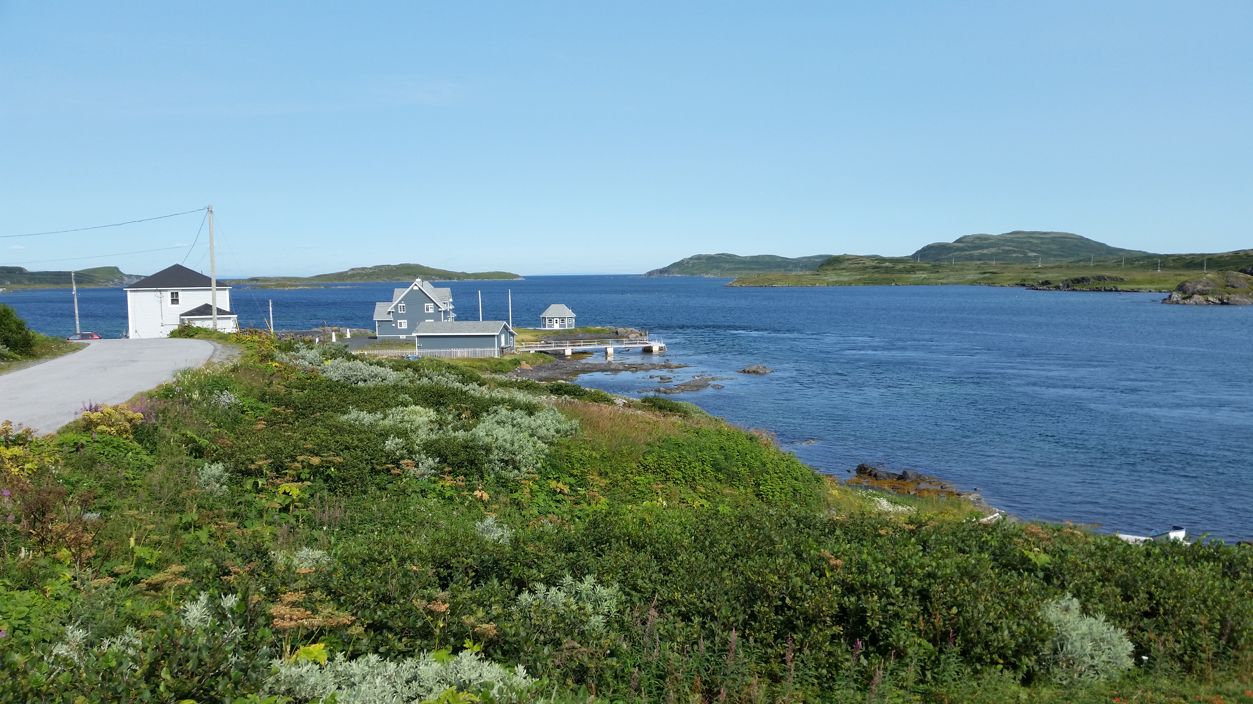
Quirpon is primarily a fishing village with a sheltered harbour. The main attraction is the
Cape Bauld lighthouse and the Quirpon Lighthouse Inn, located on the deserted Quirpon Island in "Iceberg Alley", implying that it is a good location for
viewing icebergs and whales, including Orca. There are Zodiac tours and walking trails.
Ask a local where to find Bill Bartlett, He builds model lighthouses that would
be a great souvenir to take back, and is also
considered to be the local historian. If he has time, chat him up about the area and its
history. I understand that the population of Quirpon has recently risen to 70. Here is
a writeupon Quirpon.
| |
| |
[click to enlarge]
|
|
L'Anse aux Meadows
| |
[click to enlarge]
|
| |
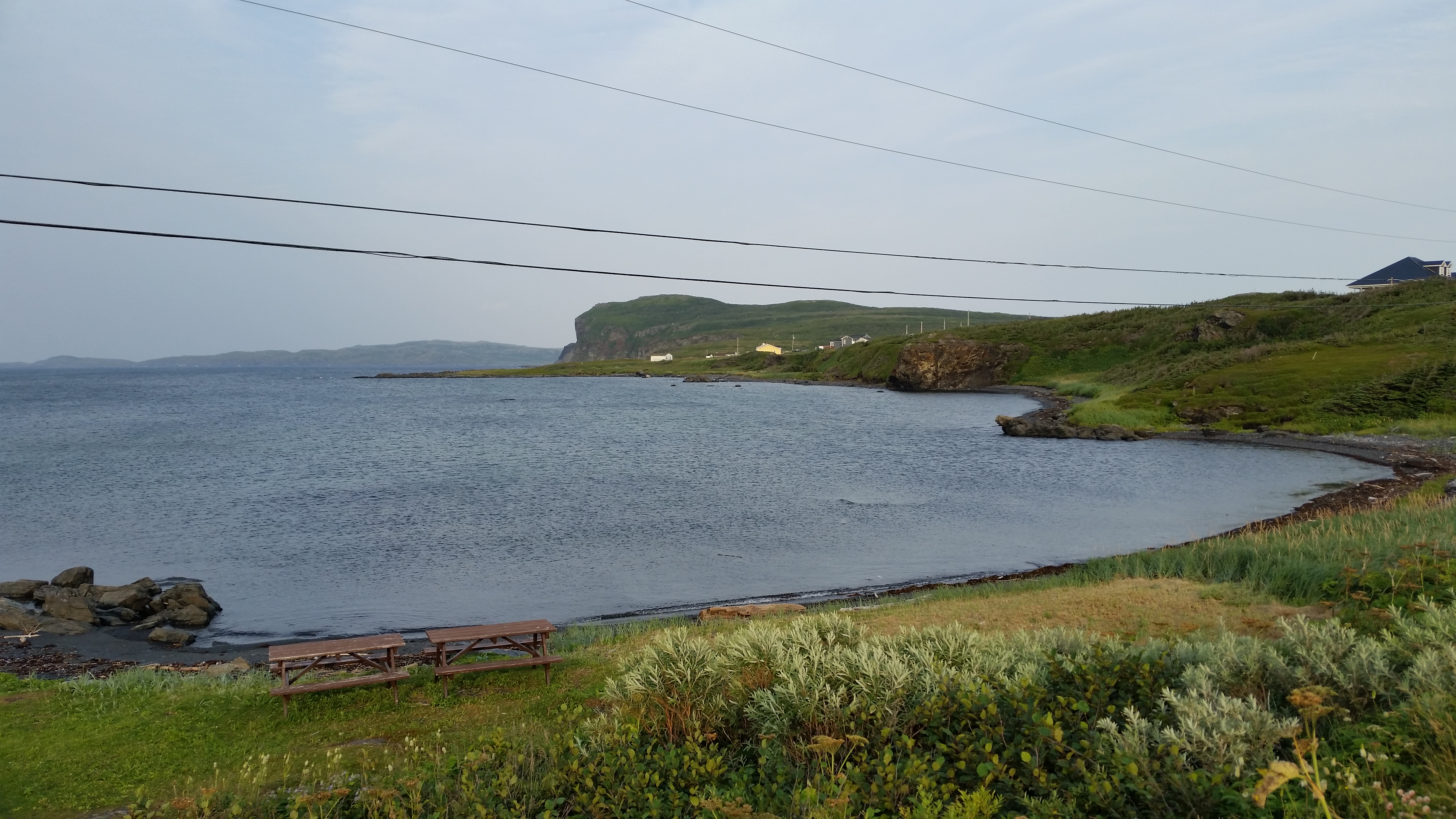
Exit the campground, take a right and go north on 430. It's just a short drive to the place where Leif Ericson and the Norse
landed and settled around the year 1000 A.D.
If you visit the Historic Center you will learn that the Vikings actually never made it to this area. This is interesting in light
of the fact that many places and things are named Viking something. It was actually the Norse who came and settled here.
The term Viking is usually reserved for the subset of Norse who specialized in raiding, pillaging and plundering for a living.
I guess they never heard of anything worth taking in the new world,
so the real Vikings didn't come.
|
After the Historic Center, on the right there is a little Viking village replica called Norstead where you can
go see what a Viking house / hut might have looked like.
As mentioned earlier, we ate at the Norsemen Restaurant which is at the end of the road. Across from the restaurant there is a
large bronze statue of Leif Ericson that is worth seeing. It makes for a good photo, as well as the scenery beyond.
When we went up there, there was a cruise ship anchored at sea some distance away, but you could see it fairly well.
As there is no port here, I figure that they were just sightseeing, probably listening to a spiel about the history of the area.
It is interesting to note that the only graffiti we have seen so far while in Canada was on the face of some rocks
just south of L'Anse aux Meadows.
See here for interesting info
on the UNESCO historic site of L'anse aux Meadows, where the Vikings originally landed in North America.
It is also where Lief Erikson established the first colony around the year 1000.
If you're interested in local crafts there is a neat little place just off the highway.
I don't remember the road name but it's off to the right before you get to the Historic Center.
The owner makes a lot of Norse-oriented things and also has some stuff he brings back from
his frequent trips to China. He loves to chat about almost everything. Notice the brilliant
purple Monk's Hood plants out front, which was the reason we originally stopped; we didn't
even know there was a craft store there!

|
|
Click here to see photos of the town of L'Anse aux Meadows.
Click here to see photos of the Norstead Viking Tour.
Click here to see photos of the Norseman Restaurant.
Click here to see photos of the Thorfinn Studio.
|
|
There is an interesting
PBS documentary
on the excavations at L'anse aux Meadows. It was produced by
Nova and is available on Netlix under the title "Vikings Unearthed". The movie also describes an
unsuccessful dig at
Point Rosee where it was thought a second Norse settlement may have been. Point Rosee is not far from the
Grand Codroy campground near the ferry port at Channel-Port aux Basques. I don't know if the dig site is accessible
to sightseers. If you find out please let us know.
For Norse history buffs in general and archaeology buffs in particular, you'll want to check out a lenghty discussion
entitled
The Norse in Newfoundland: L'Anse aux Meadows and Vinland by Birgitta Wallace who was in the Nova video.
Historic Center
Website
|
Just before you get to L'Anse aux Meadows on 460 there is an Information Center on the left.
Follow the drive down to the Center. There is a fairly big parking lot with some spaces big
enough to accommodate small to medium size rigs. There you will find a lot of information about the
people that settled in the area, including the Paleo-Eskimos and the Norse.
An interesting thing we learned was that no Vikings ever landed in the area, notwithstanding
the fact that the names of many places and things contain the word Viking. Folks say it is
mainly because Viking sounds more interesting than simply Norse.
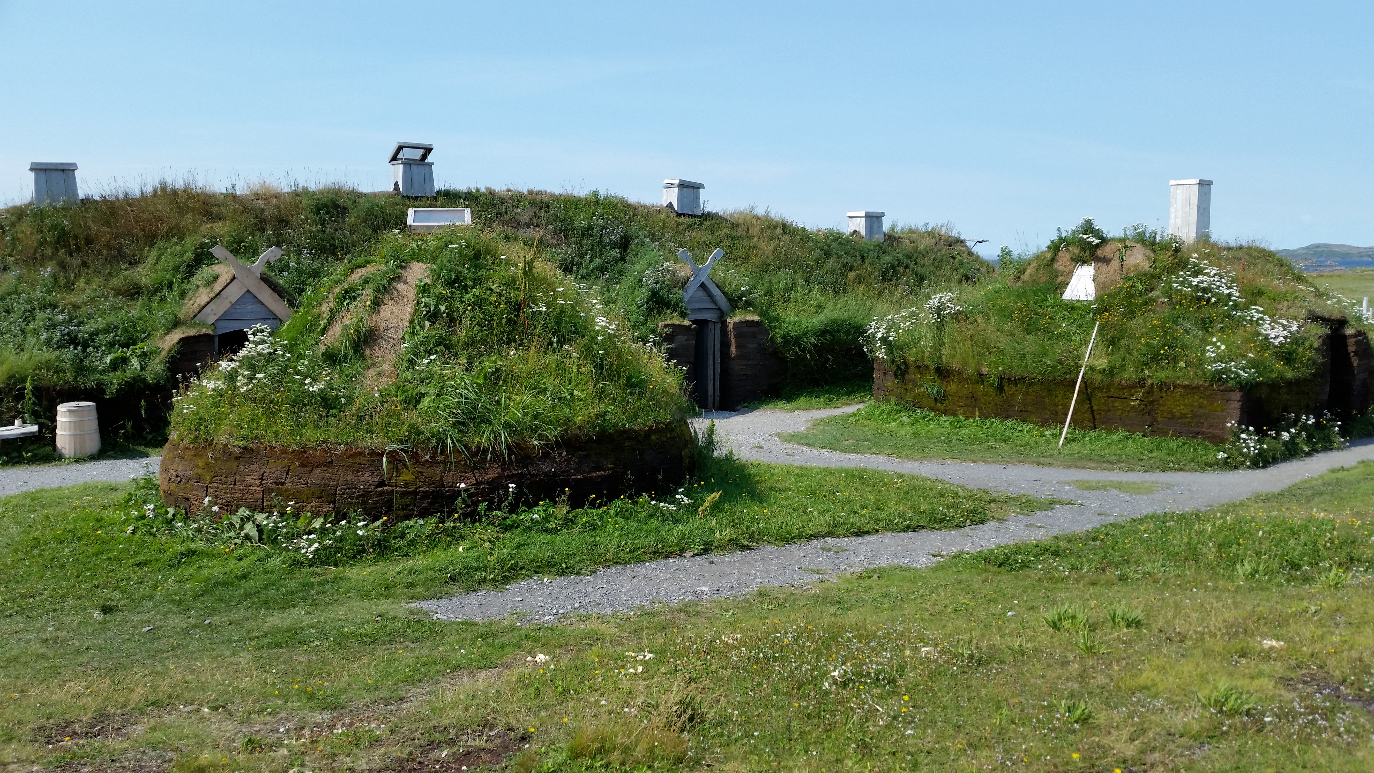
From the main Center there is a boardwalk leading down to what is the main exhibit - an authentic
recreation of a small village which appears as it might have been 1000 years ago. It is built around
a previous dig for an actual village.
On the boardwalk, when you pass through the sculpture with the nice blue patina, look for the dragon,
ship, etc hidden within.
Nice touches to the village include the use of bog peat for building foundations, and earth and grass
for the roofs. Be sure to go into the great room and sit around the fire while period actors regale
you with Norse stories.
There is also a coastal trail from the dig.
If you care anything about the history of the area, this is a must-see stop.
| |
| |
[click to enlarge]
|
|
I recall the feeling of humbleness thinking about the rough and rugged conditions those
early people must have endured trying to hack out a living there. They must have been hardy folks
indeed. There wasn't a lot in the way of game or wood, which likely accounts for the type
of building construction they did. The winter weather was probably terrible, but not much different
than what they were used to. Fishing was probably their mainstay. Although I can't say for sure
I do believe that they just got tired of everything and headed elsewhere.

|
|
|
Click here to see photos of the Historic Center at L'Anse aux Meadows.
|
|
Raleigh, Cape Onion and Ship Cove
| |
[click to enlarge]
|
| |
Go south down the 436 and take a right on 437. Pistolet Bay Provincial Park is on the way,
on the right, where there are dry camping spots
for tents and rigs. It looked like you can get a pretty big rig backed in if you want. There are no hookups but there are
washrooms, showers and a laundry.
If you want you can go on down to Raleigh but I don't think it is worth the time;
it seems like a bedroom community on the water.
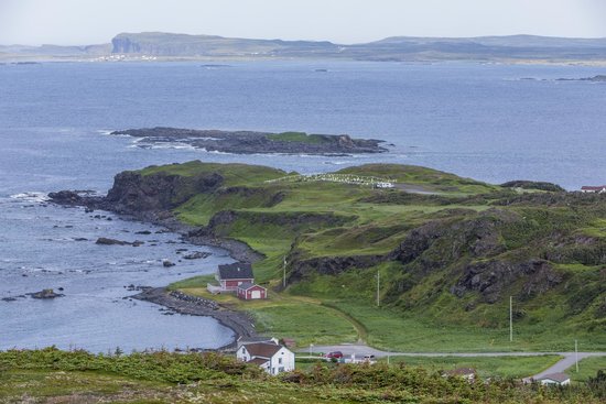
The more interesting places are Cape Onion and Ship Cove. The road down is quite bumpy and rutted and you will likely wonder
what you have gotten yourself into (the Ship Cove road is particularly bad) but believe me it's worth it. Cape Onion is a
wonderful sight and quite photogenic. Be sure to find the quaint little rock formation with the small houses that seem to be models of
other places in the community. We thought it to be kinda special, and the houses on the road behind are quite pretty.
Ship cove is also a great photo op.
|

|
|
|
Click here to see photos of the towns of Raleigh, Cape Onion and Ship Cove.
|
|
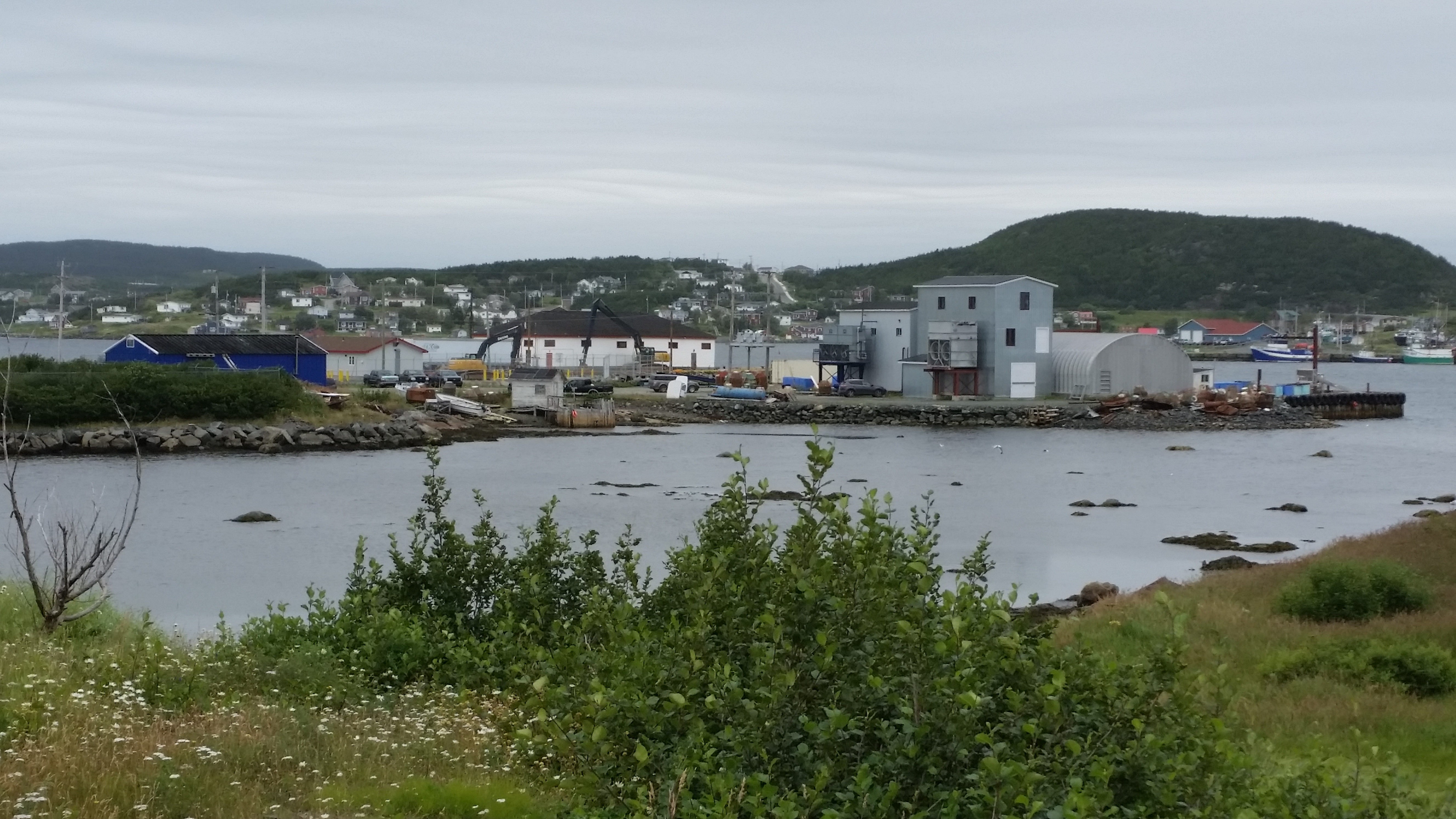
St. Anthony and Goose Cove
|
To get to St. Anthony, exit the campground, take a right and go a few hundred yards
to the 436. Take a left and go south. Follow it to the end and take another left onto 430,
which dead-ends at St. Anthony. The end of the road culminates in a nice view of the
St. Anthony harbor. There is a
lighthouse there, as well as the Lightkeepers Seafood Restaurant which is famous for seafood and
Viking Feast events. We didn't eat there but you might want to give it a try just for the
experience
I was frankly a bit disappointed by the size of the town - I thought it would be larger, although it may well be the forth
largest town on the island after Port aux Basques, Corner Brook and St. Johns.
One thing we noticed about the drive down was the complete lack of trees, which is probably a testament to the harsh winters
in the area.
Regarding supplies, at St. Anthony there are two gas stations with diesel, a hardware store, a building supply
store, a Foodland grocery, two pharmacies and a Tim Horton.
The Triple Falls RV campground is on 430, so you may want to look to see if it better
suits your needs. We didn't go in
to examine it, so do your research on Google and Earth.
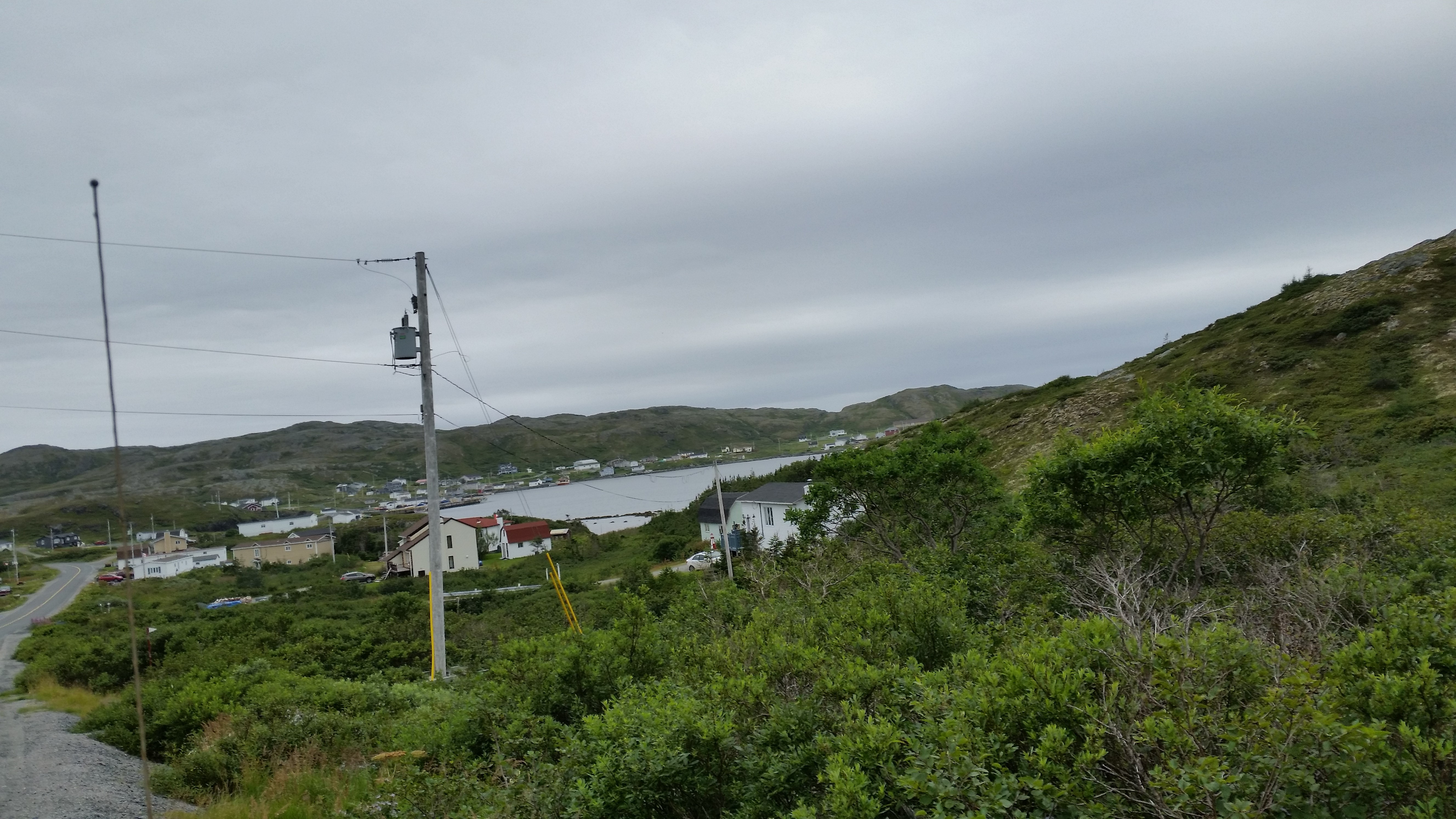
Just before you get into the town proper, 430 makes a sharp right and goes up to Goose Cove. Be alert. as there is no sign
telling you that 430 makes the turn; only the sign to Goose Cove gives you a clue. If you go straight past the turn you wind up in downtown St. Anthony.
Goose Cove is somewhat famous as the place where Dr. Wilfred T. Grenfell got stranded on an
"ice pan". You will likely see the name Grenfell on many signs
along the highways. There is a book on the subject
called "Adrift on an Ice-Pan" by Dr. Grenfell. As it happens, I bought the book at some little store in Nova Scotia
without knowing anything about the legend, and I haven't read it yet. I did note that the first page is signed by the author!
| |
| |
[click to enlarge]
|
| |
| |
[click to enlarge]
|
|

|
|
Click here to see photos of the town of St. Anthony.
Click here to see photos of the town of Goose Cove.
|
|
St. Carols, St. Anthony Bight and Great Brehat
| |
[click to enlarge]
|
| |
Going back (northwest) away from St. Anthony, turn right onto 430-something.
When you come to an intersection, the right takes
you onto St. Anthony Bight Road, while the left leads to another intersection with
St. Carols Road on the right and the road to Great Brehat on the left.
Note that no road names are currently marked from 430 onward, so you will either have to
use GPS or closely follow the above directions.
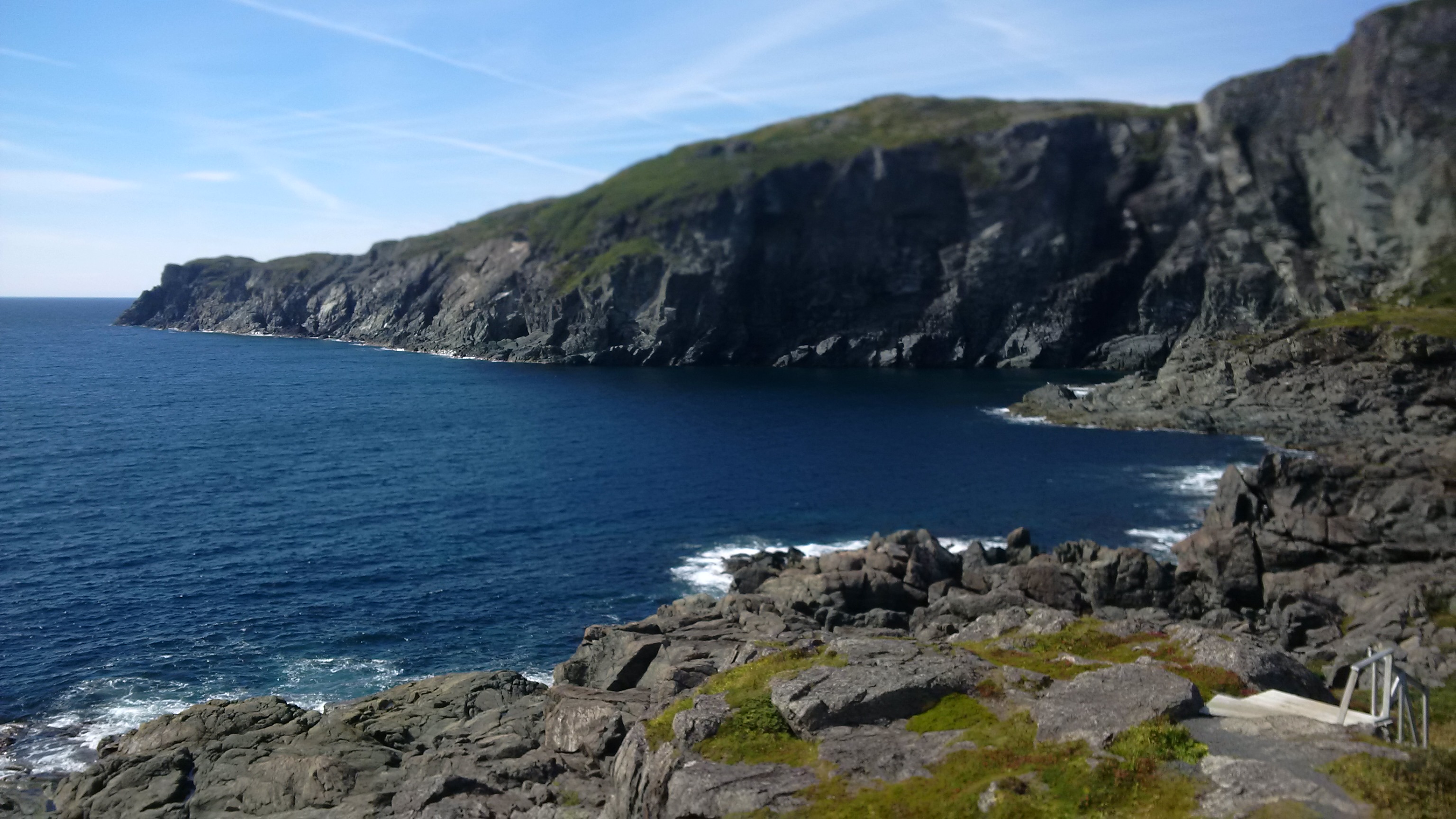
Each of these three little towns is on the seacoast, and none is very large.
But the views are quite nice. If you go, do
yourself a favor and make the climb up the various trails up to the top of hills
where you will be rewarded with spectacular
panoramic views. I particularly enjoyed the one at Great Brehat.
|

|
|
Click here to see photos of the towns of St. Carols and St. Anthony Bight.
Click here to see photos of the town of Great Brehat.
|
|
Englee
|
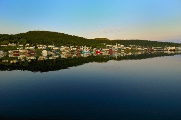
This is a small fishing village that seems quite picturesque and photogenic.
Unfortunately we didn't get to go there, mostly because of the long drive, but
here are some good looking photos I found on the Web.
To get there, from 430 at Plum Point, take route 432 southeast until you get to route 433
south.
It's a bit of a drive, which is one reason
we couldn't go. Along the way there is a Green Moose Interpretation Center at Roddickton.
| |
| |
[click to enlarge]
|
|
L'Anse aux Meadows back down to Deer Lake
[88660 - ---]
Still suffering from sensory overload from all the great places we visited
on the Northern Peninsule, it was time to point our noses toward St. John's over on the
east coast. We had originally planned to stay a couple nights on the beach at Port au Choix
again before going on to Gros Morne, but unfortunately we had a medical issue with one
of our dogs and needed to get back to a vet in Corner Brook.
Curiously enough, we couldn't find a single vet on the whole of the Northern Peninsula.
I don't know what these folks do if they have problems with their pets or farm animals.
Gateway to the North campground
29 August @ 2 nights, 30 C$ / night
We stayed again at Gateway in Deer Park for a night before heading east.
Deer Park is not far from Corner Brook where there are vets. It rained heavily
that night, which was nice for us. We always enjoy hearing rain on our slideout roofs.
Refer here
to our prior stay at the Gateway campground, and what there is to do in the area.
 Go back to the previous leg of the journey
Continue on to the next leg of the journey
