"OK. Now things start getting good..."
|
Canada in general is big, with big providences. The providence of Newfoundland and Labrador
is particularly really big, but not huge. Alaska is huge. Russia is huge. The universe is really really huge.
But Newfoundland is certainly big too. It is Canada's fourth largest
island but only about 500,000 people call it home."
PS: Do you know about a neat website called
MAPfrapp? It's a cool site for visually comparing the sizes of various places.
Some people seem to have the mistaken impression that Newfoundland is rather flat, rocky and drab. Nothing could be
further from the truth. It is beautiful, quite mountainous and covered with trees and water.
But they are right about the rocks; they are everywhere! In fact, NL is often referred to as
a huge rock garden or, more simply, "The Rock".
One of the common themes I heard when talking to folks in Nova Scotia about how beautiful the sights of the Cabot Trail
are, they inevitably replied with "Wait 'till you see Newfoundland."
| |
| |
[click to enlarge]
|
|
Eateries on The Rock tend to have one main item: fish and chips. Whereas the fish in Nova Scotia
is usually halibut, in NL it's always cod and, more than likely, it will be good. They've been doing cod
for a long time and have it down. Squid dishes are also a favorite that we enjoyed.
And if you're into trying new things, cod's eyes and
cod cheek meat are delicacies on the island.
I don't know about you, but my wife and I aren't big on large crowds, a condition that has
persisted ever since we went to Mardi Gras many moons ago. As it happened, we hit Newfoundland at just the
right time for us - late enough in the season that many of the tourists were emptying out, but not so late as that
everything was shutting down. If that appeals to you too, then this is the time to come. But don't wait
much later as some or most of the points of interest will be closing down, and things will start to get rather cold.
Also don't forget that most campgrounds in NL shut down around the first week of October, so while you
might make it to
St. Johns just fine, you may find that campgrounds are closed on the trip back.
As for the weather, the temperature was absolutely fabulous - around the high 60s to mid 70s F,
although one night it did get down to around 45 F. I never got out of shorts and tee shirts the whole time, although I
do admit I'm not quite as susceptible to cold (or hot) as others. Little or no rain to speak of.
The wind had been
just fine except when we camped on the shore, where it was a bit strong and chilly
Note that when I talk about Newfoundland in this blog I am referring to the island. While most
non-Canadians think of Newfoundland and Labrador as separate places, they are in fact part of the
same providence known as 'Labrador and Newfoundland.'
If you look at it on a map you will see that it consists of the island
as well as a huge part on the mainland. I haven't researched how they both came to be consumed
under the same providence name but I'm sure it is an interesting story.
Campers that have satellite TV should know that NL seems to be out of reach. Although
our rooftop DTV dish could find three satellites, it did not get sufficient signal strength
to pick up actual programs.
Our Sprint cell service also did not work at the campground, although it did when we got a
little farther out. This
is likely an issue with the cell towers that Sprint cooperates with, and may not be true with T-Mobile or
some other carrier.
If you are not inclined to read the whole blog, here are quick links to things
you should know about for this part of the trip. Points of interest up to the Great
Northern Peninsula will be covered in the next blog.
Here is something I ran accidently ran across on the 'net. I haven't pursued it but I believe it is a compendium
of stories about Newfoundland. I figure if you're either a Newfie or have an intense interest in the area and its
history, look into
The Book of Nwefoundland by Smallwood and Thomas.
[--- - ---]
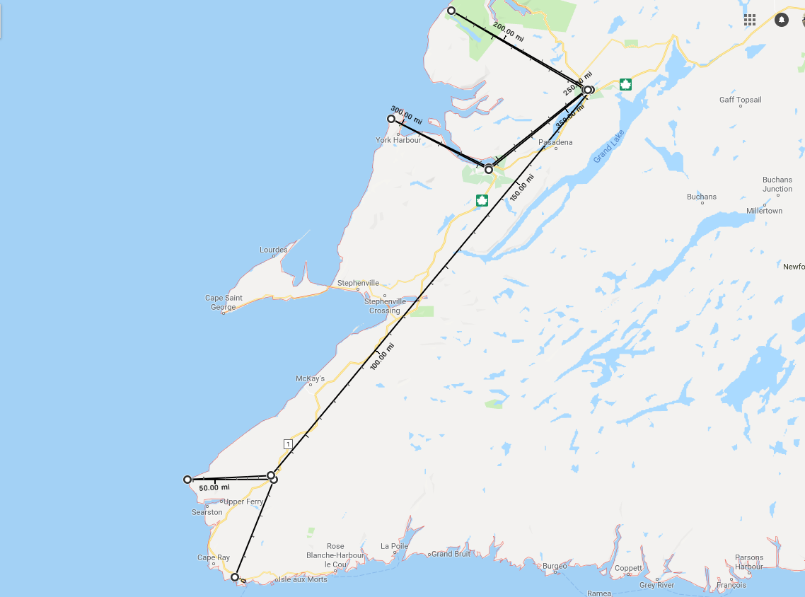
You get to the campground from the ferry by taking the TCH (highway 1)
north up to just south of Doyles.
Turn left onto route 406 at the Esso station. Turn right onto Doyles Station Rd, and the campground
will be on your left.
If you miss the 406 exit, no sweat. Continue up the TCH a bit further and
turn left onto Doyles Station Rd. There is a post office on the right. Continue up to the
campground which will be on your right.
Grand Codroy RV Camping Park
5 Doyles Station Rd, Route 406, Doyles NL A0N IJ0
Ph: 902.383.2116, 877.955.2520
Email: grandcodroyrvcamping@nf.sympatico.ca
Website
15 August @ 2 nights, $38 C$ / night
|
This is the closest campground to the ferry, so we stayed here when we got off.
You can always tell
when the ferry comes in because twice a day there will be several rigs lined up at the
office to check in.
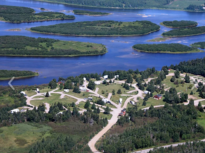
This is a really well done campground that sits on the Grand Codroy Provincial Park.
It is neat and clean, and has plenty of common green
space. There are picnic tables,
fire pits, and they offer free firewood! The sites are uncrowded. The staff is friendly and helpful. One of the owners
cheerfully helped me pull our truck out a precarious situation I foolishly blundered into.
| |
| |
[click to enlarge]
|
|
There are currently 69 RV sites, all with full service. It seems to be primarily transients, which makes sense considering how close they are to the
ferry. There are garbage cans at each site which are emptied by the staff. There is also a little bakery and gift shop next to the
office, as are the laundry facilities.
Our site was # 23. It was pretty long, an easy back-in, level and had 30 amp, water and sewer, no cable. There is an open
field next to the site, which was great for dog walking.
You can always tell when the ferry comes in by all the rigs lined up at the office.
There is wi-fi internet, but a connection didn't seem to hold for long. On the good side,
that was the only minimally negative thing I can find to say about this campground.
Because we took the night ferry, our stay here turned out to be only one night
instead of the planned two, but we did manage to pack in a busy day.
The Tourism Department produces a fine Traveller's Map that usually ships with the
Traveller's Guide to make
trip planning easier. Request a copy before you leave or pick up a copy when you arrive.
There is diesel at the station where you turn off the TCH onto 406. There is also a station
with diesel on 406 just north of the campground.
Be sure to pick up a map of the area from the campground office.
We were told about the Seashore Restaurant in Margaree, just east of Port aux Basques. It is supposed to be a really good
restaurant, and we were told it has a great buffet on Sundays, but call them to make sure [709-698-3751].
We didn't have time to go but we really would have liked to if we had stayed longer.

|
|
|
Click here to see photos of the Grand Codroy campground.
|
|
Codroy

| |
[click to enlarge]
|
| |
Take a drive up the 406 north of the campground. The 406 goes by the Codroy Valley
Wildlife Museum.
406 will make several jogs. It makes
a sharp right at Great Codroy just before the bridge over the Grand Codroy River.
It then makes a sharp left and heads west toward Milleville. If you take a right toward
Maclellan Inn, there
is a gas station up the road that has diesel and some groceries.
Taking a left on 406 toward Millville you will pass route 407 which goes south back down to the TCH.
The Codroy Valley Provincial Park is on the 407. We didn't have a chance to check it out.
Continue past Millville through Woodville and finally wind up at the town of Codroy.
This is the definition of a small coastal fishing village.
If you want to know how cold it gets, simply look
at the piles of 6 or 7 cords of firewood sitting in people's yards.
|
There is a small marina at the Codroy waterfront where a few fishing
boats can be found. This little town (actually more like a community) likely makes its living almost purely from fishing.
There is a little hamburger stand just outside of the community.
Keep driving north past
Codroy and Shoal Point to the end of the road where you will see the
Cape Anguille lighthouse. There is a small inn next to the lighthouse, and they don't seem to mind if you go down
and have a look at the scenic coastline.
I got a long overdue haircut at the Tangles Solon [709.955.4247] on route 430, across the road
from Gillis Bros Grocery and Speedy Automotive. I was pretty lucky to hit it at just the right time
as a walk-in, since they normally require reservations. Maybe the lateness of the season was
a factor.
After investigating the Codroy area we packed up and headed to Deer Lake, a central
stopping off place for going either north to the Peninsula or east to St. John's.
The location is close to the magnificant Gros Morne National Park,
and there's also lots of shopping to be had at nearby Corner Brook.

|
|
|
Click here to see photos of the road to Codroy and Cape Anguille.
|
|
Doyles to Deer Lake
[87540 - 87639]
To get to the campground, take highway 430 (exit 16) off the TCH. It will loop around back
over the TCH. The campground will be about a km on the left, across from the butterfly museum.
Route 430, known as the Viking Trail, continues on to some very scenic places that I will
talk about a little later. It is also the only road up to the Northern Peninsula.
Gateway to the North Campground
1 Bonne Bay Rd, Deer Lake NL A8A-2V1
Ph: 888.818.8898 for resv, 709.635.5888 for the park
Email: geribeaulieu@hotmail.com
Website
17 Aug @ 3 nights, 38 C$ / night
|
This is a medium size campground situated next to the Humber River, and is convenient to the Deer Lake area.
The sites seem level, have 30/50 amp service, water, sewer, picnic tables, fire rings,
and internet which impressively
held together for quite a while. I only had to reconnect a few times.
There is a laundry, and a small fishing lake next door where some of the
seasonals stay. They advertise that the 7th night is free but we didn't stay long enough
to take advantage. They have Good Sam discounts.
Update: on our second stay here the internet was quite bad; actually atrocious. I had to reconnect often, and one day I
couldn't access the internet for half the day.
| |
| |
[click to enlarge]
|
|
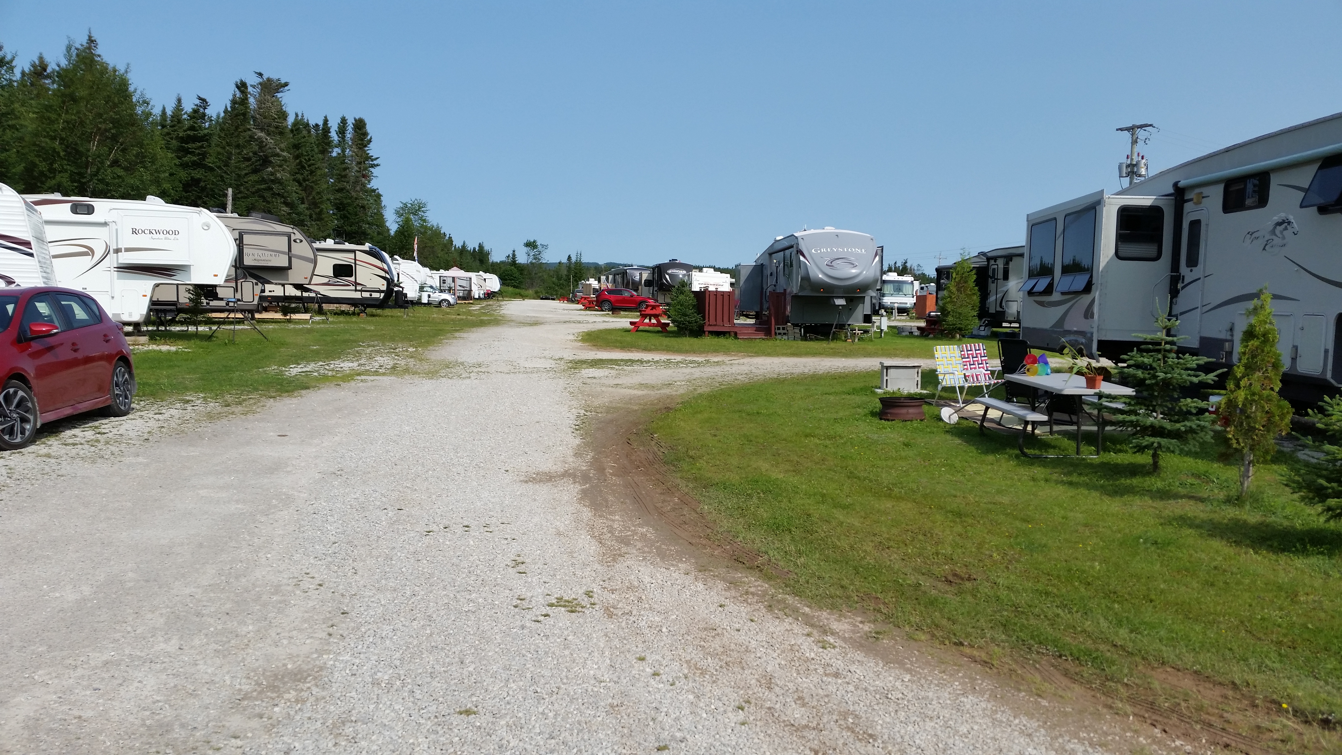
They have somewhere around 100 sites. Our site was
# 27. The sites are not nearly as crowded as may appear
in pictures; there is plenty of room between rigs. There are boxes next to, or close to each site where you can place
your garbage, and it will be picked up for you.
The Deer Lake Airport is nearby and planes can sometimes be heard flying overhead. They can be noisy, but it's not all
the time and doesn't seem to be a big deal.
At TCH exit 16 there is a small shopping mall
with fast food and a grocery store. We ate at the Canton Chinese restaurant,
which I cannot recommend as the food was pretty bland and not up to our US standards.
The next night we ate at the
Deer Lake Motel restaurant across the road from the Canton, and it was much better.
I had halibut and Phyllis had pan fried cod.
I also tried the cod tongue and found it interesting;
seems like an acquired taste but I would try it again. The bill with drinks, appetizer
and deserts was 83.63 C$.
The campground is about an hour away from Gros Morne National Park to the north.
They say there are about 4 hours from icebergs and whales.
It is also about 45 minutes down to Corner Brook in the south. I'm not sure but
Corner Brook may be the second largest city in NL, so of course there are a lot of
facilities there, including the Marble RV dealership and service.

|
|
|
Click here to see photos of the Gsteway to the North campground.
|
|
Butterfly Museum
2 Bonne Bay Rd, Reidville NL A8A2V1
Ph: 709-635-4545, 866-635-5454
13 C$ adult, 11 C$ senior, 9 C$ child
| |
[click to enlarge]
|
| |
Across 430 from the campground
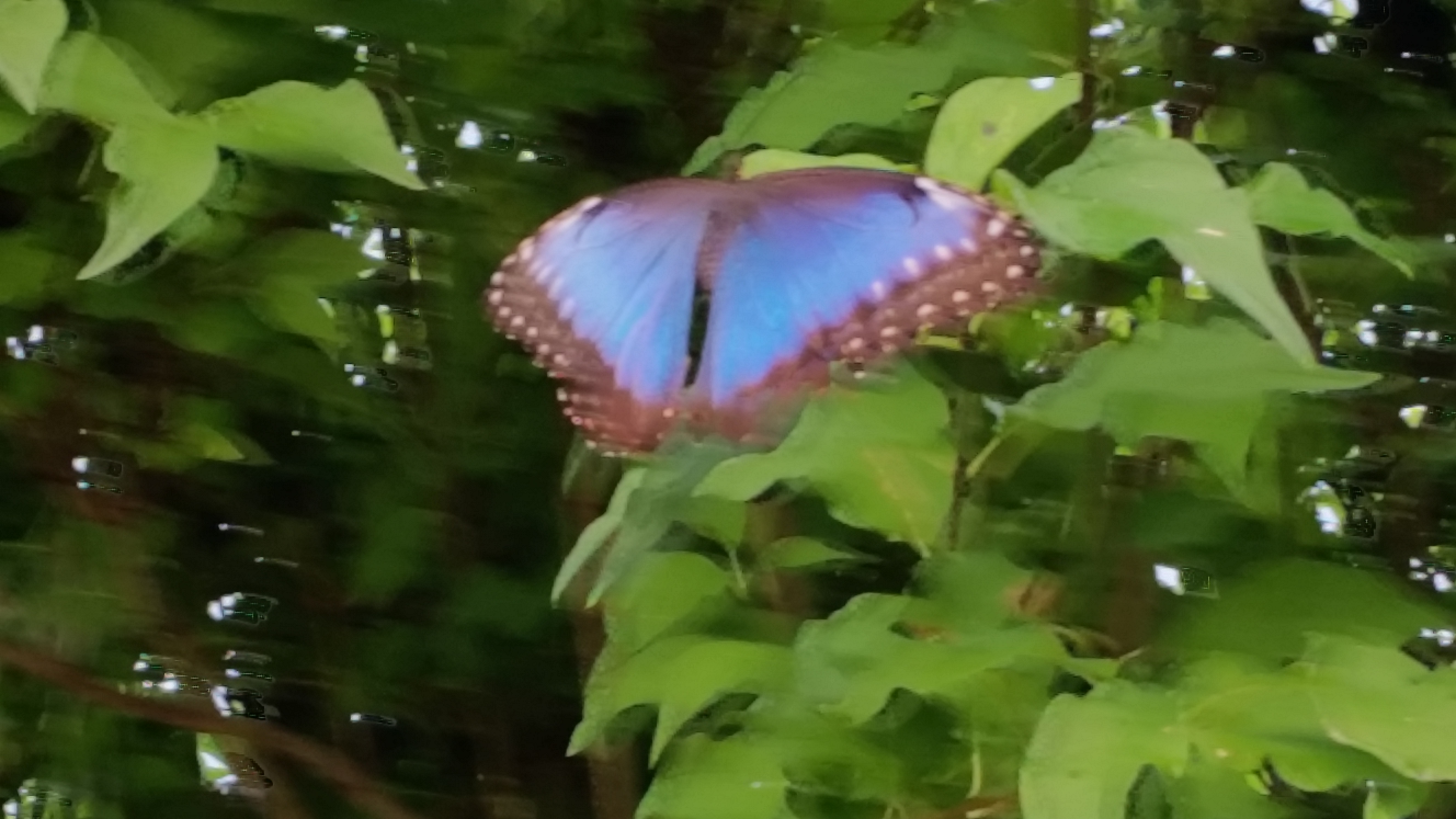
is the Newfoundland Insectarium and Butterfly Garden, with a nice live butterfly area that
you can walk through.
They also have an interesting beehive exhibit where you can watch the bees make honey.
There is a transparent pathway to the
outdoors so the bees can fly off and find pollen from local flowers. The large exhibit of
bugs and insects from all over the
world will take a while to see.
They have kennels where you can leave your pets while you are inside. This probably won't be a problem if you're staying at
the Gateway campground across the street since your pets will likely be in your rig anyway.
|
Highway 431 to Woody Point and Trout River
|
This is a wonderful side trip that should not be missed.
From the campground, take 430 northwest [left] from the campground and go on through Bonne Bay Pond.
Hwy 431 veers off to the left (west) at Wiltondale and continues through Glenburnie-Birchy
and Head-Shoal Brook. Further down the road you will come to an intersection. 431
makes a sharp left and goes out to Trout River. If you stay to the right at the
intersection you will go down to Woody Point and Bonne Bay.
You will likely find the initial stretch from 430 somewhat repetitious.
Don't get me wrong - the
mountains are beautiful and majestic, but there's not much else to see until you get to
the lake views. The initial part
of 431 is the same way. However, when you get to the coastline things change!
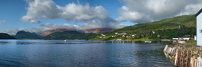
From there to Woody Point (our first leg)
is incredible. We probably stopped every few hundred yards to take pictures.
| |
| |
[click to enlarge]
|
|
Woody Point is a picturesque little fishing village. Walk around and visit the shops there. We ate at the
Granite Coffee Shop and had ice cream afterwards. Be sure to go down all the side roads and lanes leading to the water;
you won't be disappointed. By the way, this rule seemed to apply to all the little waterside villages we've been to.
We rate the drive up to Woody Point only slightly below our all-time favorite so far - the drive up to White Point
off the Cabot Trail.
The fork leading to Trout River is also interesting, although Woody Point was our favorite of the two. Trout River has a
surprisingly long boardwalk with a great view. We tried to stop in the Seaside restaurant for takeout but they couldn't
handle us due to too many sitting customers.
We passed several small RV parks along the way but found none that we would consider -
except for the
Waters Edge RV Campground
just outside of Woody Point where each rig backs up to the water. There is 30 amp and water at the
sites, as well as showers, washrooms, a convenience store and a boat ramp. They also have a
dump station. This campground is particularly attractive since it is a short drive to the
Tablelands, Woody Point and Trout River.
I think if we came back to this area we would give this one a try!

|
|
|
Click here to see photos of Woody Point and Trout River.
|
|
Route 450 from Corner Brook to Bottle Cove
| |
[click to enlarge]
|
| |
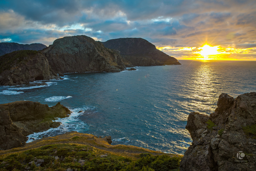
Wait a minute! We have a new winner! The drive out to Bottle Cove is now our "most-est favorite-est", even better than the
White Point drive from the Cabot Trail. From the campground take TCH down to Corner Brook. There is lots of water on the right so you
won't be bored with the drive down. I realize that beauty is in the eye of the beholder, and different
people will differ as to which place they think is the prettiest, but I believe you would be doing yourself a
disservice if you come all this way and miss places like this.
To enjoy this lovely day trip, take the TCH south from Deer Lake and go down to Corner
Brook, one of the larger towns on Newfoundland. There is lots there in the way of shopping, and
Marble RV is just outside of town. When you get off the TCH at highway 450 [Lewin Parkway], be sure to take
a little detour immediately past the exit where there is a
fairly large shopping center. We pulled around behind the Kent Building Supplies
store and took some amazing photos of an inlet from the Bay of Islands.
|
Continuing on 450 west through town until it makes a sharp left [don't be fooled into
taking 450-A as we were]. Soon you will be greeted with some jaw dropping views which just
keep going on and on all the way through
Frenchmans Cove and down to Bottle Cove which is at the end. Bottle Cove
sits on the Gulf of St. Lawrence.
On 450 between York Harbour and Lark Harbour is the Blow Me Down Provincial Park.
You can drive in as far as the lookout but most of the park is not accessible by vehicle,
for which there is a 10 C$ entry fee. The park gets high ratings on TripAdvisor.
We stopped at a little wharf in Lark Harbour to snap some pics, and on the way out I stopped to chat with
a couple of locals out
repairing their fence posts. Before we left, they insisted on giving us a bag of moose steaks and some trout! We certainly didn't
expect this kind of thing. They wouldn't take any money or anything, so we now know what they mean about Newfie hospitality.
We've even heard that sometimes locals will invite you in for dinner, but unfortunately
we didn't have the pleasure.
When you get to Bottle Cove, park in the lot and walk up the trail to the right. It's not too long, and
the views at the top are simply majestic. You can go even higher and I believe there is a lighthouse up there, but
I didn't have time to do it because we had to get back to the dogs in the trailer.
I'm not lying when I tell you that we must have stopped at every turn to take more pictures. It's that pretty. And
they're not all of the same views, since the shoreline makes lots of twists and turns. The bay is called the
Bay of Islands, and if you go there you will see why.
Down toward Bottle Cove there is a little restaurant on the left called Captain Cook's Galley. We had a late lunch
there and the pan fried cod was superb. We asked them to make the milkshakes really thick and
they were glad to oblige, so we were quite pleased.
There is a place called Cedar Cove that folks tell us has even nicer views than Bottle Cove, but we didn't have time
to check it out as it requires a 2 km hike up a trail to get to. Some locals said the it is a "must see" visit, and
supposedly there is lots of driftwood there.
There is quite a bit of road erosion down around Lark Harbor, which can make for a bit of a bumpy ride.
But do not let road conditions keep you from making this trip - it's definitely worth it.
The temps were in the low 60's to low 70's F - perfect weather.
More problems...
Permit me to share a couple issues we had with our slideouts, not to gripe but
hopefully to make you aware of some difficulties you too could experience, and what
to do about it. We had yet another slideout incident when we were packing up to leave the campground. The big slideout on the
dining table side wouldn't go in all the way. It turned out that one of the cables broke, so the motors were pulling
it in cockeyed. I tried to push it in but it was too heavy. Even if we abandoned our trip and headed back, I knew they
wouldn't let us on the ferry like that.
So we headed down to Marble RV in Corner Creek but they weren't able to help, mostly due to our
manufacturer [Open Range] being out of business. And even if they could get the cables it would
have taken a long time for them to get to it, perhaps days or weeks. We had no choice but
to struggle on, but we do have to give them kudos since they were nice enough to get a
few guys together and push the slideout back in. No charge!
To make matters worse, this this was our second of three slideout cable failures we had on
this trip, the first being the kitchen slideout problem we had back at the Bras d'Or
campground at Braddeck in Cape Breton, and the third was at the Smith Mountain campground
in Penhook VA on the way home to Florida.
I believe that going eight years without changing the cables led to these problems,
especially since we were sliding them in and out every couple days or so during the trip.
And all the terrible roads in Newfoundland and elsewhere certainly didn't help things.
Anyway, now that we had the slideout pushed in we had to make a decision.
Do we turn back or press on? Living with one slideout permanently pushed in
and another only able to go out about 3/4 way would make for a rather
cramped existence, especially with three dogs added to the mix. But what the heck - in
for a penny, in for a pound. We didn't come this far to be stopped now, so we decided
we could tolerate cramped quarters in exchange for more oohs and aahs.
We were determined to make to St. Johns, so, next stop Portland Creek.
A personal opinion
During our trip we had the luxury of spending multiple weeks touring around Newfoundland. As I've said often,
there was no place where we were sorry we went. However, not everyone can spend that much time there, so if your
schedule is limited I wholeheartedly recommend you restrict your stay to the western part of the island. While
St. John's is a fun town, the Irish Loop is interesting, and the eastern and northern coasts offer lots of
opportunities for exploration, the western coast is far and away the most majestic offering. Gros Morne National
Park is there. The Northern Peninsula and L'Anse aux Meadows are there. And all the little fiddlybits along the
coastline that made our trip magical are there.
So I recommend you eschew the long ferry and instead take the relatively short ferry ride over to Port aux Basques.
This gives you more time on land, which is after all why you go to Newfoundland. You can easily take in the entire
western area in a couple weeks without being rushed. But if you do have the time, by all means take in as much of
the island as you possibly can -- you won't be disappoined!
 Go back to the previous leg of the journey
Continue on to the next leg of the journey
