New Glasgow PEI to St. John NB
[--- - ---300]
|
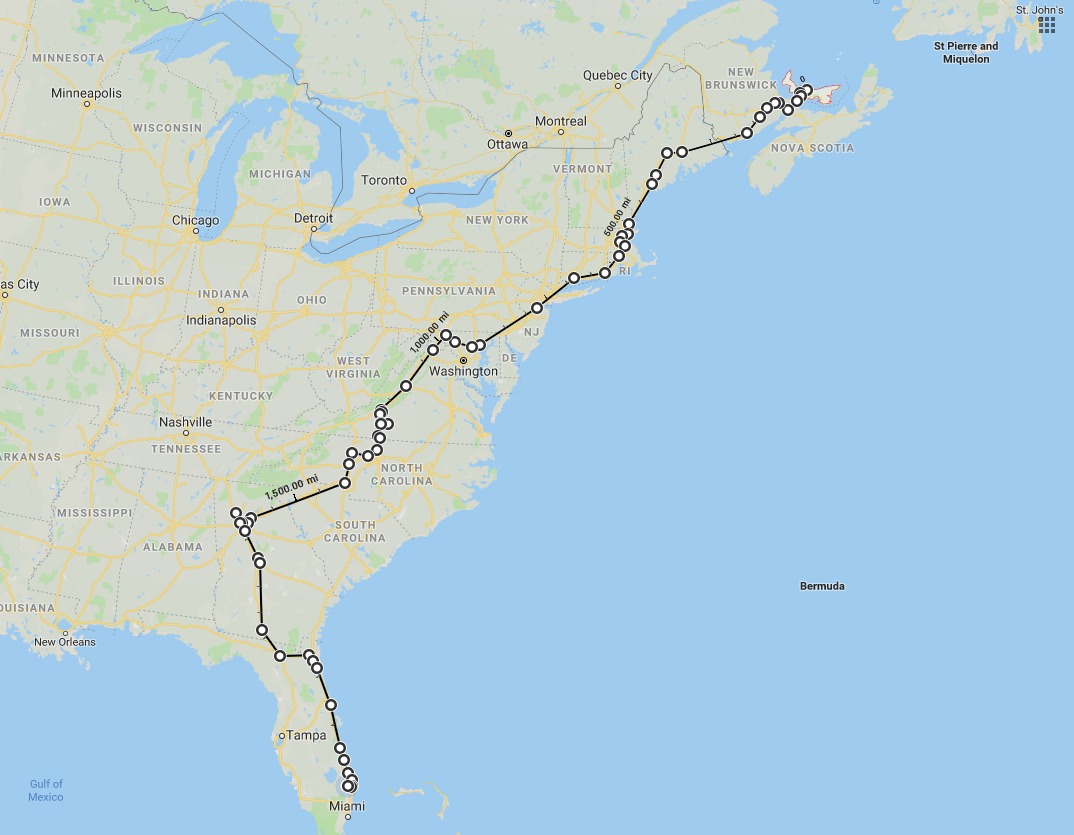
After our brief time on Prince Edward Island, we were getting ready to
say goodbye to Canada and head back to the States. We would still have a couple more nights in
New Brunswick and then start thinking about south Florida. We didn't look forward to
cleaning up the house and yard after four months of neglect, but we (as well as the dogs)
were ready to lodge in a little more roomy environment and perhaps even contemplate a
hot bath.
We crossed the Confederation Bridge again on the way out of PEI. The toll was
$63 C$ for truck and trailer.
We eschewed Moncton and drove straight through
to St. John. We had heard about Magnetic Hill (exit 450) in Moncton and wanted to check
it out but decided it wouldn't be worth the extra day.
| |
| |
[click to enlarge]
|
|
The TCH from the bridge through New Brunswick was, well, patchy. I do think that
the patches were almost as bad as the potholes.
Note that the TCH has various route numbers, depending on where you are.
In PEI it was numbered 0, wherea after the bridge
in Nova Scotia it was 2. I don't think it actually had a number on the bridge.
The temp got up to a sunny 70 F during the drive, then things got drizzly, then rainy,
then quite foggy.
Rockwood Park Campground
142 Lake Dr S, Saint John NB E2K-5S2,
Located off Route 1, Exit 125 or 129
Ph: 506.652.4050 [506.657.1773 off-season]
26 September @ 1 night, 42 C$ / night
Website
|
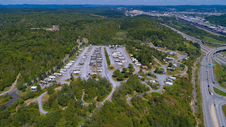
This campground is located, well, inside Rockwood Park. The Park is a recreational
area with fishing, swimming and boating, and ice fishing and ice skating in
the winter. There are many trails where you can
see unique geological rock formations, caves and waterfalls. There were a lot of folks enjoying
the park while we were there.
Being a caver in my younger days, I wish I had known about the
caves while we were there; we may have stayed an additional day. That said, the videos
I have seen on the web suggest they are very short and probably only interesting to the
merely curious.
Despite some good reviews on TripAdvisor, I'm not real crazy about this campground.
It seems less like a campground and more like a parking place
for your rig while you visit the area.
Our site # 94 had 30 amp, water and a picnic table, but no sewer. Lots of sites do have sewer hookups though,
and some have fire rings. There is a shower and washrooms. The gravel site looked level to the naked eye,
but it wasn't.
| |
| |
[click to enlarge]
|
|
The area we were parked was composed of a grid of marked off rectangles which are pretty wide, but barely long
enough to get in a 37-footer. Many sites are back-to-back where your rig is almost literally touching the
one behind you. Each group of four sites shares common water and elec posts.
One advantage of this campground is its proximity to St. John. If you plan to spend a lot
of time visiting
the area and not much time in your rig, this campground should work out well for you.
There are two dump stations on the way out, offering easy access; they both have water hoses.
If we had this to do over again we would have returned to
Hardings Point Campground which is just a little
northwest of St. John.
That was the one where we took a short ferry ride over to the campground. I'll admit I have
a preference for
experiencing different campgrounds rather than going back to the same ones again, but this time I
think I made a mistake.
The roads around the area of St. John where we were are somewhat of a jumble. They seem like they
were designed to follow old cow paths. It was hard for me to determine general directions
and I got myself lost a number of times. Thank God for good old GPS.
Notice that the city of St. John NB is different from St. John's NL. Both are rumored to
be named after the Nativity of John the Baptist, not John Cabot. Also note that the name of
this city does not contain an apostrophe whereas the one in Newfoundland does.

|
|
Click here to see photos of the Rockwood Park campground.
|
St. John NB to Richmond ME
[92367 - 92650 - 24]
The drive from NB to Maine was uneventful. We started to see the beginnings of fall colors: some
reds and oranges and a few yellows. I think in another week or so the area should be aflame.
The colors continued to be bright when we got into Maine and became a little more plentiful, which you might expect, as
the evergreens gave way to hardwoods the farther south we went.
I was reminded on the way back that we should have taken the Fundy Coastal Drive when we
came in, but we did see a part of it when we went to
Hopewell Rocks. This is a scenic drive [routes 111 and 114]
along the entire
southern coast of NB, where there is whale watching to be had during the whale season.
Not counting photo taking time and campover time, count on around 5 to 6 hours driving time.
Although we missed it, I encourage you to try to work it in while you are in NB.
Here is a link.
Crossing the border
[--- - 92143]

| |
[click to enlarge]
|
| |
Again, we had almost no problems at the border. They did ask us about the truck bed full of driftwood.
The agent wanted to know if it was firewood, and when we told her it was driftwood my wife was going to use
to mount her orchids on she seemed to be satisfied. She then asked if we had any citrus and we told her we did.
She came into the trailer to look around and we gave her the tangelos we were carrying. Since the trailer was
so crammed with our crap she wasn't inclined to walk around, and she didn't ask us to put out the slides or anything.
She also didn't ask to see our dogs certificates. In total, it was a rather uneventful encounter.
|
The border warnings coming into the US include the following restrictions:
- no poultry
- no pet food over 1 day's worth
- no pork
- no potatos
- no firearms
- no alcohol
Also remember to reset your odometer to miles rather than kilometers, and change your phone GPS to miles.
Back in the USA
Once we entered Maine, our Sprint phone service was non-existent all the way down to Bangor.
Perhaps they don't have cell towers there.
Route 9 was a lot better than the way we originally came in. There is a stretch that has been recently paved,
but there remains a lot of bumpy road.
We saw a nice windmill farm with a couple dozen windmills, but I forgot exactly where
on route 9 they were. We also passed a neat looking campground called Park Pond on 9 north of Bangor. You might want to
Google it if you are interested in staying in the area.
Speaking of Bangor, we had originally planned to see Bar Harbor and
Acadia National Park, either coming or going, but schedules didn't permit. We had been there
years before and had
great lobster, so we settled for reminiscing about it a lot.
I-95 was a pretty drive all the way down to the KOA. The temp actually got up to
a blistering 70 F.
Augusta-Gardiner KOA
30 Mallard Dr, Richmond ME 04357
Ph: 207.582.5086
Website
27 September @ 1 night, 42 C$ / night
|
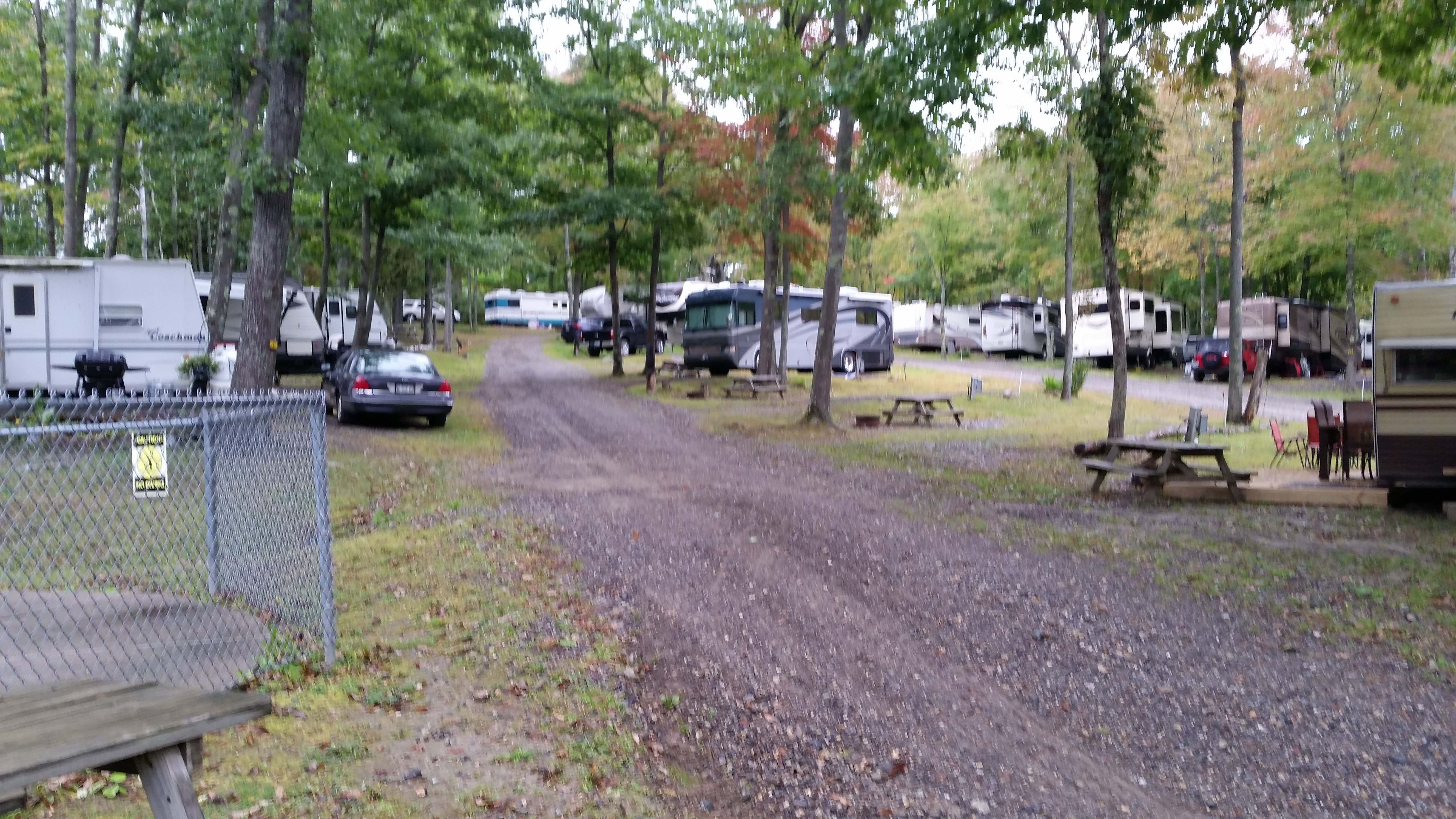
This is a rather rustic KOA nestled in the woods. There are sites for big rigs as well
as small.
Our site # 19 had 30/50/110, water, sewer and a picnic table. There was a water faucet on both sides of
the site which was thoughtful. The gravel site was not at all level. A lot of the sites are cut into
the hillside, so be very careful walking at night, and use a flashlight.
There is a pool, a playground, a shuffleboard court, a Putt-Putt course, a basketball court, a dog park
and a short nature walk. There are also a few cottages.
The roads are currently rough and need to be graded, which they are apparently getting ready to do.
When we checked in, a nice lady at the office escorted us to our site, which I thought was nice.
| |
| |
[click to enlarge]
|
|
There is an Irving fuel station reasonably close. Exit the campground and turn right
onto US 201. Go about four or
so miles to the blinking light and turn left on route 197. Go about another three miles, over I-295, to
the Irving station on the right. It also serves as a small truck stop, so the diesel pumps are around back.
If you go there, be aware of a bewildering anomalie. First, the pump hose on the far left probably won't reach
your tank so you might have to come in the other way [regardless of what the Do Not Enter signs say].
Secondly, the other two pumps, designed for semis, actually have two tanks each; one on the left
side and one on the right. If you pull in the wrong way,
what you have to do is swipe your card on the righthand pump, take the nozzle out,
lift the handle and lay it on the ground. Then go over to the other pump and dispense your diesel.
When done, put the left hand nozzle back, go over to the first pump, and then replace the nozzle that
you laid on the ground. I originally learned this trick at a station in Maine. I think this is for older stations that
don't have card readers on both sides. Confused? You'll figure it out.
There is a moderately stocked camp store at the office, as well as a tv lounge. They also refill propane
tanks at the office.
There is a big hump going out of the campground. Make sure your landing gear is
sufficiently raised to clear.
You can get back onto I-295 by following the directions above to the Irving station.
Note that I-295 splits off from I-95 a few miles north of the campground around Libby Hill.
They merge back together down south at Portland. You can skirt Portland by taking the Falmouth
Spur over to I-95.

|
|
Click here to see photos of the Augusta-Gardiner campground.
|
Richmond ME to Mystic CT
[92650 - 92987]
ME, NH, MA, CT
We had no particular destination for this leg of the trip. As with the prior two legs I simply wanted to
find a convenient stopover target to limit our driving time.
As soon as we hit Maine I started thanking God for the good old USA interstate system, which turned out to be
a bit premature. While a lot of it is good, and some is really good, there are parts that felt like I was back
in NL again. And bridge joints? They can tear up a trailer with the best that Newfoundland
has to offer.
We got tolled to death on I-495 from Amesbury to I-290.
I had almost forgotten about New England interstate tolls.
We paid about $19 just on this short leg. It wasn't the amount of the tolls I hated, but rather
the stop after stop that was so annoying. Welcome to New England!
I had also forgotten how bad the drivers in Massachusetts can be. I like to say we lived
there for a lifetime one year way back ago.
I am ashamed to admit that I had become accustomed to the bumper car type havoc, but living down south sort
of calmed down my driving - except when I'm in Atlanta on I-285!
I had to laugh at all the signs that say "Plows Use Caution". Does this mean that there could be snow
plows in the area and one should exercise caution, or that the plows themselves should use caution?
Just goes to show how important a comma can be.
It rained or drizzled almost the entire way, but the tree colors got better and better, likely due to more
hardwoods. We started seeing more and more yellows.
Our GPS did not do us a solid on this part of the trip. In fact, it lead us an hour too far west.
I haven't figured out why yet. Anyway, we had to get off the expressway in a not-very-small town,
where the GPS proceeded to lead us down almost every street in town. I finally figured out that it
was not actually taking us to the campground. After rebooting the phone and trying again we finally got back
on track again. We arrived at the campground 2.5 hours behind schedule, but they were still open so
all was ok in the end.
Sun RV Resorts at Seaport
45 Camp Ground Rd, Old Mystic CT 06372
Ph: 877.817.5696, 860.536.4044
Email: seaport@suncommunities.com
Website
28 September @ 1 night, ?? C$ / night
| |
[click to enlarge]
|
| |
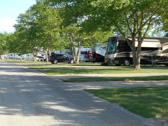
I like this campground. It is large, with about 130 RV sites and a few tent sites. Our site
# 67 had 30/50 and water, but no sewer. The lack of sewer was to be expected since we made the
reservation that same morning. There is a fire ring, but it is in the ground and was flooded out due to rain.
The grounds are nice and well kept.
Regarding the roominess of the sites, it's a mixed bag. Some are large and spacious but, as usual
with most campgrounds, the good sites are taken by the seasonals. Others are still roomy, but rigs are forced to
park next to each other because they share common hookup posts, and hence must park in opposite directions.
This is really my only complaint about the park.
|
There is plenty of green common space, as well as a nice stream flowing along the back of the property.
There is also a big event area where I assume they hold activities during the season. There is a game room,
basketball court, convenience store, fishing pond, horseshoe area, fitness center, heated swimming pool,
miniature golf, volleyball court and several game areas.
There is a gate, but you can come and go as you please. Your mirror tag also serves as a gate entry card.
There is a Mobile station with diesel; leave the campground, turn right on 184, and go just a few miles
to the station. There is also a Dunkin Donut shop there.
Oh, and no, we didn't try to get any Mystic Pizza!

|
|
Click here to see photos of the Sun RV Resort campground.
|
Mystic CT to Woodbine MD
[92997 - ----]
CT, NH, NY, NJ, DE, PA, MD
The colors quickly went away as the temps started to rise; it got up to 71 F.
Once we got to NY on I-95 the road got really bad. There was a long backup on the NY Turnpike and another
going across the George Washington bridge. Things got better a little south of the Newark airport.
I-95 becomes divided around the airport, with one half for use by cars only, and the other half for cars, trucks, busses, etc.
Traffic was not a problem on either side. But, like in Newfoundland, bridge joints continued
to be an issue.
I'm certainly not a civil engineer but I cannot understand why this continues to be a problem in the northeast USA.
I-95 in PA was generally bad, but outside of Philly it was good.
Should you happen to follow the path indicated here through CT, a word of warning
is in order. Our GPS mistakenly guided us to New Haven CT
rather than to Mystic, which is actually way back east of New London. I can't explain
how it could have made such a drastic error. Now, it was partly my fault since I should
have Googled Mystic on the map and would have known that we were going way too far on I-95.
This is one of the pitfalls of obediently relying on technology. Anyway, the GPS took us off
I-95 just southeast of New Haven and onto state road 10. This was bad enough because of the
hour we wasted going too far on I-95, but things got even worse!
After you get onto route 10 there is a warning sign that vehicles over 10 feet high are
not allowed. Nice! Warn us after we're already on the road. Fortunately, just as I was
starting to panic, someone in front of us frantically
motioned that we should get off at the next exit. We did, and I'm very glad
because I really didn't want to find myself
blocking traffic for hours in front of a 10' high overpass with a 13' high trailer!
There are also warnings in NY that high vehicles should use expressways rather than parkways,
presumably because
of low bridges. I don't know how you tell the difference between an expressway, a parkway
or a turnpike except for the name.
There was a toll on the New England Thruway portion of I-95, from Port Chester NY
to Eastchester NY of $36.40 for our rig.
Because my wife is intensely into growing orchids, we had originally planned to go to Longwood Gardens in
Coatesville PA but we figured we were too late in the year to see a lot of blooms. We do plan to come back
before long. If you like flowers, gardens, fountains and such, be sure to visit their
website
to see if this might be something you would like to put on your agenda.
There were lots and lots of geese flying overhead in the morning when I got up. I always enjoy all the honking
and squawking; I would love to know what they're saying to each other. Guess they're headed back to Florida too.
I think of the migrations as a promise of things to come. Old joke: why is one side of the V always longer than
the other?. Answer: because there are more geese on that side. Sorry, couldn't resist.
Ramblin Pines Campground
801 Hoods Mill Rd, Woodbine MD 21797
Ph: 410.795.5161, 410.552.0378 fax
Email: rpines@qis.net
Website
29 September @ 4 nights, 58.00 US$ / night
|
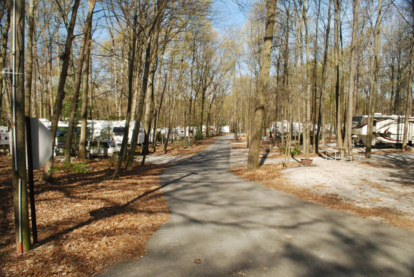
We returned to this campground so we could re-visit some of our longtime friends. The
same comments I made earlier
about the campground still apply. This time we had site # 11, a fairly easy back-in. In addition to the
50 amp, water and sewer, the cable was quite good with lots of channels.
The wi-fi internet was an on-again, off-again sort of thing.
When we were there before, I didn't realize how big this campground was. It's huge! There are over 200 sites
nestled in the woods.
Although we got there during the first few days of October, the staff and residents were
already busy outfitting the
place with Halloween regalia. As one person put it, "At this park Halloween is the last four weeks in October."
There is a railroad a couple miles from the campground. Personally, my wife and I love to hear the train whistles,
especially at night. We both grew up around railroads and they bring back nice memories from long ago.
| |
| |
[click to enlarge]
|
|
We didn't notice last time but the gate closes around 8 pm, and the night guard leaves at around 10 pm.
So if you plan to get back after 10 be sure to get a gate card at the office. There is a $40 deposit that is
returnable when you turn in the card.
Temps got up into the mid 80's F while we were here this time.
Woodbine MD to Penhook VA
[93050 -- ----]
MD, WV, VA
I-70 -> I-81 -> Roanoke -> I-481 - 40
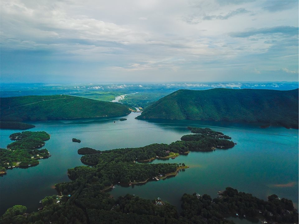
We decided to take a side trip over to the Smith Mountain Lake in Virginia, not too far from
Roanoke, in order to see
some other long time friends. We took I-70 west thru Hagerstown MD, then I-81 south to Roanoke VA where we
picked up I-481/220 over to route 40 and then west to Liberty Rd.
I-70 is no different than most eastern interstates so I don't have much to say about that.
Going down I-81, however, is a whole different story. Exit numbers on I-81 decrease as you
travel south through MD, WV and VA.
Here is a handy list of mile markers on I-81.
Going south from Hagerstown MD, when you get to exit 23 on US 11 in WV
there is Wagner's Outdoor Express RV, a big RV repair
facility not far from the Potomac River.
Although we were still too early for leaf viewing, seeing the Blue Ridge mountains
off to the left was quite nice. The 105 mile portion of the Blue Ridge Parkway in
Shenandoah National Park VA,
between Front Royal and Rockfish Gap is is known as Skyline Drive. During non-leaf-viewing parts
of the year this would be about a three hour drive without stops. During peak leaf activity,
count on it being bumper to bumper, but the leaf colors up in the mountains are gorgeous.
There are something like 70 overlooks on the Drive, and you may well encounter deer or black
bears during your visit.
RV warning - If you take your rig up on the Drive, which I don't recommend (especially
during leaf season) the Marys Rock Tunnel just south of the Thornton Gap entrance is 12'8" high.
Here are the four places you can get up onto Skyline Drive from I-81:
- Front Royal Entrance Station (mile 0) near I-66 and route 340
- Thornton Gap Entrance Station (mm 31.5) at route 211
- Swift Run Gap Entrance Station (mm 62.7) at route. 33
- Rockfish Gap Entrance Station (mm 105) at I-64 and route 250. This is also
the northern entrance to the Blue Ridge Parkway.
Here is a nice
map of the Skyline Drive.
We didn't see any real truck stops along I-81 except for the Sheetz at exit 273.
I hear there is a truck stop at mm 291, a Flying J on route 669 at mm 323, and another Sheetz
at mm 222.
At mile marker 293 on I-81 you start to see mountains to your right.
At mm 288 close to Toms Brook they start appearing to your left, and pretty soon they are
right in front of you.
If you are a history buff, I-81 is not a bad way to go. There are lots of battlefield
sites and museums along the way.
If you're into caves, like I am, you're in luck.
There is a Camping World at exit 146.
If you turn off I-81 to go to Roanoke as we did, don't be fooled by your GPS. If it tells you to get off onto
Elm Avenue, ignore it! Just keep heading down 220 and take route 40 east thru Redwood and Glade Hill, on
to the town of Penhook and Liberty Road [which is also Lancing Rd]. There may be more traffic on 220 and 40,
but if you have a large rig this is probably the better course.
You can also take Smith Mountain road [route 626] which comes just after Liberty Rd [route 779]. They
both lead to the campground.
Smith Mountain Campground
155 Liberty Rd Penhook VA 24137
Ph: 434.927.4198, 941.380.3020
Email: smithmountaincampbround@gmail.com>
Website
3 October @ 2 nights. 45 US$ / night
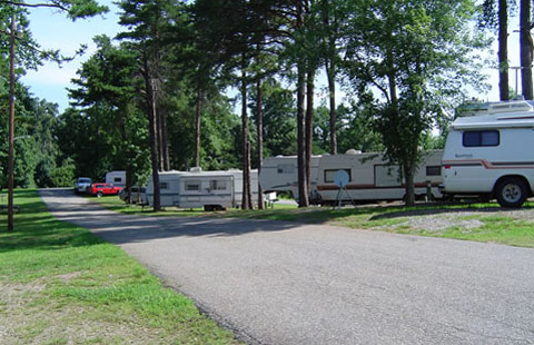
![Smith Mountain Campground in Penhook VA [this is an old photo] Image](/RV/Images/RV/Smith Mountain campground.jpg)
| |
[click to enlarge]
|
| |
| |
[click to enlarge]
|
| |
This is a nice little campground with only 27 sites. They are all full hookups, some have 50 amp and
some have 30. We had site #27 (or was it #23 ?) which is a spacious pull-thru at the front of the campground. There is
lots of open space, with a game and play area in the center. There is a pavillion and
a catch-and-release pond. The RV fees wee $30 US per night although their website show higher
rates.
Be aware that unlike most campgrounds, the office is in the rear. When we pulled in we
didn't think there was actually an office until someone told us where it was.
Most campgrounds in the area were fully booked with pipeline workers, who we found to be a friendly
and helpful bunch. They are installing a gas line along route 40. The owner Sylvia said that she wanted to
keep some sites open for traveling people like us. Good for her; this is the way campground owners should
think if they want to be a campground rather than a housing project.
Ok, so it's early October now and here we are again with the temps in the low-to-mid 80s F. Will somebody
please tell me again about how global warming is a hoax?
And speaking of stars (?), the second night here was cloudless so we could see the stars clearly. Being this
far away from the big city has its advantages, one being the ability to see a good deal of the Milky Way.
Mars was also out in all its red glory. Of course it wasn't quite as good as in Newfoundland, but it's
certainly a lot closer ☺.
|
While there, we took a ride around Smith Mountain Lake in our friend's pontoon boat, and
went over to have lunch at the Mexico Viejo #1 in Moneta VA ($98.65). It wasn't very good by our
Mexican food standards, but may be ok for folks who haven't spent four years in San Antonio
like us.
Penhook VA to Statesville NC
VA, NC
[94213 - ----]
In order to get to our next campground just off I-77, we left Smith Mountain campground and
headed west on route 40 west toward Rocky Mount, then on US 220 south, to US 58 west, and then
to I-77. If you need fuel, on 40 when you get close to 220 there is a big Sheetz truck stop.
This drive also gave us a reason to go down I-77 to Charlotte NC, rather than putting
up with I-95, which I hate with a passion. I-77 is a beautiful drive, especially when the
leaves are turning.
Since you likely won't be taking a side trip over to Smith Mountain, continue on down
I-81 past Roanoke and then go south on I-77 just before you get to Wytheville.
But be warned: don't take I-77 if there is a chance of snow since there is a very steep hill around
the Fancy Gap area. It shouldn't be a problem in normal weather though.
Statesville / I-77 KOA
162 KOA Lane Statesville NC 28677
Ph: 800-562-5705, 704.873.5560
Website
5 October @ 1 night, $44.50 US$ / night
|
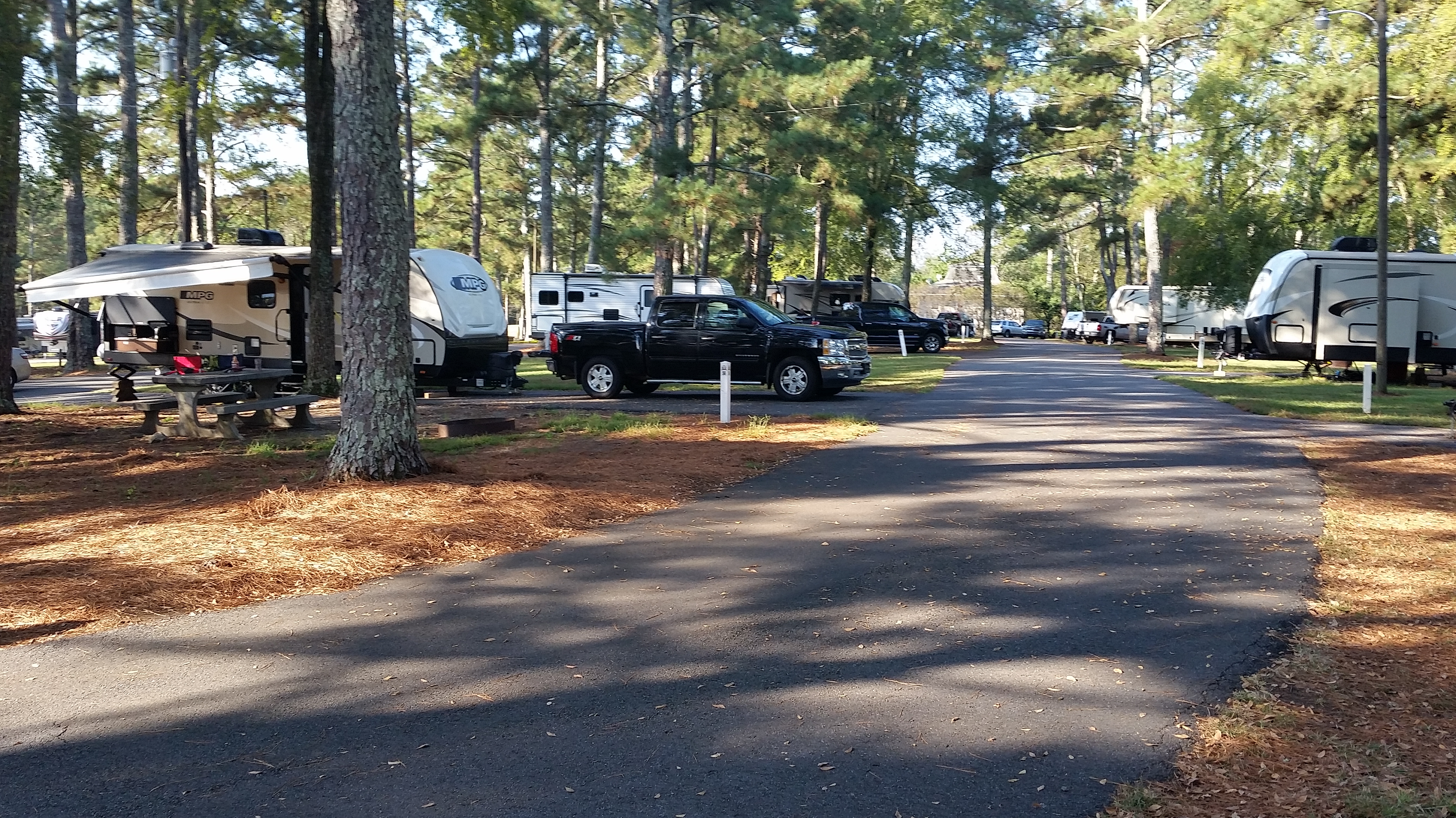
This campground is located close to I-77 so you can hear the cars and big trucks roaring by,
There are lots of pull-thru sites, as well as a few back-ins. Our site # 60 was a pull-thru, and was not
anywhere close to level in any direction. Actually, unlevel is too kind of a word - it was like living
on the side of a hill in West Virginia. We could not accommodate our rig and truck together, so we parked
on the grassy area next to the rig. I don't know if that was ok but no one complained.
The roads are paved, which is a good thing. There are speed bumps, which is a bad thing. Seeing as the
speed limit is 7 mph, speed bumps serve no purpose other than to jostle things around inside your rig.
There are currently 67 sites in the campground. Our site had 30 amp, water and a picnic table.
No fire rings. The 30 amp didn't work when we tried to connect. One of the employees came down to test it,
and changed out the circuit breaker. It worked fine after that.
| |
| |
[click to enlarge]
|
|
They have wi-fi internet but we couldn't connect to it while we were there; probably too many people.
The dump station on exit was way too short for my 37-footer, And to exacerbate matters, there is an iron
post at the end that prevents you from making a wide turn in order to get out
of the dump area. I decided to bypass it
completely since we only had one night's worth of accumulation. I guess some brave souls with big rigs
do manage to squeeze through, but I wasn't about to chance scratching up my rig [54 feet total with truck
and trailer] any more than I already had.
Sorry, but I cannot find the pics I took of this campground.
Statesville NC to Red Top Mountain GA
NC, SC, GA
40 - US 220 - I-81 - I-77 - I0485 - I-85 - I-285 - I-75
[94373 - ----]
There was some construction south of Statesville around Lake Norman, causing a good-sized backup.
When getting off I-77 onto I-485 around Charlotte, there was also a delay due to merging traffic
getting onto I-85. I suspect this was not an anomolie.
The town of Gastonia must have grown considerably of late, since there are no less than 7 exits off I-85.
I-85 is pretty good from there on. At Gaffney there is the Cowpens Battlefield, as well
as the big peach water tower - a local attraction.
I-85 is undergoing construction where I-26 splits off at Spartanburg for about 30 miles.
There is a Love's truck stop at exit 104 and a Flying J at exit 102.
There is an RV dealer at exit 120.
If you choose to get onto I-285 around Atlanta, make sure your pacemaker is working, you've taken
your blood pressure meds, and have a few Xanax handy. The drivers on the beltway are insane, especially
during rush hour. We were lucky enough to hit it pre-rush hour so we had no problem.
When you merge onto I-75 going north, be aware that the 6 lanes on the right
have a propensity to slowly go away one by one.
I-75 then becomes a relatively sane 3-lane highway on the north side of Marietta. Also be aware that I-75 is
under construction in the Marietta area - it always has been, and it always will be.
Allatoona Landing Resort
24 Allatoona Landing Road, Cartersville GA 30121-7673
Ph: 800.346.7305, 770.974.6098, 770.974.6143 fax
Email: info@allatoonalandingmarina.com
Website
6 October @ 7 nights, ? US$ / night
| |
[click to enlarge]
| | |
| |
[click to enlarge]
| | |
| |
[click to enlarge]
|
| |
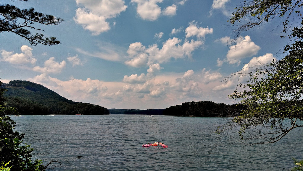
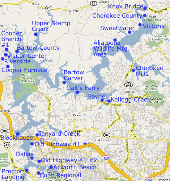
In the past we have camped at three other campgrounds on Lake Allatoona and this is by far the best. There are
about 125 sites, the roads are paved and wide, and most sites are quite spacious except for a few which
are rather close together. They have 30 and 50 amp sites with water and cable. Some sites have sewer,
some have fire rings and some have concrete picnic tables - our site # 44C did not have any of these.
A handful of sites are next to the water but the vast majority are not. The campground is located close
to a railroad track, so we enjoyed listening to the train whistle as it reminded us of our childhood.
They have wi-fi, but I couldn't get onto the internet even once during our stay.
Some sites
by the lake are for tents and small rigs. The roads are paved, as are many if not most sites.
Our site was paved but was not level from front to back. Many of the sites are quite
spacious.
When you approach the campground at the railroad tracks, be aware that there is a bit of a bump.
My front jacks weren't high enough to clear, so I bent the left one although not too seriously.
They have a security detail that periodically patrols the campground and checks on the laundry and bath houses.
There is a rather large RV dealer, Campers Inn, on I-75 exit 277 (route 92 east) which is two exits south of the
campground.
I think wheel chocks would be recommended on sloping sites.
The restrooms and laundry facilities have coded access, and are clean and well-kept.
They have a mobile pump-out service, as well as a
very convenient paved dump station on the way out. The only improvement I could suggest is that
they provide a sewer hose and water hose so that folk don't have to worry about digging our their own, hooking
it up, cleaning it and re-stowing it. It's just a little thing than can make campers real happy.
There is an access gate with a code, so you can come and go as you please.
|
On the other side of I-75 from the campground there is a Love's truck stop. It is a bit pricy but you can't beat the convenience.
In the same area are several fast food places. If you keep driving past Love's for a
couple miles there is Dave's Place on the left. They have all you can eat catfish, among
other things. Yum!
Next to Dave's is an RV repair facility.
The remnants of hurricane Michael came through south of Atlanta while we were there. For us it was simply
a rain event that lasted about 6 or so hours. Due to the rather hilly nature of the campground, the runoff
kept large pools of water from forming, so water was not a problem.
Since we have family in the area and because of the coded entry gate,
this is likely where we will stay in the future when we come up to visit.

|
|
Click here to see photos of the Allatoona Landing campground.
|
Marietta GA
The city of Marietta is quite large. There are tons of shopping, entertainment and culture.
If you drive south on I-75 and then east to either Chastain Road or Barrett Parkway, there is
lots of shopping and restaurants to be had. There is a Cracker Barrel; take Chastain Rd east and
immediately make a right onto Busbee Dr NW. Five Guys hamburgers is further down Chastain
on the left; their burgers are great! There is a Home Depot; take Barrett Pky east from
I-75 and then immediately make a right on Roberts Ct. To get to Costco, go west from I-75
on Barrett Pky, and immediately make a left onto Cobb Pl Blvd NW; Costco will be up on top
of the hill. They have diesel.
For some historical things to see in the area, refer to the discussion of the
Acworth and Marietta
at the beginning of our trip.
When considering dinner, I wholeheartedly recommend that you try the
Marietta Diner
on 306 Cobb Parkway South. The foold is phenomenal and portions are gigantic. Check out the extensive menu on
their website.
You might also want to revisit the earlier discussion of things to do in the greater Atlanta area.
See here for details.
Red Top Mountain GA to Valdosta GA
[---- - ----]
As we left the campground to head south, I-75 north of Marietta was a virtual parking lot,
even on a Saturday. It continued
to be that way south of the city. But traffic on I-75 through Atlanta was relatively
light, so I chose not to take the I-285 beltway around Atlanta.
If you have not driven through downtown Atlanta where I-75 and I-85 come together, be aware that lanes tend to
go away quite fast. Try to stay in the lanes marked for interstates; there are signs overhead as well as markings
on the pavement. Especially heed this if there is heavy traffic, since it can be quite difficult to change lanes
with big rigs in the midst of maniac Atlanta drivers!
Once past the Atlanta airport I-75 is quite nice, assuming of course that there are not the inevitable accidents
to slow you down. There was construction where I-75 and I-16 split off just north of Macon.
There is a Camping World at mile marker 150.
At exit 142 there is a Lane Southern Orchards, about 5 minutes west (ph. 800.277.3224).
It is famous in the area for its peaches, pecans, jams and jellies
and other Southern things. It has room for big rigs.
There are lots of RV parks along I-75 in the south part of Georgia. For example, Valdosta Oaks RV Park at
exit 22 looked rather roomy.
River Park RV Park
1407 St Augustine Rd, Valdosta, GA 31602
1 Suwanee Dr, Valdosta GA 31607
Ph: 229.560.6352
Website
13 October @ 1 night, 40 US$ / night [Good Sam, AAA, AARP, military discounts]
|
Take exit 18 off I-75 then drive around 300 yards west to the campground.
The first thing I noticed about this campground were the birds singing their little hearts out.
The noise of the big trucks may bother you if you get a site next to the highway, but since we were only
there overnight we didn't find it much of an issue.
There are 122 pull-thru sites with 30/50 amp, water, cable and sewer. We were in site C-12 which had 30 amp service.
The roads and sites are all paved, which was quite nice. The sites I saw were somewhat spacious.
I didn't try the internet so I can't report on its service.
There is no gate. There is an enclosed dog area where you can let your dogs off-leash
if you wish.
There is a station with diesel across the street, and there are lots of fast food places
in the area
Sorry, I forgot to take pics of this campground but here are
some pnotos from the web.
| |

| |
[click to enlarge]
|
|
Valdosta GA to St. Augustine
[95164 - ----]
I-75 - I-10 - I-295 - I-95
On this leg we soon left Georgia and headed down into Florida.
The Horizon RV Center as well as a Camping World are on I-75 at exit 5 in Lake Park GA.
Just before Lake City FL, take I-10 toward Jacksonville.
Go through Oceola National Forest. Just before Jax, take the I-295 beltway south to I-95.
The General RV Center is on I-95 at exit 295.
The temp was a toasty 83 F during this leg of the trip.
At St. Augustine, when you get off I-95 onto route 207, don't rely on your GPS as it will inevitably lead
you astray. Instead, follow the directions on the email confirmation you receive
when you reserve. If you don't have the directions then follow these. From I-95 take
route 207 and head east. A few miles down you will see a
Dollar General store on the north (left) side. The entrance to the campground is
next to the store.
A note: on I-95 just before route 207 you can see an RV park back in the northeast corner,
next to the flea market. Don't be fooled; this isn't it - it's St. John's RV Park and Storage
Yard.
This is actually the second campground in St. Augustine where our GPS has screwed us up! Must be some
sort of Bermuda Triangle thing going ☺
Compass Point RV Park
1505 State Road 207, St. Augustine FL 32086
Ph: 904.824.3574, 800.233.4324
Website
14 October @ 3 nights, ? / night
| |
[click to enlarge]
|
| |
Being Florida residents, we have a great affinity for this campground.
My wife Phyllis has a particular relationship with the "old Florida" feeling as she was born
in Jacksonville back in the day, and the environs reminds her of where she played
as a child among the palmetto bushes and Spanish moss. By "old Florida"
I mean how Florida used to look before
all the "modernization" and "civilization"
came in. The area is very wooded with Spanish moss hanging in the trees.
It feels like Ponce de Leon might have been there a few weeks ago.
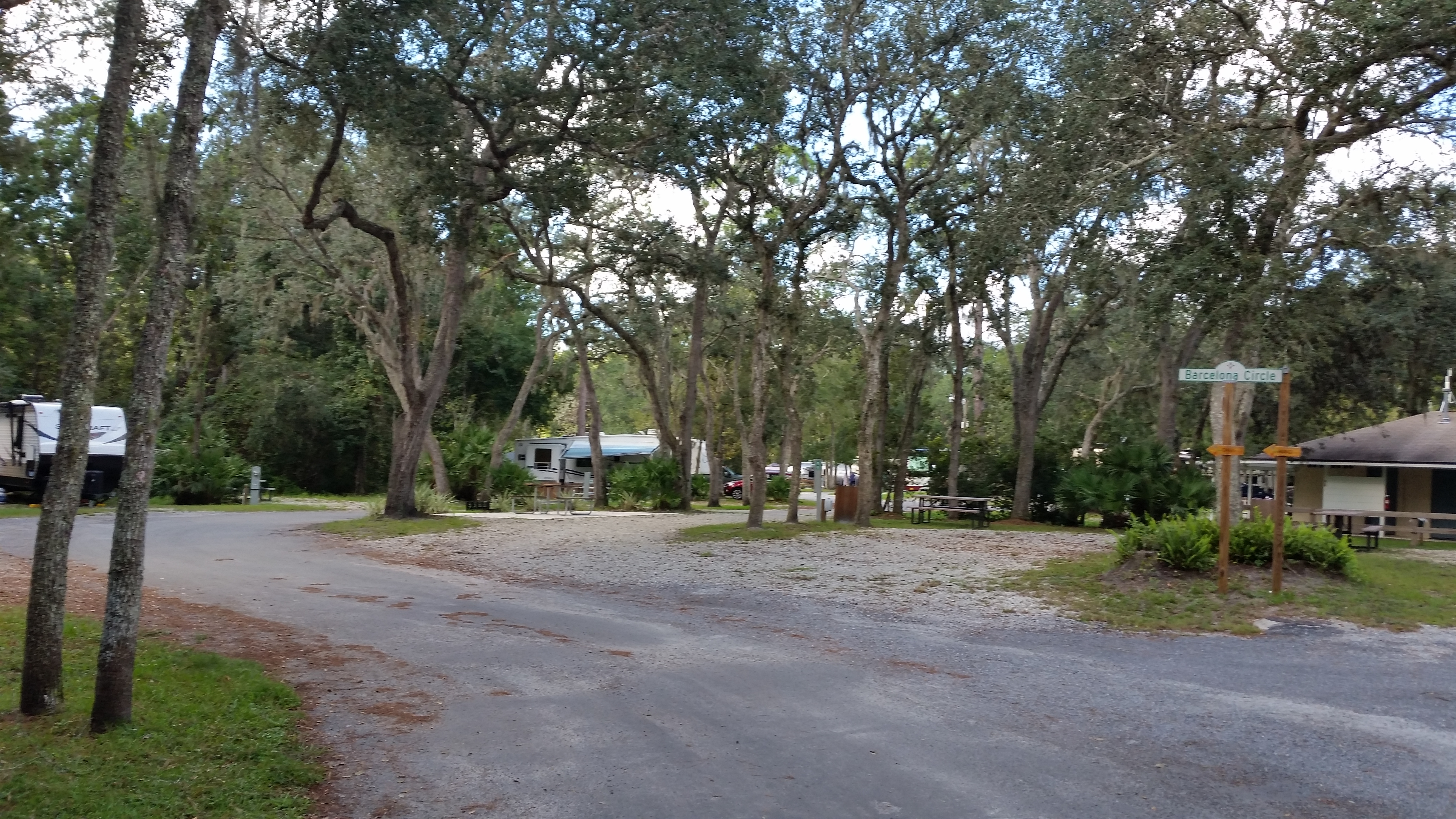
The roads are paved and the sites are gravel. Most sites are spacious, some have 30 amp full hookup,
some have 30/50 amp full, and some just have 30 amp and water. Some have cable and some have picnic tables.
Some sites have fire rings. A few sites have 10 x 30 concrete pads for the picnic tables. Some sites are
"buddy sites" that share hookup facilities.
|
The park staff were very friendly and helpful.
The internet was up the whole time we were here and was reasonably fast for an RV park. There are repeaters
positioned throughout the park.
They can refill propane tanks on site.
There are restrooms, laundry facilities, a fitness center and a rec area. There is a small fishing pond
and a common
area with a nice community fire ring. There is also a swimming pool, a small dog park and a big dog park.
There are regular events scheduled at the clubhouse. Ask for a calendar at the office.
Some sites are pull-thru, some are back-in. The back-ns don't seem to be a problem; they are angled and I
didn't see any impediments such as posts or poles.
There are a few seasonals, but not as much as you might find up north. Given the weather here, there may
even be some permanent residents.
Our site # 49 was an easy pull-thru at the end of a row. We were quite happy with it.
If and when we come back I will try to get either site 15 or 59 which are long enough for a big rig,
have a concrete patio, and are next to the woods for privacy. Sites 85 A & B and 98 are the same way.
There are a couple sites next to the pond but they are only long enough for rigs on the
smaller side.
The gate is accessed via a card, which allows you to come and go as you please. This is almost a necessity
since you will undoubtedly want to spend a lot of time visiting the St. Augustine area.
Rig washing is allowed but you have to purchase a permit for $15. This sounds reasonable due to the water
usage required to wash a large rig.
There are garbage and recycle bins close to the front office.
If you have dogs, there is a resident pooch sitter right in the campground.
'Bobbie's Fur Baggies Sitting Service' resides
in site #52. Her phone is 240.682.4069 and she can be emailed at bobbiernfa5853@yahoo.com

|
|
Click here to see photos of the Compass Point campground.
|
St. Augustine
|
On the first night we ate at our longtime favorite Casa Maria Mexican restaurant. It can be found in
the Anastasia Plaza shopping center at the corner of A1A and A1A Beach Blvd. Because we lived in San Antonio TX
for four years, we know good quality Mexican food, especially Tex-Mex. Casa Maria
had always lived up to our expectations, until now. I don't know what changed but the food, while
still ok, did not meet the quality levels we had come to expect. And it was not only the meal, but
the flan seemed to have also changed. Too bad. We may go there again but we will definitely not be
looking forward to a genuine Mexican food experience.
Also in the same
Anastasia Plaza shopping center where Casa Maria is there are several other stores
of interest: Publix grocery, liquor store, Starbucks, pizza, sushi, Subway, Dollar Tree,
Chinese food and several others.
On the second night we ate at the Seafood Kitchen, which is in a little strip mall on A1A a couple miles
south of the shopping center where Casa Maria is located. They have some of my favorite things: conch
fritters, hush puppies, soft shell crabs and frog legs. Since they were out of frog legs I got the shrimp
scampi and Phyllis got the soft shell crab, both of which were very good. Their key lime pie was good,
but it didn't have that mouth puckering tartness of real key limes; it was more like a light
mousse.
The third morning we had breakfast at Tammy's Breakfast and Lunch. They are located on highway 1 a
little north of 207, and they serve breakfast all day. Next door is a nice fruit and veggie stand;
check out their jams.
We haven't tried it yet, but lots of folks have recommended the Back 40 Urban Cafe.
There is a main
restaurant on Dixie Highway (close to US 1) and a satellite on A1A north of
of 206 in the same little strip mall as A1A Patio. Use the Google.
On route 16, just past I-95 there is a fuel station with relatively cheap diesel;
at least it was when we were there. I believe it is a Kangaroo Express.
There is also a Gate Gas Station on Anastasia Island. From I-95 take 207 east to route 312;
Gate will be on your right soon after you cross the bridge. They have room for bit rigs
to pull in.
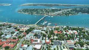
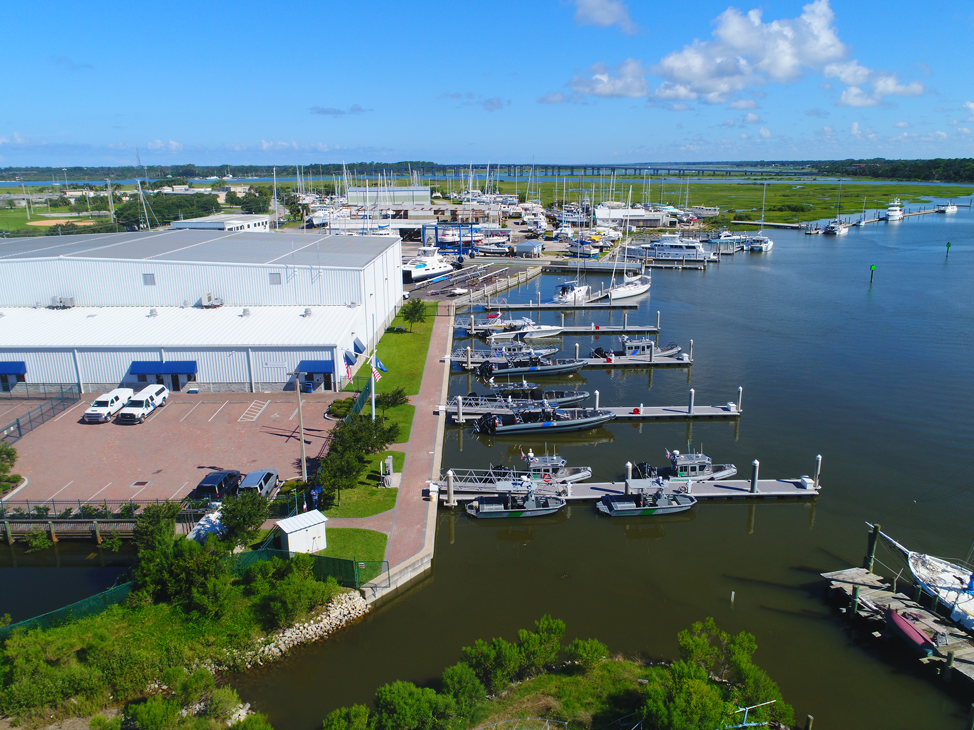
See here
for some other RV parks in St. Augustine that you might want to consider.
There are several others but these are the ones that we have personally looked at.
| |
| |
[click to enlarge]
| | |
| |
[click to enlarge]
| | |
| |
[click to enlarge]
|
|
St. Augustine FL to home
[---- - ----]
17 Oct 2018
As they say, all good things must come to an end. As much as we thoroughly enjoyed
our time away, it was good to get back home. A hot soak in the tub, letting our dogs freely
run around in the back yard, convenient shopping, fast and reliable internet access, and
simply having room to spread out
were just a few of the creature comforts we had missed. Of course, we are prepared to
do it all over again in 2019 when we go spend a few months out west visiting the national parks!
All that being said, we do wish we had had a lot more time on the trip. There are
numerous places and things we missed. See the
Epilog (next section) for a partial list
of things we wish we had had time to do.
 Go back to the previous leg of the journey
Continue on to the next leg of the journey
