|
This segment reflects the portion of our journey through the providence of New Brunswick.
Although we didn't spend much time there, we did find some interesting spots we wanted
to tell you about.
In hindsight we probably should have taken a little more time in NB. There is quite a bit
of interesting looking coastline to the south after you get past customs. Moreover, the drive up the
eastern coast north of Moncton looks like it would be quite scenic. Unfortunately
I had already booked campgrounds all the way over to Peggy's Cove in Nova Scotia so we were committed.
I guess we could have taken in the coast on the way back home, but we really didn't
think about it.
This particular blog is relatively short, but if you don't have time to read everything,
here are links to the main highlights of this portion of the trip.
| |

| |
[click to enlarge]
|
|
Bangor ME to St. John NB
[84557 - 85008]
Route 9 east from Bangor was pretty bad, although they were paving part of it with blacktop.
Route 9 dead ends into US 1, which then goes northeast up to the Canadian border.
The exit off US 1 leading to the customs station at Calais and Saint Stephen was not obvious
and is easy to miss. You take a
sharp left just before you get to the Saint Croix River Reservoir. On the other side
of the Reservoir is the Canada customs station.
Our passage through customs at the border was uneventful.
They didn't try to inspect the trailer,
and they didn't even ask to see the dogs rabies certificates.
I have already talked about customs in the Prolog, so if you missed it,
see here for a little more complete discussion
of our customs experience.
Once into NB an Irving truck stop soon appeared on the left, so we stopped for diesel.
This was convenient but I did have an incident with the diesel pump.
Unbeknownst to me, one is supposed to go around the station and come to the pumps from
the rear. This would situate the pump on the driver side, so you can pay and pump.
Dopey me pulled straight in, so I was situated with the pump and credit card reader on
the passenger side and my tank fill spout on the driver side. Since a line was
starting to form, I didn't want to pull out and come back in again the other way,
so I went inside and made an inquiry. It turns out that
there was also a satellite pump on the driver side,
presumably for trucks that pull in through the wrong direction, like me!
Turns out that in such instances you pay as normal at the pump with the card reader,
remove the pump handle and lay it on the ground, and
then pump from the satellite pump. This worked fine except for the fact that the
pump handle laying on the ground leaked
pretty bad and ran fuel all over the ground! I guess the trick is to either (a) have
someone hold the handle for you
while you pump from the other side, or (b) pull in from the correct direction.
Lesson learned.
The drive through NB on the TCH (highway 1) was quite pleasant and scenic. Although the countryside
is rather sparse, the views are panoramic with occasional ocean views.
Hardings Point KOA Campground
71 Harding Point Landing Rd, Carters Point NB E5S1N8
Ph: 506.763.2517
Website
5 July @ 2 nights, 46 C$ / night
|
While doing pre-research for campgrounds in the St. John area I ran across this one.
What drew my attention was the ferry you have to take to get over to it.
Since it was to be my first introduction to Canadian ferries I just had to do it.
If there were mistakes to be made or lessons to be learned, better to do it there
rather than on the big ferry to Newfoundland, which I knew was ahead of us.
No worries. It turned out to be a short, pleasant ride over, and provided a no-pressure
intro to pulling a big rig onto a ferry. The personnel were quite friendly and helpful.
While we were there we decided to take another ferry ride back to the mainland and look around,
so we got four crossings in all under our belts at one campground.
The ferry is free and runs all day and night.
| |
| |
[click to enlarge]
|
|
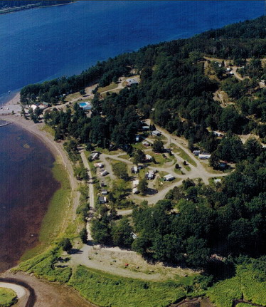
This was a rather nice campground. It is rather large, and
although it feels like it is on an island, it is not. There are roads on both the east
and west side which go north up toward Sussex and Moncton, but the ferry is the only way to get
to the campground from the east. Check the area out on
Google Maps.
Many sites have a view of the water, but ours (# 26) didn't. They were near capacity when we were there,
which wasn't surprising since the season had already started. Sites were roomy. The rigs seemed to be
mostly seasonals, and some may have been year-rounders in park models. Our site had 30/50 amp, water, sewer, picnic tables, a fire ring, but no cable. The wi-fi internet was incredibly slow which,
as I would come to find out, is typical for the Maritimes. There was a camp store.
The staff is quite friendly and there is a guy who shows you to your site.

|
|
Click here to see photos of the Hardings Point KOA campground.
Click here to see photos of the ferry to the Hardings Point KOA campground.
|
|
St. John
| |
[click to enlarge]
|
| |
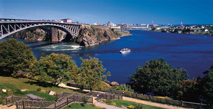
The town of St. John is pretty big and provides a good opportunity to stock up on
whatever you need, especially those things that you couldn't bring through customs.
It is a port city located on the St. John river, which empties
into the Bay of Fundy. It happens to be Canada's third
largest port, and is also the oldest incorporated city in Canada, chartered in 1785.
As you might imagine, much of the economy depends on the sea. There is a large
cargo infrastructure as well as an Irving oil refinery. You might also be interested
to know that the Moosehead Beer brewery is located there.
|
We didn't spend much time in town except to go to see the Reversing Falls (see below).
I did find that unless you stay close to highway 100 and the TCH, it is rather easy
to get lost without your GPS.
We also forgot to take photos of the city. Sorry.
Reversing Falls
|
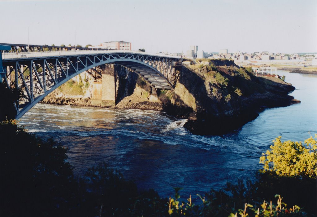
The Reversing Falls are located on the St. John River. The Falls
are actually formed around a conglomeration of rocks where water
flows back and forth, producing noticible rapids, eddys and whirlpools. The water movement
is due to the inflow and outflow of water as the current from the St. John River
collides with the tides coming in from the Bay of Fundy.
At low tide the river empties into the bay. At slack tide the waters become
rather calm. Towards high tide the water from the Bay overwhelms the river
current, hence the falls "reverse".
The Falls are located just of route 100. Although there are signs in the area,
I had a hard find locating exactly where to go.
| |
| |
[click to enlarge]
|
|
Here is
a video taken off the web that shows the reversing action.
The photos and videos below were taken by us from the Reversing Falls Restaurant and Skywalk
(shown to the right)
which turned out to be a nice place to munch and watch the Falls.
There is also a nice little path down to the water.
St. John NB to Moncton NB
[xxxx - xxxxx]
It's not far from Hardings Point campground to the Hopewell Rocks area. The TCH [1]
is nice and the scenery is not bad. The TCH from St. John to Moncton is well inland so
you won't see the Bay of Fundy.
We took the TCH up to Salisbury, then 112 east, then 114 south down to the campground
at Hopewell Cape.
Ponderosa Pines campground
4325 Route 114, Lower Cape NB E4H-3P1
Ph: 800.822.8800
Website
7 July @ 2 nights, 46 C$ / night
| |
[click to enlarge]
|
| |
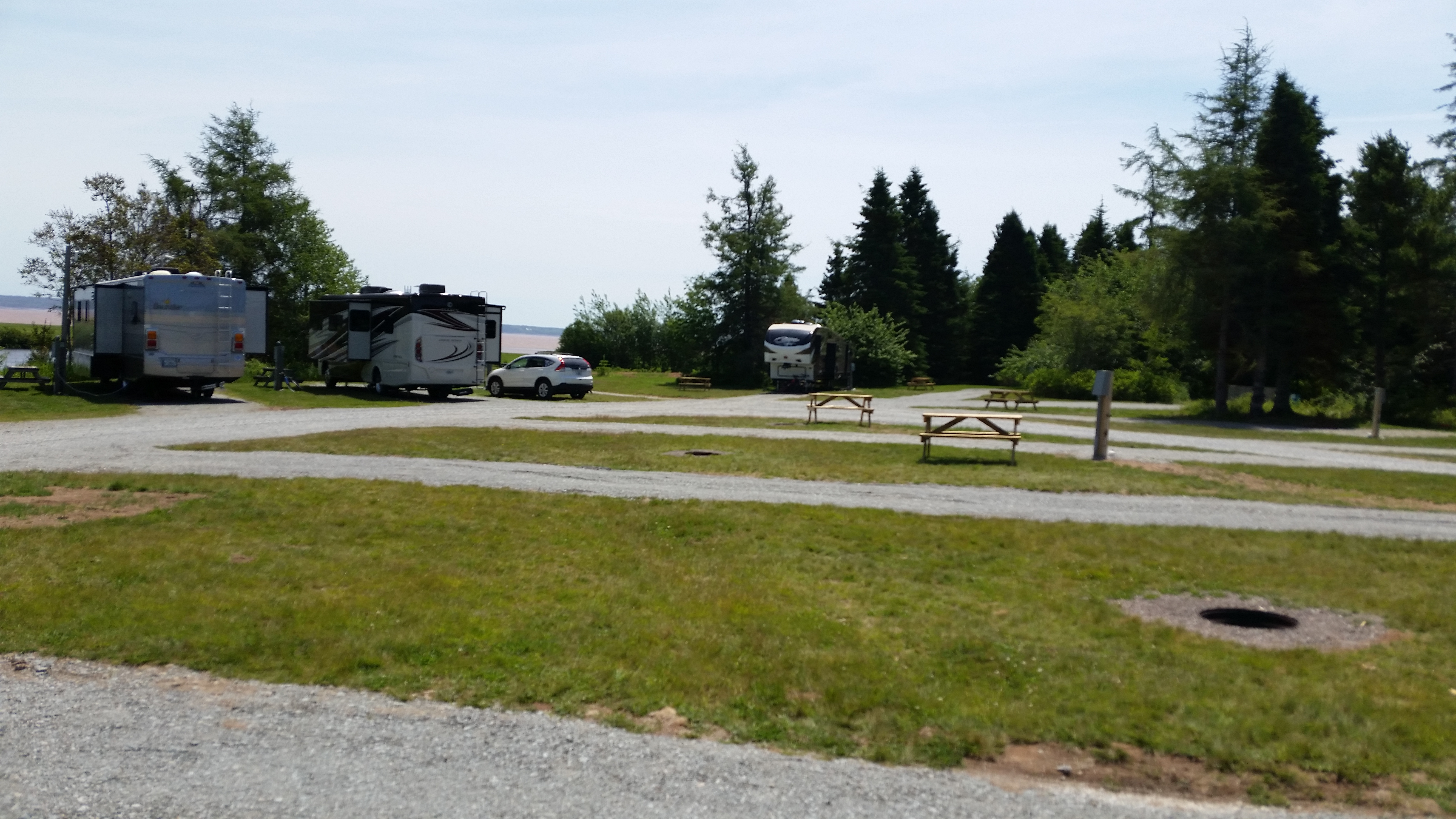
If I were giving star rating I would give this campground a 4.5, although it is a bit
pricy. The parking pads are long with lots of space between sites. It is very close to
the Bay of Fundy and Hopewell Rocks.
|

|
|
|
Click here to see photos of the Ponderosa Pines campground.
|
|
Alma
|
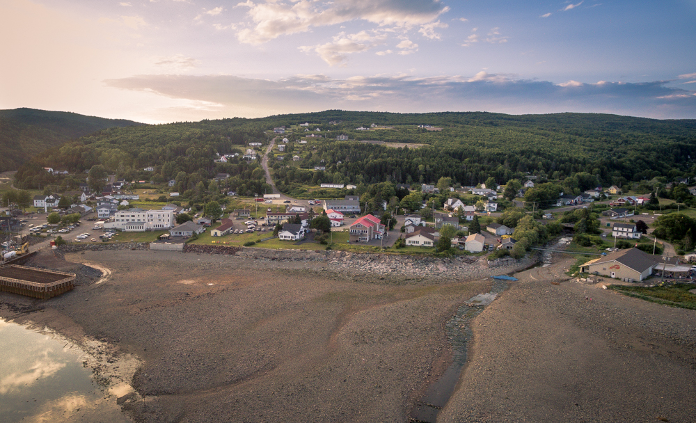
Other than seeing Hopewell Rocks, we also made a side trip to the town of Alma,
situated on the Upper Salmon River. This is also the HQ of the Fundy National Park.
This is a rather picturesque town with the flavor of a Cape Cod. Take route 114 west
to Alma.
The Boat House restaurant had pretty good lobster bisque, and the local bakery
has tasty cinnemon buns.
Be sure to take the scenic drive on route 915, either on the way to Alma or on the way
back (or both). The road is a little rough but the views are worth it. On the way you will
encounter S&C's ice cream stand; I had a cone with big chunks of black cherry. Yum!
| |
| |
[click to enlarge]
|
|
Hopewell Rocks
Visitor Center
| |
[click to enlarge]
|
| |
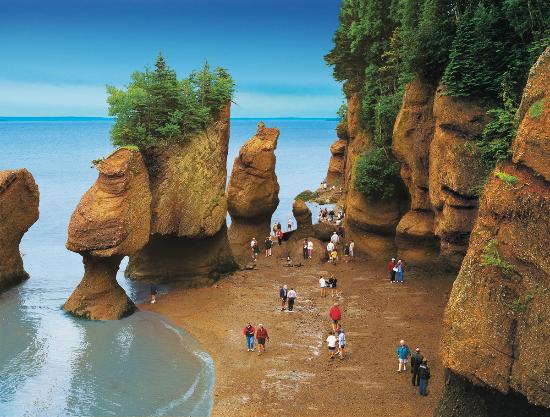
Located at Hopewell Cape, this formation is also referred to as the Flowerpots Rocks,
or simply, The Rocks.
This is an unusual rock formation formed by massive tidal erosion. The erosion, which still
continues, continually eats into the composite rock which contains some limestone.
Two formations, Castle Rock and Elephant Rock, have been destroyed over the years due to
splitting from water and ice.
Hopewell Rocks is located on the Bay of Fundy, home of the highest tides in the world.
If you have heard about walking on the ocean floor at the Bay of Fundy during low tide,
this is a good place to do it.
|
The park personnel are friendly and helpful. I
had a lengthy conversation with one who was well-informed and eagerly answered all my
questions.
There is an informative interpretation center on the grounds. If you are interested in geology,
here is what Wikipedia has to say.
The park is open between mid-May and mid-October. Here is some info on the
tide tables in the area.
Here is a neat time-lapse movie showing the drastic
tide changes at Hopewell Rocks on the Bay of Fundy. Be sure to view it in full screen mode.
The restaurant at the Hopewell Rocks Motel is just up the road from the park.
We both had lobster rolls which ran, in total, 79.83 C$.
 Go back to the previous leg of the journey
Continue on to the next leg of the journey
