|
This beautiful island's license plates say "Canada's Ocean Playground" which is appropriate
for a land thick with evergreen trees, blue lakes and oceans, rocky landscapes and friendly folks.
It is clean and hospitable.
Except for Halifax/Dartmouth, Truro and Sydney, the island is rather sparsely populated,
occasionally dotted with small towns and fishing villages which make perfect postcard pictures.
Shorelines present spectacularly panoramic views. It's hard to drive a golf ball without hitting water of some kind:
stream, river, lake or ocean.
Many of the campers we encountered were Nova Scotia residents, and some were from the mainland such as Quebec or Toronto.
Not so many US residents. Apparently the RV-ing population just likes to get away from home and go to a
nearby campground for a few days.
At my latest count there are around 20 provincial parks on the island. Some of these are
viable for big rig RVs and some aren't.
Click here to investigate the
parks by region, and you can even make a reservation.
| |

| |
[click to enlarge]
|
|
If you don't have time to read everything, here are links to the main highlights of this portion of the trip.
Lower Cape NB to Peggy's Cove NS
[--- - ---]
When we got into Nova Scotia we drove directly to the Peggy's Cove area.
I had heard a lot about the Cove from friends who recently moved up to Nova Scotia from
our neighborhood in south Florida.
I had looked up the neat pictures on the internet and decided I wanted to see it as soon as
possible.
Neptune campground was very
close to the Cove, and not that far from our friends home in Windsor. It's also an easy drive to the
Halifax/Dartmouth area, which is one of the few places on the island you can find lots of varied shopping.
By the way, when driving from New Brunswick down to the Halifax area, don't miss exit 15
(route 102) off the TCH.
It's the way down to Halifax. If you miss it you will wind up in Truro and have to either
track back to exit 15 or take route 4 to US 2 and make your way over to 102. US 2 south
is probably ok but likely not as fast at the 102.
As mentioned, we had originally planned to stay at the King Neptune campground but when we
got there we discovered that, quite strangely,
hookups were shared between back-in sites. As a result, if
you back into a site where the hookups are on the driver's side of your rig then you are ok,
since water, elec and sewer connections are on
that side of most rigs. But the site they gave us had the hookups on the passenger side,
which didn't work for us.
We would have needed extensions for our electric and water lines, which I had,
but they were buried deep in the sub-basement compartment and I didn't feel like taking
everything out of the basement to get at them, and then putting everything back in again.
So, we decided to say thanks but no thanks, and headed to our friends up in the Windsor area.

|
|
|
Click here to see some photos of the drive down to Peggy's Cove.
|
|
Windsor NS
9 July - 18 July
|
Luckily, our friends in Windsor have a house with a large circular driveway big enough
for our rig. So, we high-tailed it up there and stayed with them for eight days. They had water and 110 hookups
which served us just fine, since we could eat and shower at their house. I spent most of the time helping him
and a neighbour clear the lot of trees so they could get a better view of the lake. When we returned later
in the trip we were amazed at how nice the place looked with the trees no longer blocking the view. Lots of
boulders and new sod made everything look spic-and-span.
Windsor sits on an arm of the Minas Basin, which is itself off the Bay of Fundy.
It is also not that far a drive from Grand Pre, New Minas, Annapolis Royal and Digby to the west, and
Chester and Mahone Bay to the south. Most of these places are further discussed below.
| |

| |
[click to enlarge]
|
|
During all our work, we somehow managed to take a short break and drive to Windsor
to have dinner at the Spitfire Arms Alehouse on Water St. Voted the 10th happiest
place in
Canada by Expedia, this is a charming pub and grill
where we all got fish and chips, which was very good, running 70.63 C$ for meal, beer and tip for
four people. They have live music every Thursday, Friday
and Saturday night.
Hwy 14 between Windsor and Chester
Another break from work included a day drive down to the Chester and Lunenburg area.
Both are picturesque towns which lots of character.
Chester is one of the wealthiest communities in NS, mostly due to it being a holiday and
resort destination. There are lots of estates and mansions, and sits on Mahone Bay which also
happens to be a yachting community with a quaint marina. There are also lots of islands in the area with
corresponding day cruises Boating enthusiasts may be interested in the annual Chester
Race Week.
There are a number of good restaurants in the area. We ate at the Rope Loft
on Water Street [different from the Water Street in Windsor], right on the marina.
We had lobster & shrimp rolls, shellfish chowder, drinks and
desert. The bill was 124.77 C$ with tip for four.
I didn't learn about
Big Red's restaurant in Chester until
we were back home in Florida, but word is they have great donairs.
When we left our friends house, we headed back to the Peggy's Cove area and
decided to give the King Neptune campground another try, mostly because I had called them
to discuss the situation and was assured we could
get a site with hookups on the correct side. We're glad we did.
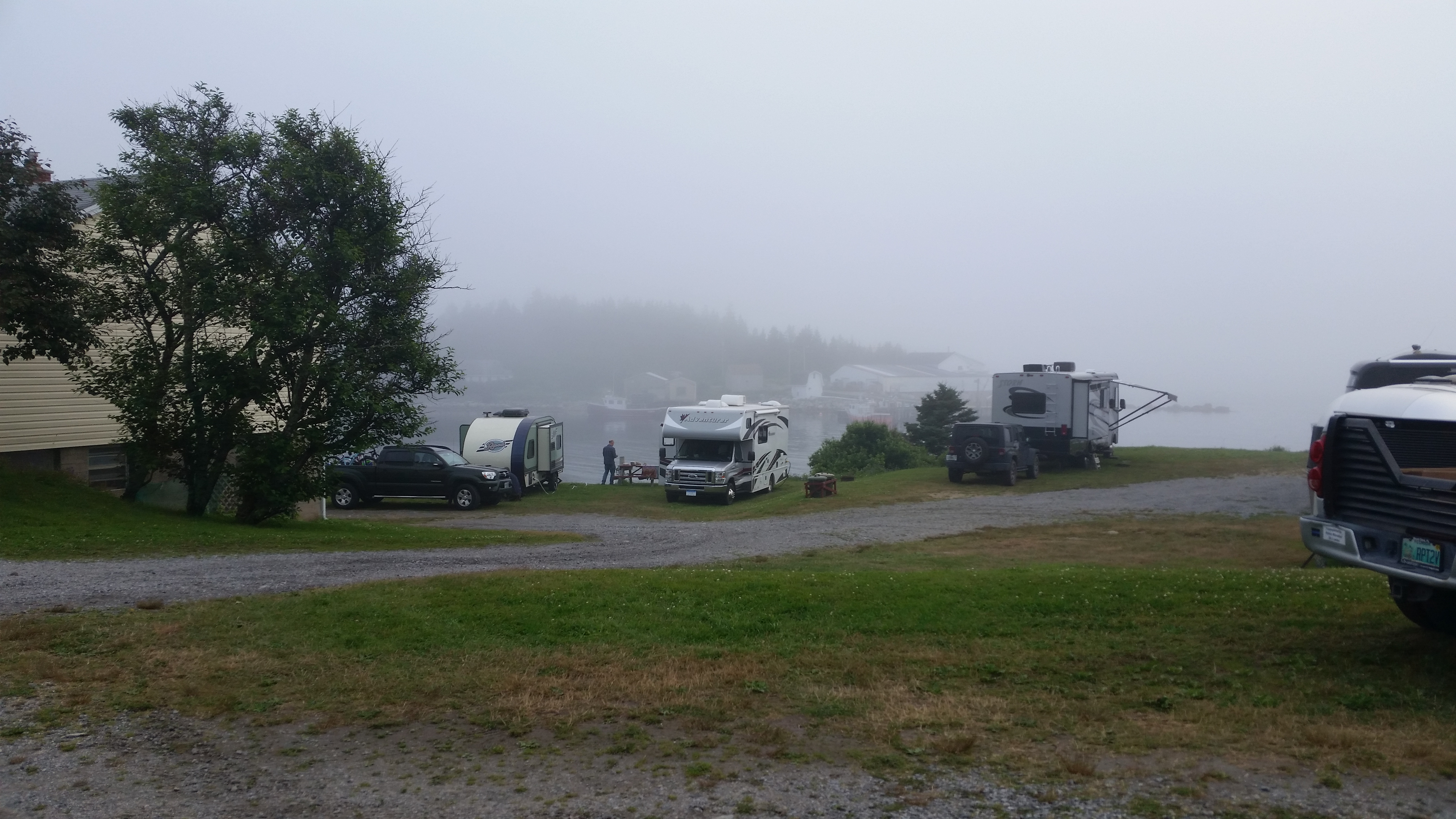
King Neptune Campground
8536 Peggys Cove Rd, Indian Harbour, NS B3Z-3P4
Ph: 902.823.2582
18 Jul @ 5 nights, 40 C$ / night
Website
| |
[click to enlarge]
|
|
|
As I mentioned, this campground is the closest to Peggy's Cove, only a couple miles away.
There is a beautiful view of the ocean, but only rigs next to the water have direct views. We had to
walk around a little to get to the water but that wasn't a problem.
There are 65 sites, some next to the ocean. Most sites have 30A and water; some also
have sewer. There is wi-fi, some fire rings, a small playground and pay showers.
Some sites are pretty close together. and there are no shade trees.
I don't believe they take reservations.
We ate at the restaurant across the road and it wasn't bad.
The Rhubarb restaurant also is close by and has excellent ratings. We didn't eat there since you
need reservations, so we didn't bother.
|
There is a mobile RV repair guy that serves the Halifax / Dartmouth area.
Bob Weber of 360 Group Ltd will come out to
your site. He's not cheap, but we used him twice and he was pretty good.
Ph: 833.360.MYRV. Email: robert@360groupltd.ca.
Peggy's Cove
Website
|
Peggy's Cove is one of the reasons we wanted to come to Canada. It is an absolutely
beautiful old
fishing village that has been slowly converted to cater mostly to the tourist trade,
although it does still support a small but active lobster fishing contingent. It is located
on highway 333 (Prospect Road), about a 40 km drive southwest of Halifax. If you want to
get a quick idea of the beauty of Peggys Cove, just click on the image on the right.
Wikipedia has this to say about the Cove's origin: "Popular legend claims that the
name came from the sole survivor of a shipwreck at Halibut Rock near the cove. [People say]
she was a young woman while others claim she was a little
girl too young to remember her name, and the family who adopted her called her Peggy.
The young shipwreck survivor married a resident of the cove in 1800 and became known as
"Peggy of the Cove", attracting visitors from around the bay who eventually named the
village Peggy's Cove, after her nickname."
| |

| |
[click to enlarge]
|
|
If you do get up to Nova Scotia, do not - I repeat, do not - miss going to Peggy's Cove.
It isn't large, and it isn't magnificent, but it is very lovely and photogenic.
Peggy's Cove is also the historic site of the Swiss Air Flight 111 disaster, resulting
in the death of all 229 passengers aboard. There is a little
memorial at 8250 Highway 333, next to the ocean. There is a parking area and a trail leading
down to the memorial. It's worth walking to and taking some photos, both of the monument
as well at the water and rocks.
Here is a writeup of the disaster on Wikipedia.

|
|
Click here to see photos of Peggy's Cove.
Click here to see photos of the SwissAir Flight 111 Memorial.
|
|
Peggys Cove to Grand Pre
[85610 - ---]
When it came time to leave Peggy's Cove, we took route 333 north up to the 103 and
went west to US 14 back up to Windsor. We didn't go back to our friends house this time,
but rather met the wife out on 14 to pick up some mail. It was then a relatively short
hop up to the 101 and on to Grand Pre.
When you get to the Grand Pre area you will be on Minas Bay, an eastern outcropping
of the Bay of Fundy.
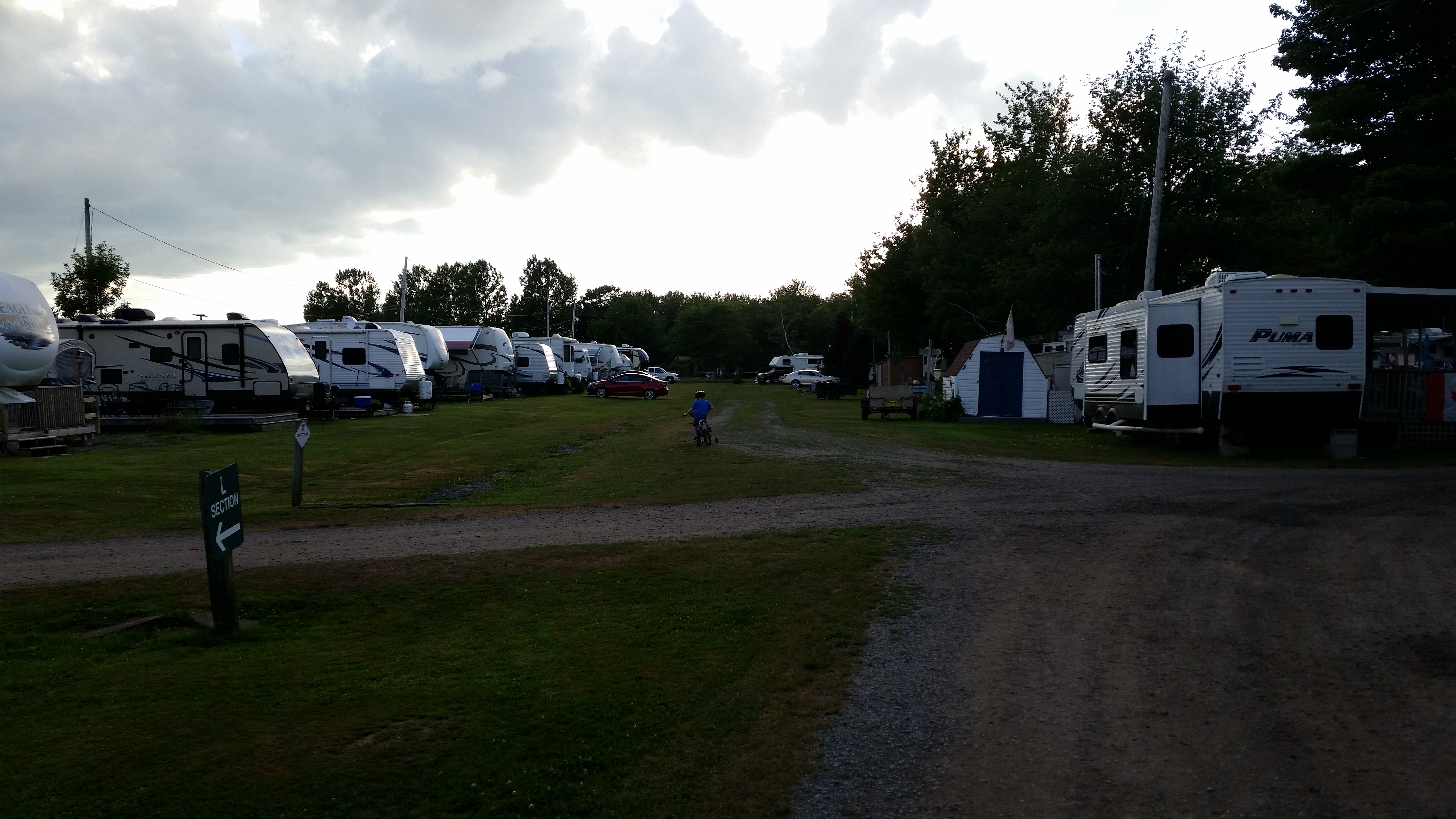
Land of Evangeline Campground
84 Evangeline Beach Rd, Grand Pre NS B0P-1M0
Ph: 902.542.5309
Website
23 July @ 2 nights, 45 C$ / night
|
This is a rather large but pleasant campground. There are 83 overnight sites; we were in
site L26.
They offer 30/50A, water, sewer and wi-fi (although the internet can be spotty for sites not
ear the office), fire rings and picnic tables.
The sites are rather close together; the slideouts aren't quite touching,
but you can often hear people talking in the next unit.
Minas Bay is a very short drive from the campground, or a 5-10 minute walk if you prefer,
where you can watch the massive tide changes for which the Bay of Fundy is famous. At low tide
you can actually walk on the ocean floor. There is also a nice bike trail nearby.
There are laundry facilities and washrooms, and they have what they call a "store" but it just has ice cream.
The have both residents and transients; as well as some tent camping in a big open field.
| |
| |
[click to enlarge]
|
|

|
|
|
Click here to see photos of the Land of Evangeline campground.
|
|
Grand Pre National Historic Site
Website
| |
[click to enlarge]
|
| |
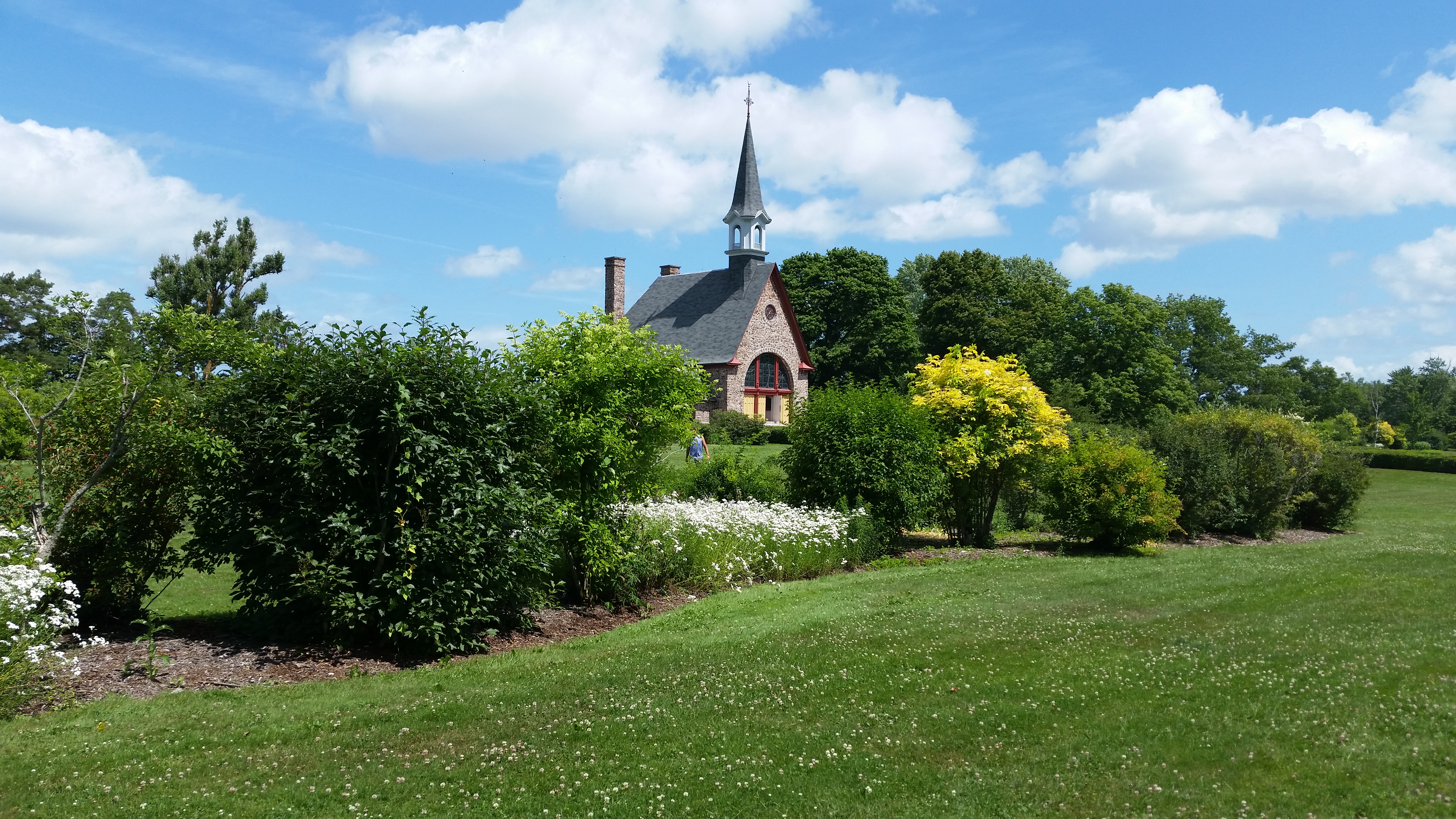
The Grand Pre Historical Site is not far from the campground. It is an emotionally moving
place where visitors learn
about the Grand Pre people, as well as a tragic time in
Acadian history. It commemorates the culture along with the relocation (actually
deportation) of Acadians from the area by the British from 1755 to 1762.
You can easily see how Grand Pre, which is French for "great meadow", got its name
by simply looking over the rolling hills landscape.
There is also a famous statue of the legendary Evangeline of Longfellow's epic poem
Evangeline: A Tale of Acadie
about an Acadian girl named Evangeline and her search for her lost love Gabriel.
The poem is set during the time of the Expulsion of the Acadians around 1755 by the British.
I got a copy of the book on Amazon and can't wait to find the time to read it.
See here and
here for Wikipedia info on Grand Pre
|
Also
click here for an eye-opening discussion of the heartbreaking Acadian resettlement.
The town of Wolfville is about 10 minutes up the road to the west.
It is a neat little town with shopping and restaurants. The town of New Minas
- the soccer capital of Atlantic Canada - is about 10 minutes past Wolfville.
Berwick, the apple capital of NS, is further down the 101.

|
|
|
Click here to see photos of the Grand Pre National Historic Site.
|
|
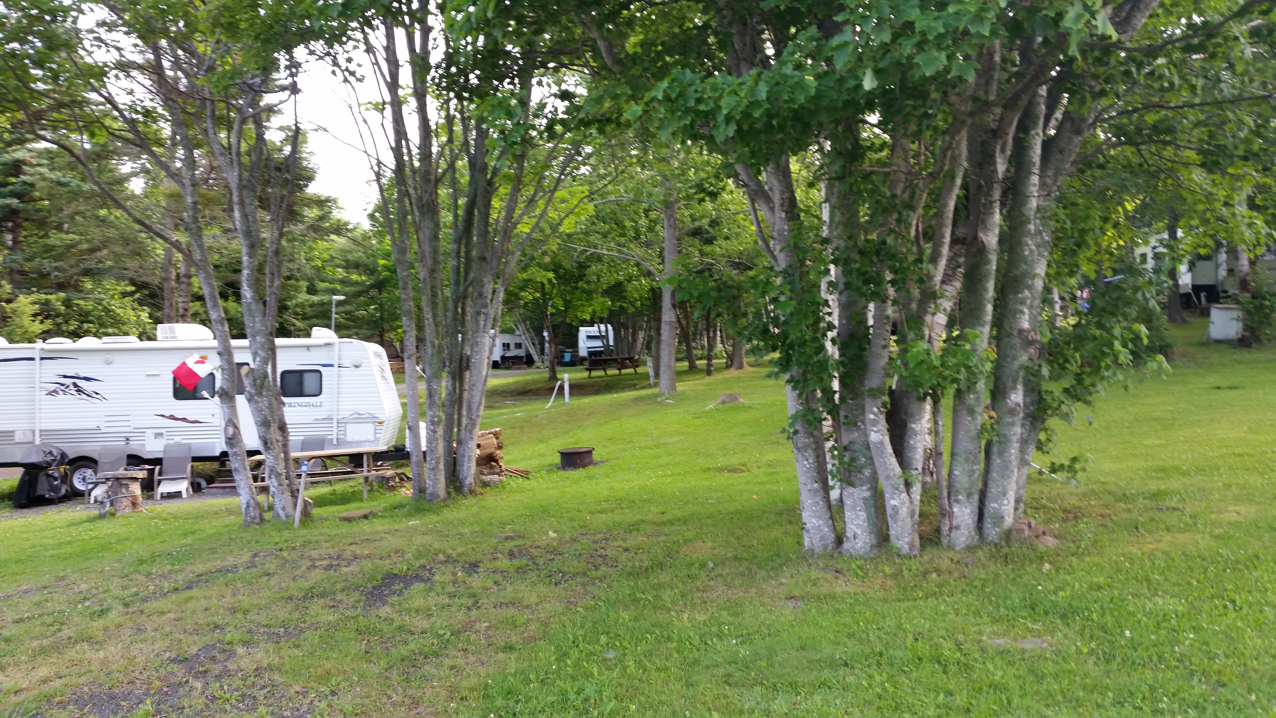
Fundy Trail Campground
62 Delaps Cove Rd, Granville Ferry NS B0S-1K0
Ph: 902.532.7711
Website
25 July @ 2 nights, 40 C$ / night
| |
[click to enlarge]
|
| |
This campground has been owned by a young couple for a few years. The area was apparently
in disarray when they acquired it, and they have been working hard to improve it.
They do have a way to go to make it attractive to many RV-ers, especially those with big rigs.
Sites have elec, water, sewer, a fire ring and a picnic table.
Our site # 64 had 30A service which I don't think was a full 30A because I blew the
campground breaker when running a single a/c unit. I got to where I was afraid to run more
than one appliance at the same time, since the circuit breaker was not at the site; the owner had
to go and unlock a breaker box elsewhere and I didn't want to put him through
that again. Some sites have 110V, presumably tent sites. There is a swimming pool and laundry,
but no camp store. There was wi-fi, although internet access seemed to be limited
to various periods of the day. When it was available, it could be agonizingly slow.
|
A short walk or drive down to the Bay of Fundy offers a beautiful view. Only a few
sites can see the water from the campground.
We could never get our rig level on the site. We don't have self-levelling jacks
which would have come in handy there. It was also hard to back into the site and took several attempts,
mainly due to a big drainage ditch in front, as well as the narrowness of the pad itself.
But in retrospect, since we were there we should have booked our stay a couple days longer. By doing so we
could have also taken in Digby. As it was, we had to drive back up to Digby from our next
campground in Yarmouth; it was an hour drive each way.
Unless you have a small rig and prefer remote areas, you might want to look elsewhere.
This campground is a little far from places
you might want to visit like Port Royal, Annapolis Royal and Digby.
You might also want to look at Upper Clements RV Park. We drove past it on the way to Yarmouth and it looked nice from the highway.
It is also conveniently located about halfway between Annapolis Royal and Digby.

|
|
|
Click here to see photos of the Fundy Trail campground.
|
|
-- drive to ?? --
[85214 - 85783]
Annapolis Royal
|
Annapolis Royal, formerly known as Port Royal (not to be confused with the current town of the
same name about 10 km away) is a beautiful waterfront community
nestled in the Annapolis Valley. The area was originally home to a large Mi'kmaq community,
and in the early 1600's saw an influx of early European settlers. It was the capital of
Nova Scotia for around 150 years until the founding of Halifax.
There is a lot of Acadian history here, as can be seen from this
Wikipedia article.
History buffs will find lots of fascinating sites and lore to pursue, including
Fort Anne, the old Court House, Charles Fort, the Sinclair Hotel and walking tours.
Here is
an interesting historical timeline of the area.
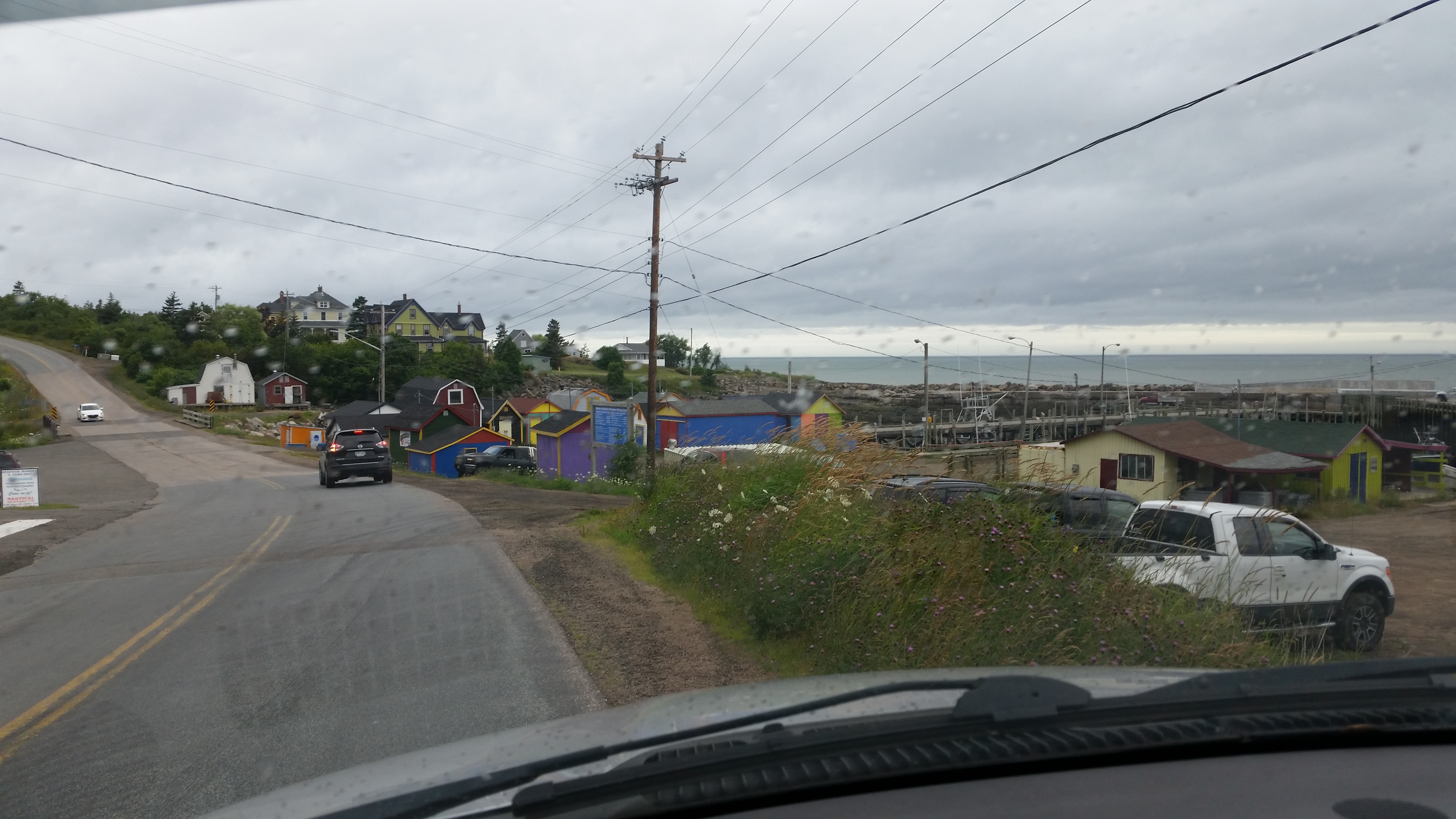
Annapolis Royal is not a large town, but it is interesting. The wharf provides a panoramic
view of the harbor. There are
a few restaurants and pubs, but we didn't find a lot in the way of shopping, especially for RV needs.
We ate at the Bistro restaurant which serves French food; the lobster roll on baguette and
the chocolate mousse were very good.
| |
| |
[click to enlarge]
|
|
There is an Irving station outside of town that has diesel.
We also visited the Historic Site at Port Royal. It's not large, but it is informative as to
the early settlement (1600's)
in the area. The buildings were burned down by the British, but the site was reconstructed in
historic accuracy to the 1900's.
Just up the road from Fundy Trail Campground is a seafood distributor called
Nautical Seafood LTD. They have a little
retail sales area where they can steam a lobster for you, and they also have scallops, haddock,
mussels, chowder and other neat stuff. I bought some scallops there for around 32 C$.
A little northwest of the Fundy Trail campground on Shore Rd is another one called
Cove Oceanfront that looks very nice.
Unlike the rustic nature of Fundy Trail, Cove is
quite neat, almost manicured. It is rather pricy [avg $67] but most if not all sites have an ocean
view. If you decide to stay
there and have a big rig, try to get site 35 or something like it, where you can park sideways
for a full ocean panorama. The lady
we talked to was quite friendly and took us for a tour in her golf cart. The sites we saw
were all full service, and they have internet and repeaters.
Historic Gardens
Website
|
We had no idea this place existed until we drove by it on the way back from Annapolis Royal .
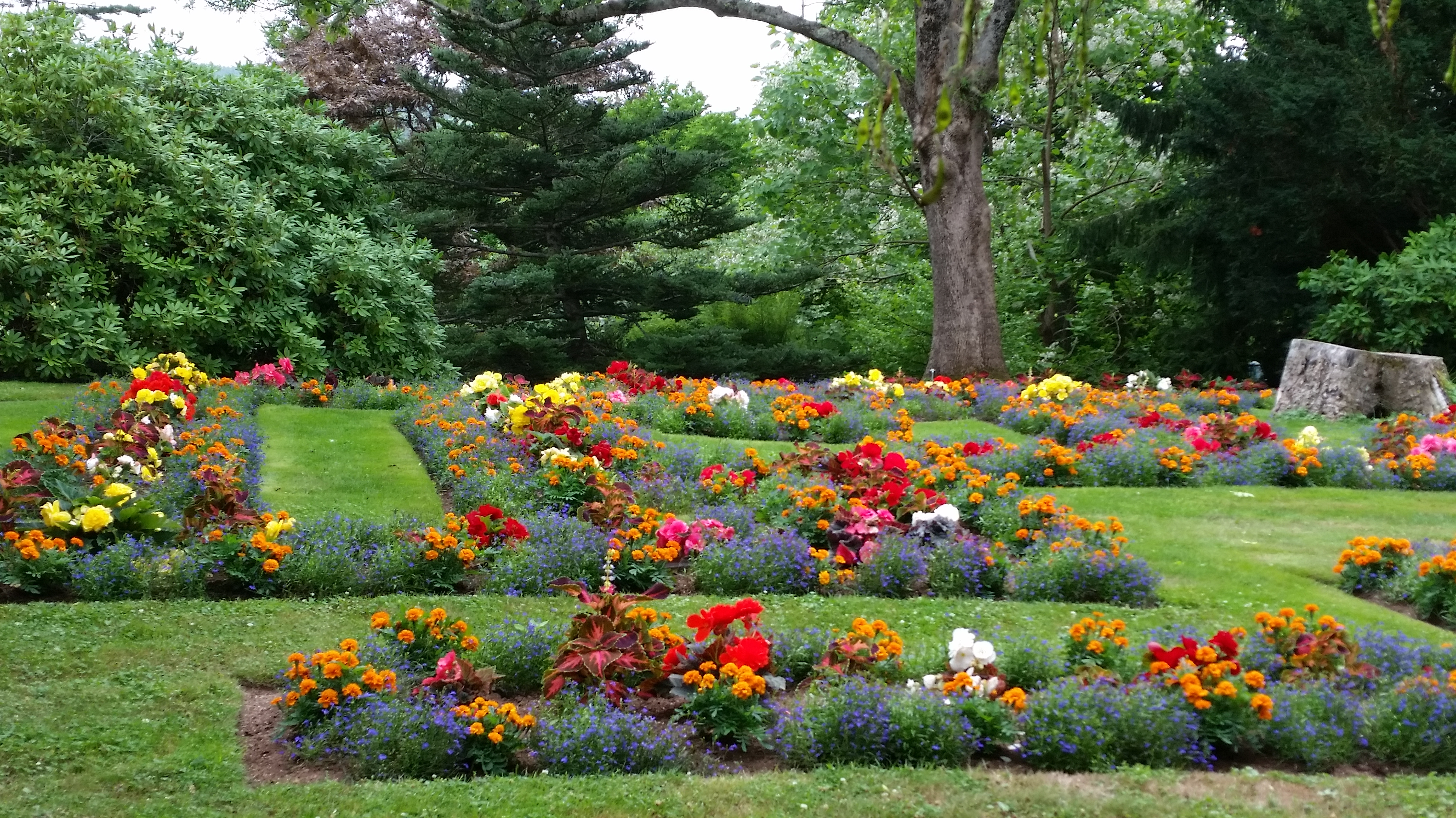
We decided to stop in and we're glad we did. The 17-acre grounds
are beautiful, overlooking a tidal river valley. We found them
somewhat reminiscent of the Buchart Gardens in Vancouver BC, although not as
large or as magnificent. It is noted as being Canada's 2015 Garden of the Year.
We particularly enjoyed the rose garden, where you can walk among several species and
savor the various colors and aromas. In June, the rhododendrons and azaleas are in high bloom.
There is a tearoom where you can relax, grab a bite to eat, and enjoy the captivating scenery.
| |
| |
[click to enlarge]
|
|

|
|
|
Click here to see photos of the Annapolis Royal Historic Gardens.
|
|
Kejimkujik National Park and National Historic Site
Website
| |
[click to enlarge]
|
| |
Due to rain we were unable to visit this park (pronounced "key-jim-cu-gik"). That's sad, because we were very much looking
forward to it.
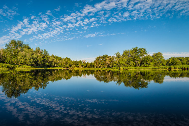
According to the literature, Kejimkujik (aka "Kiji") is a separate protected wilderness where one can
experience turquois waters, white sand beaches, canoeing, hiking, camping,
rich lagoons, rock engravings
(petroglyphs), coastal wildlife and wildflowers. It was also called home by
Mi'kmak people for thousands of years.
Kejimkujik is actually one park divided into two widely separated areas. The main park is located
18 km from the village of Caledonia on highway 8, and then there is Kejimkujik Seaside
which lies approximately 100 km southeast of the main park,
along the coast near Port Joli. Both offer incredible opportunities to explore
Nova Scotia's natural and cultural heritage, see a wide range of wildlife, or
simply sit back and soak it all in.
|
Here is a
Wikipedia writeup.
See the discussion below about the Fisherman's Cove campground for our visit to the
Seaside portion of this park.
Here are some
web photos of the park.
Annapolis Royal to Yarmouth
[85865 - 85950]
The drive from Annapolis Royal down to Yarmouth was short and sweet, about 130 km
down the 101 and around 1.5 hours pulling a rig. We went by Digby but decided to wait until
we set up at Yarmouth and then come back.
Then we went past St. Mary's Bay - a branch of the Bay of Fundy - where the tides
are some of the highest in the world, contributing to some varied and interesting flora and
fauna. This area is among the most popular whaling and birding destinations in Canada. I heard that
the hike to Balancing Rock on Long Island is a worthwhile day trip.
Lake Breeze Campground and Cottages
PO Box 1990, Yarmouth Co, Nova Scotia B5A 4A5
2560 Highway 1 Darling Lake, Yarmouth City NS B5A 4A8
Ph 902.649.2332
27 July @ 2 nights, 38 C$ / night
| |
[click to enlarge]
|
| |
This campground's motto is "Clean, Quiet and Friendly" and it is certainly all three.
As seems to be the theme with most
Nova Scotian campgrounds, this one is composed primarily of seasonals.
There are 14 full service sites, and 36 with 30A and water. Each site has
a fire ring and a picnic table. Our site did not have sewer
but there is an easily accessible dump station. There is no wi-fi, cable or pool.
There are washrooms, some sites for tenting, and a small play area for kids.
There is also a clubhouse where the seasonals meet for campfires and cordiality.
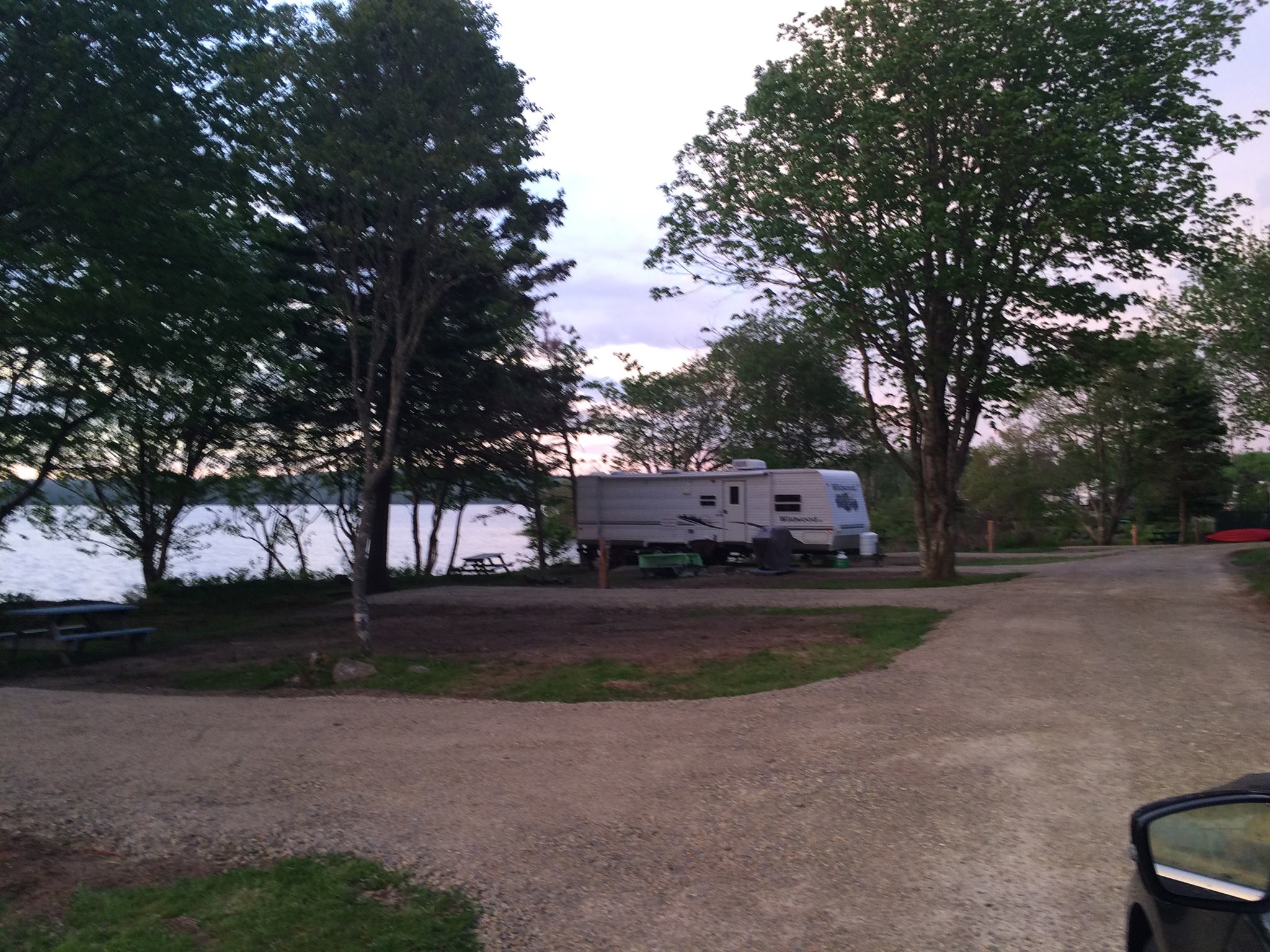
Sites are spacious, comfortable and level, and there are large common areas.
A lake is next to the campground where you swim, canoe, fish or listen to the loons.
If you reserve early you might be able to get a site next to the lake.
This is a good place to park if you want to catch the ferry to Maine.
|
During our stay at the campground they held a "Christmas in July" contest where the seasonal residents decorated
their rigs in Christmas gala. I don't know who won but my personal favorite was Santa and reindeer pulling a
little travel trailer behind.

|
|
Click here to see photos of the Lake Breeze campground.
|
Yarmouth
|
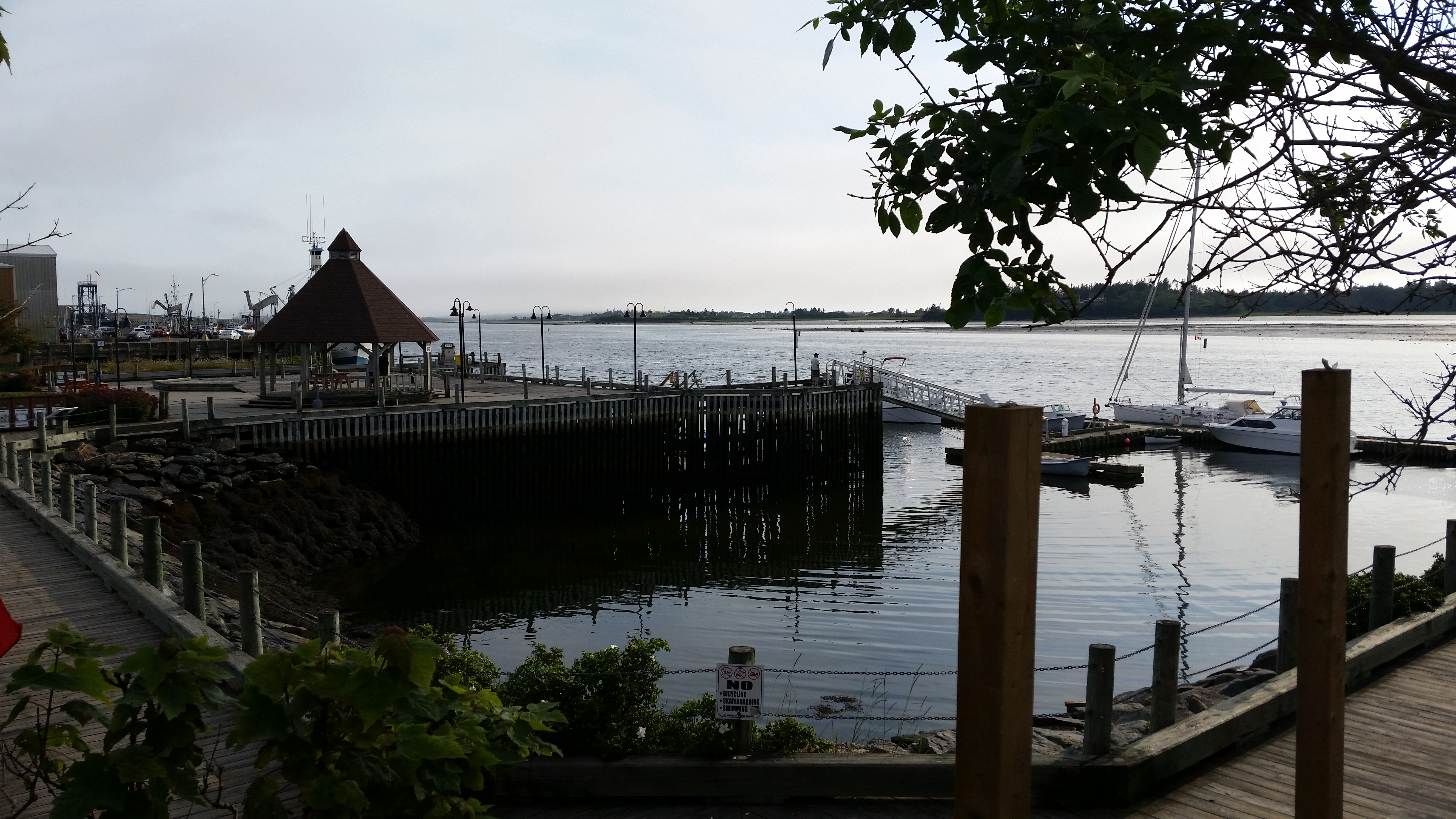
Yarmouth is a relatively big town in Nova Scotia terms, perhaps only second to the Halifax/Dartmouth area,.
Most of the "action" happens around Water Street and Main Street. Unfortunately, we only had a chance to spend a
couple hours there, but there was shopping, pubs and restaurants. Away from the downtown area is where the big
shopping is - Sobeys, Walmart, etc.
Speaking of Water Street, notice a theme? I'm not positive but I believe every town on
the island of any size has a Water Street.
Yarmouth is located on Yarmouth Harbour, just south of where the Bay of Fundy
meets the Atlantic. It is
at the heart of the world's largest lobster fishing
grounds. Like many other towns in the area, it was originally inhabited by the Mi'kmaq.
It is believed by some that Yarmouth may have been visited by Lief Ericson.
| |
| |
[click to enlarge]
|
|
Being a shipbuilding mecca in the 19th century, Yarmouth ships were found in most major
ports throughout the world at the time. It is now home to the largest fishing fleet in
Atlantic Canada. As such, the area is dotted with stunning sea captain's homes.
Be sure to visit the Cape Forchu Lightstation where
the views, picnic grounds and hiking trails earned it the distinction as one of Canada's
greatest public spaces.
We didn't get a chance to try it, but we hear the
Rappie pie is a particularly unique
dish, a traditional Acadian meal made from grated potatoes, meat and onions, sometimes
topped with molasses.
We ate at Rudders restaurant on Water Street at the waterfront.
The seafood crepe and seafood casserole were great but pricey, running $78.51 for two.
After our visit to Nova Scotia, we rated Yarmouth quite a bit below other towns
of equivalent size,
mainly because it didn't come up to the standards we came to expect of NS - Digby and
Lunenburg, for example. It was ok, but if we had
to omit one town from our trip, this would be the one. Our feelings were also echoed by a number
of other folks we talked with.
Digby

| |
[click to enlarge]
|
| |
This is a picturesque town situated on a harbor rife with fishing boats. The wharf is home to Nautical Seafood Ltd,
which also owns the little seafood shack mentioned earlier in the discussion of
the Fundy Trail Campground.
Digby advertises itself as the "Scallop Capital of the World". It must be well deserved, if our taste of Digby scallops
are any indication. We ate at the Crows Nest restaurant (again, on Water Street) at the waterfront.
The patio has a wonderful view of the harbor.
The pan-fried scallops and lobster roll were great, as was the thick chocolate shake I had
for dessert. The bill was 62.10 C$ for two with tip.
We also poked our noses into various coves and back roads outside of the town area. We were rewarded with many beautiful
shore sights you don't get to see on the beaten trail. One road just past town took us to a rustic lighthouse area out on
a point that offered beautiful views of the rocky coastline.
|
My wife Phyllis grows orchids, so naturally we had been looking for driftwood suitable for orchid mounting. We found our first
specimens at one of these little coves, and learned a secret for driftwood hunting - look for wood lodged within the rocks
and boulders that line the shores, not on the shore itself, as anything that comes in will likely go out again with the tide.
There is a little monument to Admiral Digby at the edge of the downtown area, close to the wharf. It has a pretty little
garden and a nice panoramic view of the water.
If you're a motorcycle enthusiast you'll want to know that
since 2004, Digby has become the destination of the largest motorcycle rally in Atlantic Canada.
Known as the annual Wharf Rat Rally, it attracts up to 50,000 people and
25,000 cycles during the weekend of Labour Day in August/September.
Yarmouth to Hunt's Point
[86100 - 86208]
The drive over to Hunt's Point was plesant and uneventful. We took the 101 south until it
dead-ended at route 3 east and then on to the 103. Along the way you will pass by the town
of Barrington, the "Lobster Capital of Canada."
Fisherman's Cove RV & Campground
6718 Highway 3 (Lighthouse Route), Hunts Point NS B0T-1G0
Ph: 902.646.0160
Website
29 July @ 2 nights, 50.00 C$ / night
|
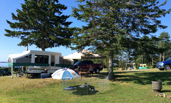
We liked this little campground very much. The spacious, open sites are about an equal mixture of
seasonals and transitionals.
It is close to the ocean, and it's just up the road from a rustic but nice seafood restaurant called Seaside Seafood which has
good fish & chips, and the chocolate shakes aren't bad either.
There are 44 sites, most with 3-way (elec, water, sewer) and a few with 2-way (elec, water)
service. All sites are 30A as is typical for NS and NL. We camped in site # 7
which had 30A, water and sewer. There is a laundry shed but no wi-fi or pool. There are
bathrooms, showers and coin-op laundry facilities. There is a store with munchies and gifts.
There are no discounts during 15 May - 15 Sept.
If you stay there for a week, the 7th night is free.
Sorry, but I can only find a couple photos for this campground. I know there are more somewhere.
| |
| |
[click to enlarge]
|
|

|
|
Click here to see photos of the Fisherman's Cove campground.
Click here to see photos of the town of Hunts Point.
|
|
Kejimkujik National Park Seaside
Website
| |
[click to enlarge]
|
| |
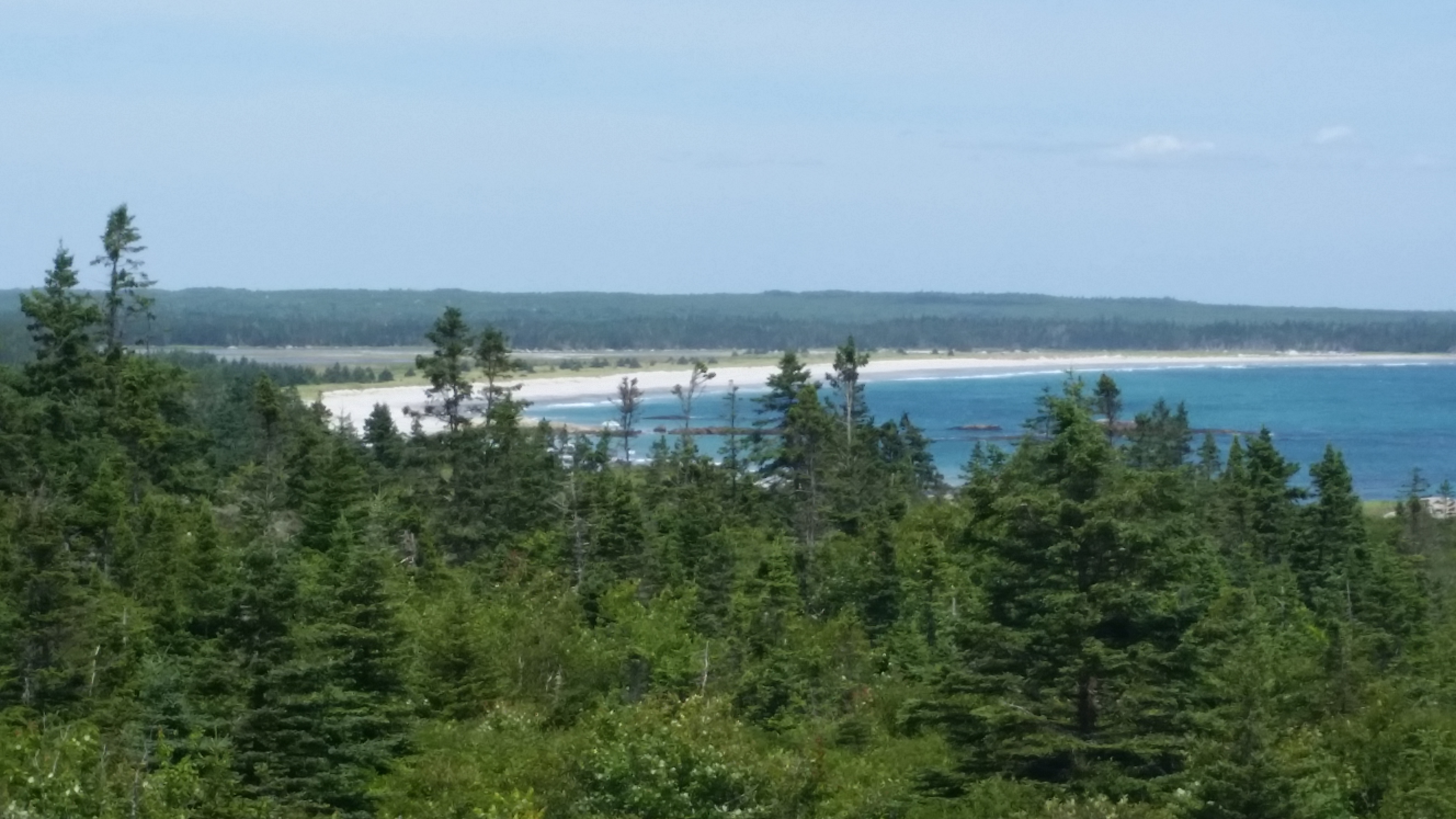
We drove down to the seaside part of the Kejimkujik National Park Seaside
[see earlier], which is not far from the campground.
Take exit 22 off the 103, then highway 3 to Port Joli. Take a left off 3 and follow
the winding St. Catherine's River Rd for quite a way. Make a left when you get to the park.
Note that this lower part of the park is
completely disjoint from the upper portion discussed earlier,
which is a wilderness version with hiking trails,
lakes and rivers, and canoeing but is not amenable to driving around.
There are two walking trails here: Harbor Rocks and Port Joli.
I walked the Harbor Rocks trail which, depending on how fast
you walk and how much you stop to take pictures, is around an hour's hike.
The trail ends at the seaside with stunning white sand beaches.
|
For those not inclined to hike, eschew the final left into the park and instead
take a short drive down to the rocky shore for a good photo op.

|
|
Click here to see photos of Kejimkujik National Park Seaside.
|
Hunt's Point to Mahone Bay
[86272 - 86322]
It was a short and easy drive from the campground at Hunt's Point up to the Mahone Bay
area. Being an inland route, there wasn't much to see on the 103. Before you get to Martins
Point, US 3 will will split off and parallel 103 for awhile before heading down to Chester.
On the way to Chester you will go past
Oak Island
which is the subject of exotic stories and legends about pirates and buried treasure.
Rayport Campground is on the left (northwesst) of the 103. The road leading up to the
campground is narrow and rough. Our fridge popped open from the roughness and several items
came out, sometimes causing a mess on the floor. Be that as it may, the short drive of a
few hundred meters is worth it.
Rayport Campground
165 Shingle Mill Rd, Mahone Bay NS B0J-2E0
Ph: 902.627.2678
Website
31 July @ 3 nights, 43 C$ / night
|
The campground is clean and neat, composed of mostly seasonals with a couple dozen sites reserved for transitionals.
If you can get a site next to, or close to the little river, you won't be disappointed. We spent time sitting and watching
the ducks playing behind our rig.
The campground is located very close to the 103 and you can hear road noise, especially at night. At the transient
sites it isn't particularly bad except that you can hear the really big rigs passing by. The seasonals probably have gotten used to it.
Be sure to reserve as early as possible, as sites here are normally in heavy demand.
| |

| |
[click to enlarge]
|
|
This is one of the best campgrounds we have stayed at on the island. The sites are spacious. We camped in site G6,
which is right by the river, and we were able to park the truck next to the rig.
The site is level with water and 30/50 amp. No sewer, but they do have a dump station and a free sewer-sucker service
which will come by if you notify them the day before, and you don't even have to be there.
The internet was reliable and fast except for an occasional glitch; disconnecting and reconnecting usually fixed the problem.
There is a small "camp store" that consists mostly of condiments and junk food. But Lunenburg is close by, and
Halifax/Dartmouth is only about an hour away if you need big box items.

|
|
|
Click here to see photos of the Rayport campground.
|
|
Mahone Bay
| |
[click to enlarge]
|
| |
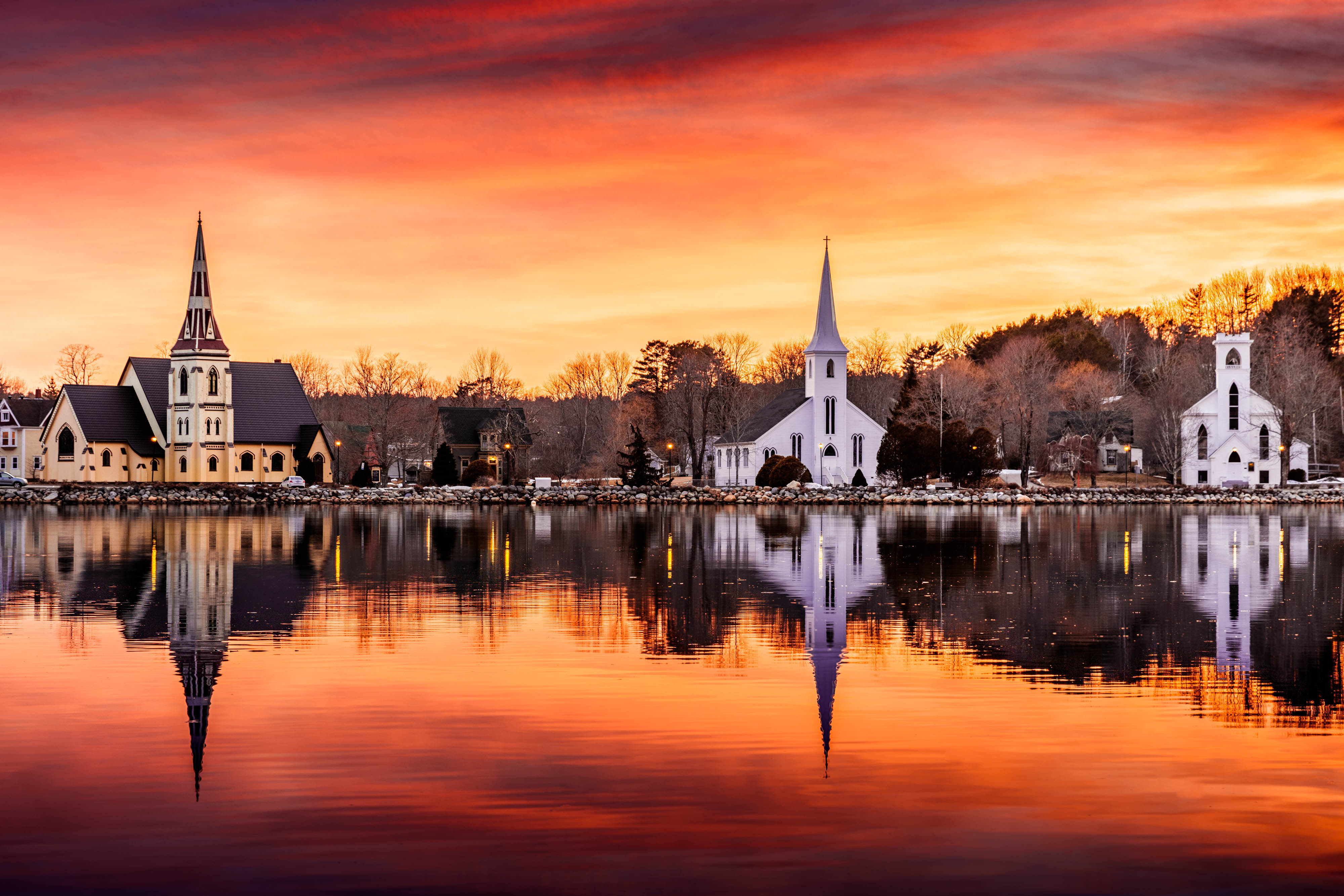
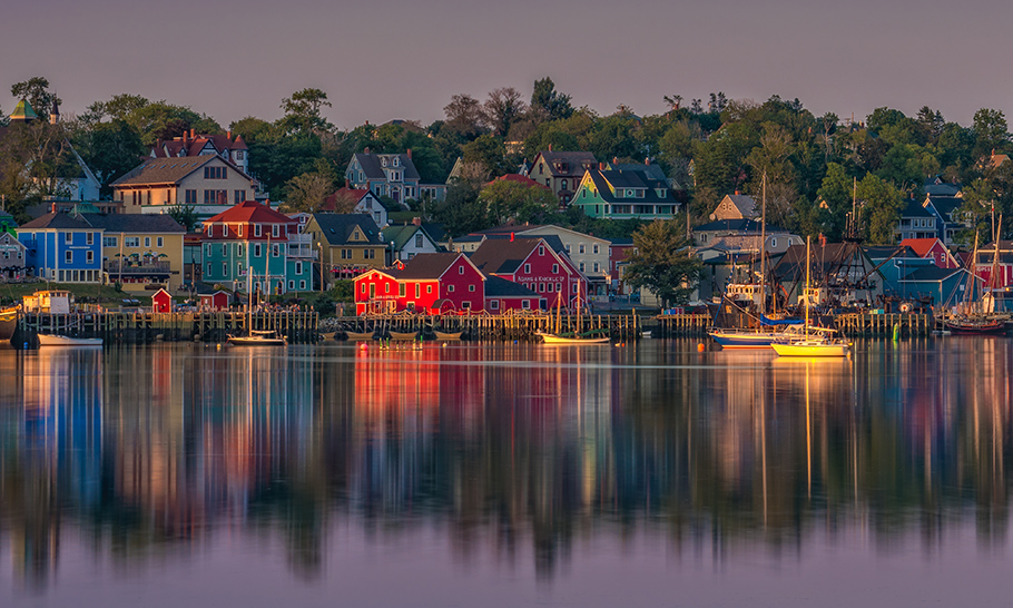
Mahone Bay is only about 6 km south down Trunk 3. This is a nice little town with a very picturesque harbor full of
fishing boats and sailboats. At the edge of town there is an Irving gas station that has diesel. Close to the gas
station is a grocery store where you can restock your fridge and freezer.
Settled in 1754, Mahone Bay is first and foremost a harbour area. Sailboats and schooners on the water and Victorian
homes and shops on shore provide a view of one of Canada's most picturesque towns. Restaurants,
artwork and shopping abound. The area is rife with wildlife such as eagles, ospreys, puffins and
great blue herons.
Like many areas of NS, this area was first inhabited by the Mi'kmaq.
And like Yarmouth, the town of Mahone Bay is also known for boat building, as you will find
out by visiting the Mahone Bay Museum.
|
We had dinner at the Mug and Anchor Pub. The steak & veggie stew, which is a little
like an Irish stew, was good.
The restaurant is a bit pricey (86.84 C$), probably due to the view of the harbor. There is an ice cream store next door that actually
has green tea ice cream! Pick up a brochure that has a map of Mahone Bay at the campground desk.
Lunenburg
|
Historic Lunenburg is about 12 km away from the campground.
It advertises itself as the "Balsam Fir Christmas Tree Capitol of the World."
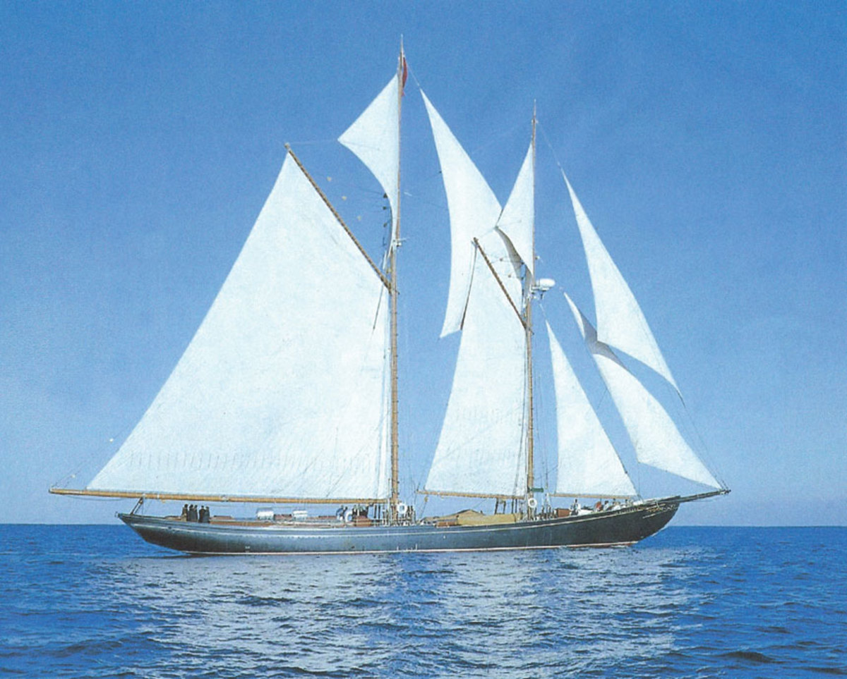
The tour de force of Lunenburg is the Bluenose II ship, a 1963 replica of the
original Bluenose
schooner. If you are a sailing buff you might want to read about the
original ship's history here.
The II was built to original specs by some of the same workers as her namesake.
Serving as a promotional yacht for Oland Brewery, she is a fully functional tall
ship that they take out for short day trips. The II is a
popular tourist attraction, in no small measure due to the fact that she has one of the largest
mainsails in the world (4150 sq ft). Tourists are free to roam her decks, and a few lucky
passengers can ride aboard for a short harbour cruise twice a day - provided they
have made prior reservations [ph. 855-640-3177 or
book online].
See here for the
2019 sailing schedule.
We ate at the Old Fish Factory restaurant on the wharf area, close to the Bluenose II.
The lobster tacos were really good but pricey [price of 53.48 C$ includes
the view!]. If you like apple cider, try the Shipbuilder Cider.
Be warned that downtown parking can be problematic, especially if you're in a truck.
| |
| |
[click to enlarge]
|
| |
[click to enlarge]
|
|

|
|
|
Mahone Bay to Dartmouth
[-- - 86425]
There are several ways to get from Mahone Bay over to the Halifax/Dartmouth area.
We took the 103 east to the 102, to the 111 at Halifax, and crossed Bedford Basin Lake on the
A. Murray MacKay toll bridge. Continue on 111 and catch route 318 north to the campground.
Be alert; there is a sign on the left side of the road but it is easy to miss if you
aren't looking for it.
Shubie Park Campground NS
30 John Brenton Dr, Dartmouth NS B3J-3S9
Ph: 902.435.8328
Email: Webmaster@ShubieCampground.com
Website
3 August @ 3 nights, 46.75 C$ / night
| |
[click to enlarge]
|
| |
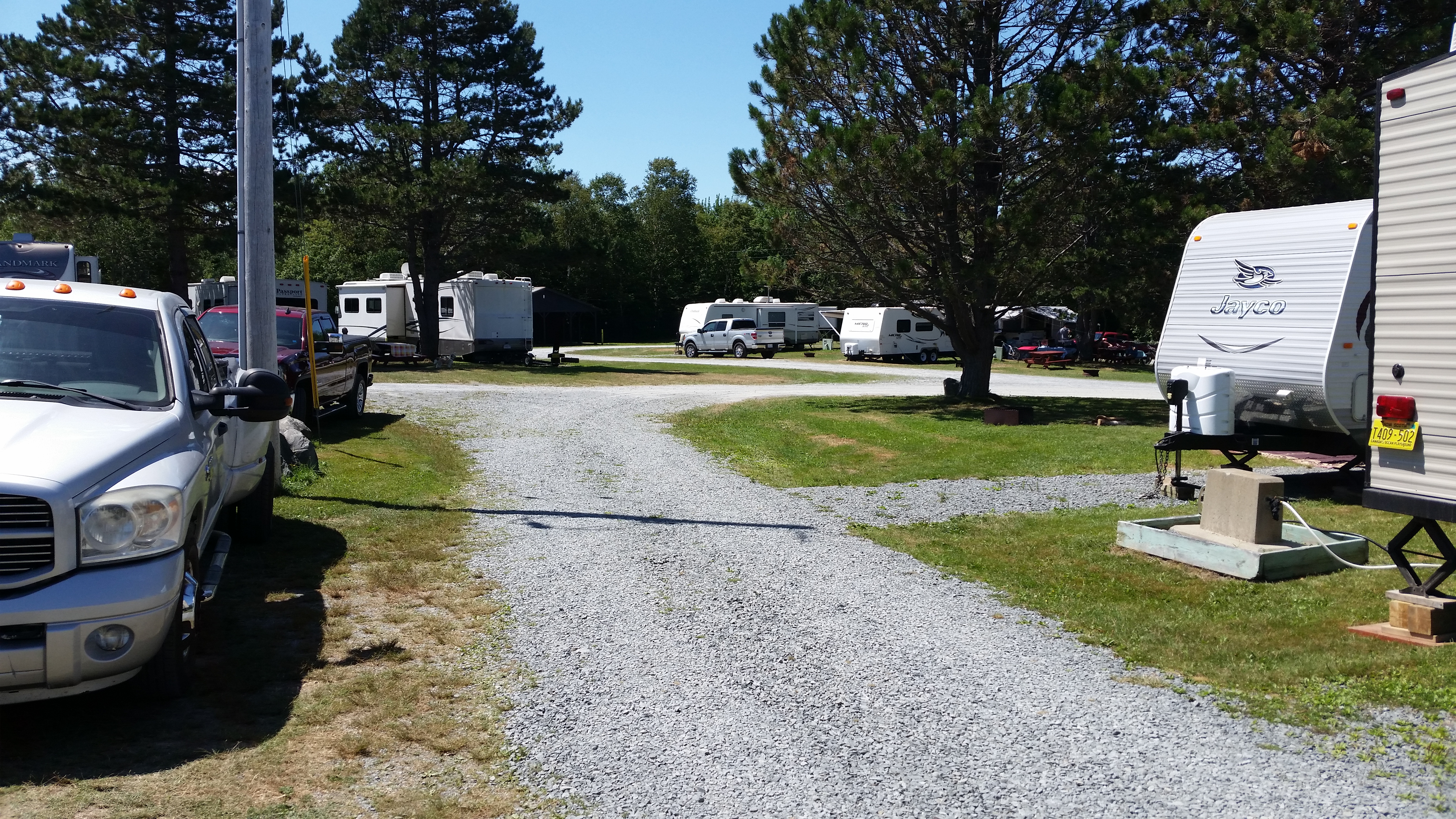
This is a nice campground located at Shubie Park in Dartmouth, which has major shopping like Costco, Walmart, Ikea, etc.
The city of Halifax is located immediately across the river from Dartmouth, and can be reached either by the bridge or by ferry.
We parked in site # 9 which was spacious, level (not all sites are) and has 50 amp and water. There is no sewer but there is a
dump station on the way out.
Unlike most campgrounds we've been in at NS, there don't seem to be so many seasonals here. There is a nice kid's playground
and a tennis court. The washrooms and washers & dryers in the laundry were good.
|
The office has junk food, ice cream and ice. They have wi-fi but it isn't very good. Their network name didn't even show up
in the list of available nets. They did say they have plans to upgrade, but didn't give a date.
In spite of the proximity to the big city of Dartmouth, star viewing enthusiests can get
a real treat on clear nights.
The Dartmouth Crossing shopping center at Micmac Village is across Lake Micmac to the west;
you can see Ikea from the campgrounds. Although being close by, getting there involves a
somewhat circuitous route. Leave the campground and take a right onto route 318 [Waverly Rd]
Merge onto route
111 west [aks Hwy of Heros], go across the water, and get off onto route 118 and the center will be on the left.
See the earlier discussion on the
King Neptune Campground for comments regarding a
mobile RV repair person that will come out to your site. He came out while we were there
to fix a leaking water heater fitting. I was satisfied with his work.
There are several RV dealers in the Halifax/Dartmouth area. Other than the mobile RV guy
we didn't have occasion to use any of them.

|
|
|
Click here to see photos of the Shubie Park campground.
|
|
Halifax/Dartmouth
| |
[click to enlarge]
|
| |
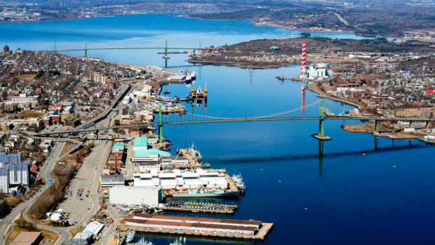
This is essentially the NYC of Nova Scotia. Halifax and Dartmouth are disjoint areas
separated by the Bedford Basin. You can drive from one to another via two bridges. One is
the MacKay Bridge on highway 111, and the other being the Angus L. MacDonald Bridge on North Street in Halifax
and Nantucket Ave (route 7) in Dartmouth.
Here is info on bridge tolls.
Both Halifax and Dartmouth have large shopping malls. The two largest are the
Halifax Shopping Centre in Halifax on Mumford Rd off highway 102, and Dartmouth Crossing
in Dartmouth on Countryview Dr off highway 118. There you will find familiar shopping
institutions like Costco, Walmart, Best Buy, Starbucks, Petco, Staples, etc. There
are also the expected amenities like restaurants, fast food, salons, boutiques and so on.
|
There are lots of provincial parks either close to or not too far from the area. Many
of these parks have room for RVs, but hookup facilities may be scant. If you anticipate
trying these parks then be sure you contact them early enough to guarantee reservations.
Here is a link.
Here is a link to a PDF of the
Nova Scotia Provincial Parks Guide

|
|
Click here to see photos of the Citadel in Halifax.
|
Some parting thoughts
After spending about a month on the lower part of Nova Scotia
(the non-Cabot Trail part), the thing that became
crystal clear to us was that in order to get the most out of your time there,
you'll want to spend as much
time as possible around the coastal areas. Although there are certainly things to see inland,
such as the Kejimkujik National Park, the beauty and magnificence is concentrated in the
seacoast towns and fishing villages. Much like our experiences in Newfoundland, our
most enjoyable surprises came from poking our noses down whatever road or trail we
thought might lead down to the water. We were rarely disappointed!
 Go back to the previous leg of the journey
Continue on to the next leg of the journey
